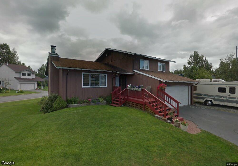
8721 Carter Cir Anchorage, AK 99507
Abbott Loop NeighborhoodEstimated Value: $342,000 - $589,000
3
Beds
2
Baths
1,650
Sq Ft
$277/Sq Ft
Est. Value
About This Home
This home is located at 8721 Carter Cir, Anchorage, AK 99507 and is currently estimated at $457,195, approximately $277 per square foot. 8721 Carter Cir is a home located in Anchorage Municipality with nearby schools including Kasuun Elementary, Hanshew Middle School, and Service High School.
Ownership History
Date
Name
Owned For
Owner Type
Purchase Details
Closed on
May 21, 2004
Sold by
Allen James P
Bought by
Olson Charles R and Allen Olson Theresa A
Current Estimated Value
Create a Home Valuation Report for This Property
The Home Valuation Report is an in-depth analysis detailing your home's value as well as a comparison with similar homes in the area
Home Values in the Area
Average Home Value in this Area
Purchase History
| Date | Buyer | Sale Price | Title Company |
|---|---|---|---|
| Olson Charles R | -- | First American Title Of Alas |
Source: Public Records
Tax History Compared to Growth
Tax History
| Year | Tax Paid | Tax Assessment Tax Assessment Total Assessment is a certain percentage of the fair market value that is determined by local assessors to be the total taxable value of land and additions on the property. | Land | Improvement |
|---|---|---|---|---|
| 2025 | $2,666 | $385,300 | $89,200 | $296,100 |
| 2024 | $2,666 | $390,100 | $89,200 | $300,900 |
| 2023 | $5,952 | $349,500 | $89,200 | $260,300 |
| 2022 | $2,371 | $340,800 | $89,200 | $251,600 |
| 2021 | $5,402 | $299,800 | $89,200 | $210,600 |
| 2020 | $4,252 | $300,400 | $89,200 | $211,200 |
| 2019 | $4,079 | $299,300 | $89,200 | $210,100 |
| 2018 | $3,956 | $291,200 | $89,200 | $202,000 |
| 2017 | $4,485 | $306,400 | $86,000 | $220,400 |
| 2016 | $3,695 | $296,600 | $86,000 | $210,600 |
| 2015 | $3,695 | $295,200 | $86,000 | $209,200 |
| 2014 | $3,695 | $270,600 | $72,300 | $198,300 |
Source: Public Records
Map
Nearby Homes
- 8944 Little Brook St
- 8131 Medellin Cir
- 2900 Sun Spot Cir
- 8141 Sockeye Unit 10
- 9191 Chapelle Cir
- 8730 Geirinhas Place
- 8203 Parkridge Cir
- 9130 Golovin St
- 4000 Justin Cir
- 7801 Spruce St
- 4041 Truro Dr
- 8540 Solar Dr
- 7811 Kiana Cir
- 2200 Sentry Dr Unit A17
- 2000 Brigadier Dr
- 7730 Little Bend Cir
- 7250 Cantonment Ct
- 9725 Independence Dr Unit A104
- 2812 Bass St
- 7201 Bulen Dr
- 3210 Rosalind Loop
- 3201 Rosalind Loop
- 8710 Carter Cir
- 3220 Rosalind Loop
- 8720 Carter Cir
- 3160 Rosalind Loop
- 8730 Carter Cir
- 8690 Rosalind St
- 8741 Carter Cir
- 3260 Rosalind Loop
- 3221 Rosalind Loop
- 3161 Rosalind Loop
- 8740 Carter Cir
- 8751 Carter Cir
- 3270 Rosalind Loop
- 3231 Rosalind Loop
- 3030 Rosalind Loop
- 3050 Rosalind Loop
- 8750 Carter Cir
- 3130 Rosalind Loop