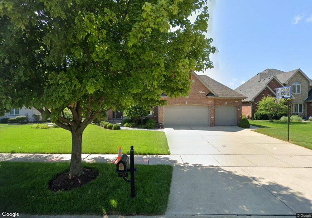
8727 W 142nd Place Orland Park, IL 60462
Silver Lake North NeighborhoodEstimated Value: $746,000 - $833,000
4
Beds
4
Baths
3,669
Sq Ft
$213/Sq Ft
Est. Value
About This Home
This home is located at 8727 W 142nd Place, Orland Park, IL 60462 and is currently estimated at $783,144, approximately $213 per square foot. 8727 W 142nd Place is a home located in Cook County with nearby schools including Prairie Elementary School, Liberty Elementary School, and Jerling Junior High School.
Ownership History
Date
Name
Owned For
Owner Type
Purchase Details
Closed on
Apr 15, 2003
Sold by
Marth Enterprises Inc
Bought by
Savas Peter P and Savas Nancy P
Current Estimated Value
Home Financials for this Owner
Home Financials are based on the most recent Mortgage that was taken out on this home.
Original Mortgage
$447,300
Outstanding Balance
$193,709
Interest Rate
5.86%
Estimated Equity
$589,435
Create a Home Valuation Report for This Property
The Home Valuation Report is an in-depth analysis detailing your home's value as well as a comparison with similar homes in the area
Home Values in the Area
Average Home Value in this Area
Purchase History
| Date | Buyer | Sale Price | Title Company |
|---|---|---|---|
| Savas Peter P | $559,500 | Cti | |
| Savas Peter P | $559,500 | Cti |
Source: Public Records
Mortgage History
| Date | Status | Borrower | Loan Amount |
|---|---|---|---|
| Open | Savas Peter P | $447,300 | |
| Closed | Savas Peter P | $447,300 |
Source: Public Records
Tax History Compared to Growth
Tax History
| Year | Tax Paid | Tax Assessment Tax Assessment Total Assessment is a certain percentage of the fair market value that is determined by local assessors to be the total taxable value of land and additions on the property. | Land | Improvement |
|---|---|---|---|---|
| 2024 | $16,584 | $69,581 | $9,116 | $60,465 |
| 2023 | $12,340 | $74,000 | $9,116 | $64,884 |
| 2022 | $12,340 | $44,616 | $7,901 | $36,715 |
| 2021 | $11,944 | $44,614 | $7,900 | $36,714 |
| 2020 | $11,560 | $44,614 | $7,900 | $36,714 |
| 2019 | $12,632 | $49,450 | $7,293 | $42,157 |
| 2018 | $12,284 | $49,450 | $7,293 | $42,157 |
| 2017 | $12,022 | $49,450 | $7,293 | $42,157 |
| 2016 | $12,328 | $46,677 | $6,685 | $39,992 |
| 2015 | $12,174 | $46,677 | $6,685 | $39,992 |
| 2014 | $12,009 | $46,677 | $6,685 | $39,992 |
| 2013 | $12,381 | $50,933 | $6,685 | $44,248 |
Source: Public Records
Map
Nearby Homes
- 8700 Berkley Ct
- 14345 S 87th Ave
- 14111 Tod William Dr
- 14040 Boxwood Ln
- 8810 Clearview Dr Unit 8810
- 14453 S 88th Ave
- 14216 Clearview Dr
- 14304 Clearview Ct Unit 8904
- 14508 Maycliff Dr
- 8820 W 140th St Unit 2A
- 14034 S 84th Ave
- 14402 S 90th Ct Unit 1A
- 8932 Pebble Beach Ln
- 14340 Mason Ln
- 14350 Mason Ln
- 9114 W 140th St Unit 204
- 14712 S 88th Ave
- 14440 Brentwood St
- 14602 Beech St
- 14023 Chelsea Dr
- 8719 W 142nd Place
- 8735 W 142nd Place
- 8710 Berkley Ct Unit 3
- 8711 W 142nd Place Unit 1
- 8743 W 142nd Place
- 8730 Berkley Ct
- 8700 Berkley Ct Unit 8
- 14230 S 87th Place
- 14231 S 87th Place Unit 1
- 8740 Berkley Ct
- 8703 W 142nd Place
- 8751 W 142nd Place
- 8701 Berkley Ct
- 8750 Berkley Ct
- 14231 S 88th Ave
- 14220 S 87th Place
- 14221 S 87th Place
- 14230 S 87th Ave
- 8731 Berkley Ct
- 8711 Berkley Ct