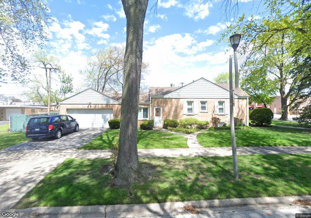
8728 Austin Ave Morton Grove, IL 60053
Estimated Value: $422,000 - $452,863
3
Beds
2
Baths
1,301
Sq Ft
$342/Sq Ft
Est. Value
About This Home
This home is located at 8728 Austin Ave, Morton Grove, IL 60053 and is currently estimated at $444,466, approximately $341 per square foot. 8728 Austin Ave is a home located in Cook County with nearby schools including Park View Elementary School and Niles West High School.
Ownership History
Date
Name
Owned For
Owner Type
Purchase Details
Closed on
Feb 28, 2018
Sold by
Agin Stephen L
Bought by
Mckennas Cynthia M and Mckennas John A
Current Estimated Value
Purchase Details
Closed on
Dec 19, 2011
Sold by
Agin Stephen L and Mckennas John A
Bought by
Agin Stephen L and The Stephen L Agin Trust
Home Financials for this Owner
Home Financials are based on the most recent Mortgage that was taken out on this home.
Original Mortgage
$156,400
Interest Rate
3.91%
Mortgage Type
Stand Alone Second
Purchase Details
Closed on
Aug 3, 2011
Sold by
Agin Stephen L
Bought by
Agin Stephen L
Purchase Details
Closed on
Apr 4, 2005
Sold by
Stolarski John and Stolarski Halina
Bought by
Agin Stephen L and Mc Kennas John A
Home Financials for this Owner
Home Financials are based on the most recent Mortgage that was taken out on this home.
Original Mortgage
$159,000
Interest Rate
5.71%
Mortgage Type
Unknown
Create a Home Valuation Report for This Property
The Home Valuation Report is an in-depth analysis detailing your home's value as well as a comparison with similar homes in the area
Home Values in the Area
Average Home Value in this Area
Purchase History
| Date | Buyer | Sale Price | Title Company |
|---|---|---|---|
| Mckennas Cynthia M | -- | None Available | |
| Agin Stephen L | -- | None Available | |
| Agin Stephen L | -- | None Available | |
| Agin Stephen L | -- | None Available | |
| Agin Stephen L | $359,000 | Multiple |
Source: Public Records
Mortgage History
| Date | Status | Borrower | Loan Amount |
|---|---|---|---|
| Previous Owner | Agin Stephen L | $156,400 | |
| Previous Owner | Agin Stephen L | $159,000 |
Source: Public Records
Tax History Compared to Growth
Tax History
| Year | Tax Paid | Tax Assessment Tax Assessment Total Assessment is a certain percentage of the fair market value that is determined by local assessors to be the total taxable value of land and additions on the property. | Land | Improvement |
|---|---|---|---|---|
| 2024 | $9,152 | $35,000 | $10,790 | $24,210 |
| 2023 | $8,691 | $35,000 | $10,790 | $24,210 |
| 2022 | $8,691 | $35,000 | $10,790 | $24,210 |
| 2021 | $7,498 | $26,708 | $6,640 | $20,068 |
| 2020 | $7,370 | $26,708 | $6,640 | $20,068 |
| 2019 | $7,442 | $30,010 | $6,640 | $23,370 |
| 2018 | $8,026 | $28,872 | $6,017 | $22,855 |
| 2017 | $8,105 | $28,872 | $6,017 | $22,855 |
| 2016 | $7,904 | $28,872 | $6,017 | $22,855 |
| 2015 | $7,060 | $24,532 | $5,187 | $19,345 |
| 2014 | $7,070 | $24,532 | $5,187 | $19,345 |
| 2013 | $6,890 | $24,532 | $5,187 | $19,345 |
Source: Public Records
Map
Nearby Homes
- 8849 Mcvicker Ave
- 6020 Lincoln Ave Unit 407
- 8836 Mansfield Ave
- 6035 Lincoln Ave
- 8841 Menard Ave
- 6140 Elm St
- 8712 Ferris Ave
- 6330 Hennings Ct
- 6332 Hennings Ct
- 6334 Hennings Ct
- 6336 Hennings Ct
- 6338 Hennings Ct
- 6340 Hennings Ct
- 6342 Hennings Ct
- 6344 Hennings Ct
- 6346 Hennings Ct
- 6166 Mayfair St Unit 33714
- 6330 Lincoln Ave Unit 2E
- 6330 Lincoln Ave Unit 2A
- 8425 Callie Ave Unit 62
- 6012 Carol Ave
- 8720 Austin Ave
- 6005 Dempster St
- 6003 Dempster St
- 6007 Dempster St
- 6003 W Dempster St
- 8716 Austin Ave
- 6001 Dempster St
- 6009 Dempster St
- 6015 W Dempster St
- 6015 Carol Ave
- 6015 Carol Ave
- 8725 Austin Ave
- 6016 Carol Ave
- 8727 Austin Ave
- 6021 W Dempster St
- 6017 Dempster St Unit 6017
- 6023 W Dempster St
- 6021 Dempster St
- 6027 W Dempster St