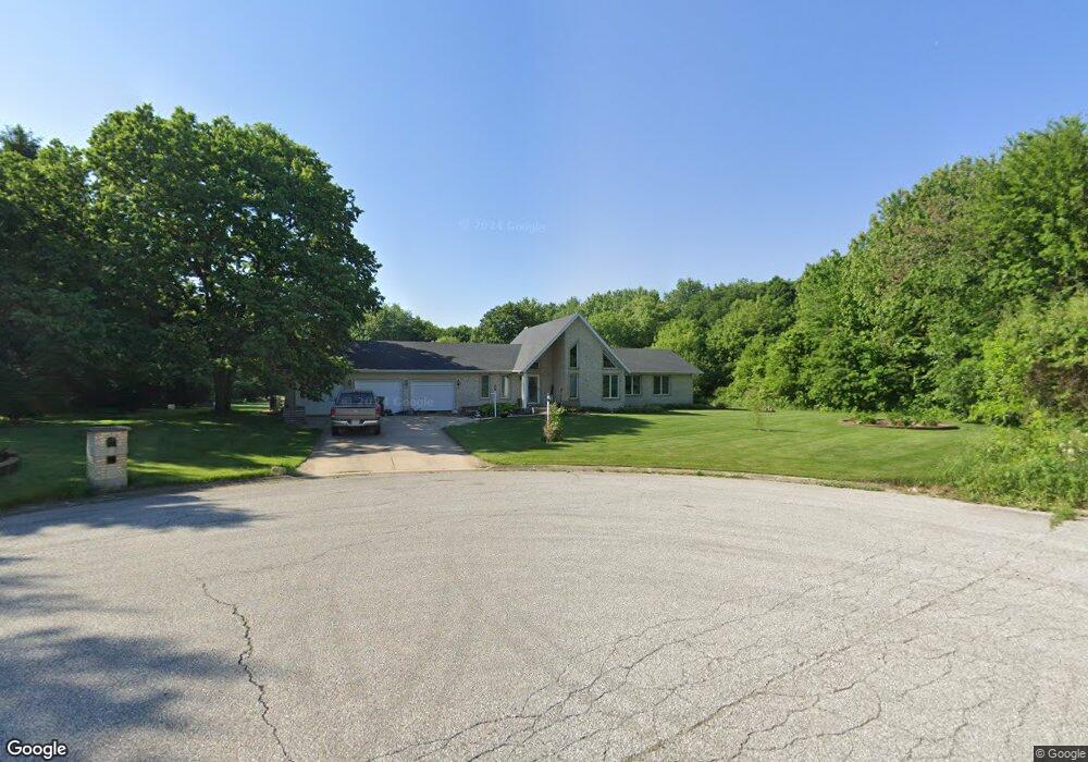
873 N High Meadow Ct Valparaiso, IN 46383
Porter County NeighborhoodEstimated Value: $478,000 - $533,000
3
Beds
3
Baths
1,958
Sq Ft
$260/Sq Ft
Est. Value
About This Home
This home is located at 873 N High Meadow Ct, Valparaiso, IN 46383 and is currently estimated at $508,192, approximately $259 per square foot. 873 N High Meadow Ct is a home located in Porter County with nearby schools including Jackson Elementary School, Chesterton Middle School, and Chesterton Senior High School.
Ownership History
Date
Name
Owned For
Owner Type
Purchase Details
Closed on
Aug 29, 2018
Sold by
Mitchell David
Bought by
Wente Jon D
Current Estimated Value
Home Financials for this Owner
Home Financials are based on the most recent Mortgage that was taken out on this home.
Original Mortgage
$278,825
Outstanding Balance
$242,651
Interest Rate
4.5%
Mortgage Type
New Conventional
Estimated Equity
$265,541
Create a Home Valuation Report for This Property
The Home Valuation Report is an in-depth analysis detailing your home's value as well as a comparison with similar homes in the area
Home Values in the Area
Average Home Value in this Area
Purchase History
| Date | Buyer | Sale Price | Title Company |
|---|---|---|---|
| Wente Jon D | -- | Chicago Title Co Llc |
Source: Public Records
Mortgage History
| Date | Status | Borrower | Loan Amount |
|---|---|---|---|
| Open | Wente Jon D | $278,825 |
Source: Public Records
Tax History Compared to Growth
Tax History
| Year | Tax Paid | Tax Assessment Tax Assessment Total Assessment is a certain percentage of the fair market value that is determined by local assessors to be the total taxable value of land and additions on the property. | Land | Improvement |
|---|---|---|---|---|
| 2024 | $3,653 | $497,300 | $60,100 | $437,200 |
| 2023 | $3,513 | $450,200 | $52,300 | $397,900 |
| 2022 | $3,509 | $421,100 | $52,300 | $368,800 |
| 2021 | $2,838 | $349,500 | $52,300 | $297,200 |
| 2020 | $2,579 | $313,000 | $47,500 | $265,500 |
| 2019 | $2,643 | $303,200 | $47,500 | $255,700 |
| 2018 | $2,563 | $298,300 | $47,500 | $250,800 |
| 2017 | $2,484 | $299,900 | $47,500 | $252,400 |
| 2016 | $2,529 | $302,600 | $56,300 | $246,300 |
| 2014 | $2,344 | $282,000 | $52,600 | $229,400 |
| 2013 | -- | $265,600 | $53,100 | $212,500 |
Source: Public Records
Map
Nearby Homes
- 877 Farmview Dr
- 458 Stonebridge Pkwy
- 456 Stonebridge Pkwy
- 479 Stonebridge Pkwy
- 454 Stonebridge Pkwy
- 486 Stonebridge Pkwy
- 874 Farmview Dr
- 488 Stonebridge Pkwy
- 494 Stonebridge Pkwy
- 880 Whitestone Dr
- Martin Plan at Stonebridge
- Harrison Plan at Stonebridge
- Dune Plan at Stonebridge
- Clifty Plan at Stonebridge
- 834 N 500 E
- 842 N 400 E
- 839 N 550 E
- 799 N 400 E
- 588 Pheasant Dr
- 825 Elk Ln
- 873 High Meadow Ct
- 875 High Meadow Ct
- 876 N High Meadow Ct
- 876 High Meadow Ct
- 876 N High Ct
- 870 Meadowdale Ct
- 480 High Meadow Cir
- 877 Farmview Ct
- 478 High Meadow Cir
- 478 E High Cir
- 478 E High Meadow Cir
- 484 High Meadow Cir
- 472 E High Meadow Cir
- 489 E High Meadow Cir
- 879 Farmview Ct
- 476 High Meadow Cir
- 869 Meadowdale Ct
- 483 E High Meadow Cir
- 483 High Meadow Cir
- 483 E High Cir