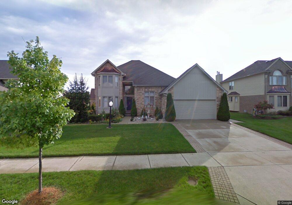
873 Norcross Dr Rochester Hills, MI 48307
Estimated Value: $535,000 - $638,000
3
Beds
3
Baths
2,771
Sq Ft
$214/Sq Ft
Est. Value
About This Home
This home is located at 873 Norcross Dr, Rochester Hills, MI 48307 and is currently estimated at $592,750, approximately $213 per square foot. 873 Norcross Dr is a home located in Oakland County with nearby schools including Hampton Elementary School, Reuther Middle School, and Rochester High School.
Ownership History
Date
Name
Owned For
Owner Type
Purchase Details
Closed on
Nov 12, 2013
Sold by
Patel Rashmikant D and Patel Vibhulata R
Bought by
The Rashmikant D Patel & Vibhulata R Pat and Patel Vibhulata R
Current Estimated Value
Purchase Details
Closed on
Jul 27, 2000
Sold by
Anderson David B
Bought by
Patel Rashmikant
Home Financials for this Owner
Home Financials are based on the most recent Mortgage that was taken out on this home.
Original Mortgage
$229,850
Outstanding Balance
$83,576
Interest Rate
8.26%
Estimated Equity
$509,174
Purchase Details
Closed on
Jun 9, 1998
Sold by
Dynasty Homes Inc
Bought by
Anderson David B
Home Financials for this Owner
Home Financials are based on the most recent Mortgage that was taken out on this home.
Original Mortgage
$186,400
Interest Rate
7.22%
Purchase Details
Closed on
Sep 3, 1996
Sold by
G V Properties
Bought by
Anderson David B
Create a Home Valuation Report for This Property
The Home Valuation Report is an in-depth analysis detailing your home's value as well as a comparison with similar homes in the area
Home Values in the Area
Average Home Value in this Area
Purchase History
| Date | Buyer | Sale Price | Title Company |
|---|---|---|---|
| The Rashmikant D Patel & Vibhulata R Pat | -- | None Available | |
| Patel Rashmikant | $306,500 | -- | |
| Anderson David B | $269,400 | -- | |
| Anderson David B | -- | -- |
Source: Public Records
Mortgage History
| Date | Status | Borrower | Loan Amount |
|---|---|---|---|
| Open | Patel Rashmikant | $229,850 | |
| Previous Owner | Anderson David B | $186,400 |
Source: Public Records
Tax History Compared to Growth
Tax History
| Year | Tax Paid | Tax Assessment Tax Assessment Total Assessment is a certain percentage of the fair market value that is determined by local assessors to be the total taxable value of land and additions on the property. | Land | Improvement |
|---|---|---|---|---|
| 2022 | $2,774 | $191,750 | $0 | $0 |
| 2018 | $4,594 | $189,120 | $0 | $0 |
| 2017 | $4,504 | $186,050 | $0 | $0 |
| 2015 | -- | $168,340 | $0 | $0 |
| 2014 | -- | $156,240 | $0 | $0 |
| 2011 | -- | $127,920 | $0 | $0 |
Source: Public Records
Map
Nearby Homes
- 2025 Somerville
- 2198 London Bridge Dr
- 2182 London Bridge Dr Unit G38
- 2162 London Bridge Dr Unit 56
- 513 Tennyson
- 535 Tennyson Unit 48
- 587 Tennyson
- 1166 Sugar Creek Dr
- 721 Enchantment Dr
- 653 Glasgow Ct Unit 207
- 980 Briston Dr
- 1037 Crestwyk Ln
- 733 Hamilton Ct Unit 120
- 1480 E Hamlin Rd
- 2082 Avon Lake Ln
- 740 Eastbridge Ct
- 830 Dartmouth Dr
- 525 Oxford Ct
- 2574 Culbertson Ave
- 273 Shadywood - Parcel B Rd
- 861 Norcross Dr
- 885 Norcross Dr
- 965 Norcross Dr
- 897 Norcross Dr
- 849 Norcross Dr
- 973 Norcross Dr
- 957 Norcross Dr
- 2163 Wentworth Dr
- 860 Norcross Dr
- 852 Norcross Dr
- 868 Norcross Dr
- 844 Norcross Dr
- 2177 Wentworth Dr
- 876 Norcross Dr
- 909 Norcross Dr
- 949 Norcross Dr
- 981 Norcross Dr
- 941 Norcross Dr
- 2107 Wentworth Dr
- 930 Maidstone Dr