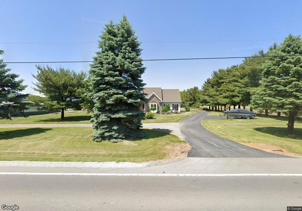
8730 W Us Route 224 Findlay, OH 45840
Estimated Value: $450,000 - $508,000
3
Beds
3
Baths
2,302
Sq Ft
$205/Sq Ft
Est. Value
About This Home
This home is located at 8730 W Us Route 224, Findlay, OH 45840 and is currently estimated at $471,789, approximately $204 per square foot. 8730 W Us Route 224 is a home located in Hancock County with nearby schools including Liberty-Benton Elementary School, Liberty-Benton Middle School, and Liberty-Benton High School.
Ownership History
Date
Name
Owned For
Owner Type
Purchase Details
Closed on
Nov 18, 2005
Sold by
Burns Scott A and Burns Ronda L
Bought by
Nichols Rick L
Current Estimated Value
Home Financials for this Owner
Home Financials are based on the most recent Mortgage that was taken out on this home.
Original Mortgage
$193,500
Outstanding Balance
$106,022
Interest Rate
6.04%
Mortgage Type
Fannie Mae Freddie Mac
Estimated Equity
$365,767
Purchase Details
Closed on
Feb 4, 2004
Sold by
Oneill Charles B and Oneill Mary E
Bought by
Burns Blake M and Burns Scott A
Home Financials for this Owner
Home Financials are based on the most recent Mortgage that was taken out on this home.
Original Mortgage
$144,000
Interest Rate
5.77%
Mortgage Type
Purchase Money Mortgage
Create a Home Valuation Report for This Property
The Home Valuation Report is an in-depth analysis detailing your home's value as well as a comparison with similar homes in the area
Home Values in the Area
Average Home Value in this Area
Purchase History
| Date | Buyer | Sale Price | Title Company |
|---|---|---|---|
| Nichols Rick L | $215,000 | Golden Key Title | |
| Burns Blake M | $160,000 | -- |
Source: Public Records
Mortgage History
| Date | Status | Borrower | Loan Amount |
|---|---|---|---|
| Open | Nichols Rick L | $193,500 | |
| Previous Owner | Burns Blake M | $144,000 |
Source: Public Records
Tax History Compared to Growth
Tax History
| Year | Tax Paid | Tax Assessment Tax Assessment Total Assessment is a certain percentage of the fair market value that is determined by local assessors to be the total taxable value of land and additions on the property. | Land | Improvement |
|---|---|---|---|---|
| 2024 | $4,666 | $125,330 | $10,940 | $114,390 |
| 2023 | $4,556 | $125,330 | $10,940 | $114,390 |
| 2022 | $4,512 | $125,330 | $10,940 | $114,390 |
| 2021 | $3,917 | $96,040 | $9,680 | $86,360 |
| 2020 | $3,950 | $96,040 | $9,680 | $86,360 |
| 2019 | $3,790 | $96,040 | $9,680 | $86,360 |
| 2018 | $3,119 | $87,180 | $8,070 | $79,110 |
| 2017 | $1,609 | $87,180 | $8,070 | $79,110 |
| 2016 | $3,120 | $87,180 | $8,070 | $79,110 |
| 2015 | $3,323 | $90,460 | $8,070 | $82,390 |
| 2014 | $3,283 | $88,580 | $8,070 | $80,510 |
| 2012 | $2,772 | $71,760 | $8,070 | $63,690 |
Source: Public Records
Map
Nearby Homes
- 8922 Township Road 94
- 7780 Township Road 89
- 9960 W Us Route 224
- 0 County Road 140
- 0 County Road 95 Unit 6097574
- 8179 Hazelwood Dr
- 8256 Silverwood Dr
- 9307 W State Route 12
- 0 County Road 223
- 2201 W Main Cross St
- 6535 Silver Lake Dr
- 9220 Colonel Dr
- 2014 W Sandusky St
- 9307 Hiegel Dr
- 9653 Early Dr
- 425 Nevada Ln
- 1405 Cypress Lake
- 0 Rock Candy Rd Unit Lot 159
- 0 Rock Candy Rd Unit Lot 170
- 0 Rock Candy Rd Unit Lot 172 206819
- 8658 W Us Route 224
- 8658 U S 224
- 8701 W Us Route 224
- 8645 Township Road 94
- 8731 Township Road 94
- 9172 W Us Route 224
- 9172 U S R 224
- 9172 U S 224
- 9172 W Us Route 224
- 8615 Township Road 94
- 7037 County Road 139
- 9133 Township Road 94
- 8498 Township Road 94
- 8083 W Us Route 224
- 8083 U S 224
- 9147 Township Road 94
- 9100 Township Road 94
- 8050 W Us Route 224
- 8050 State Route 224
- 8040 County Road 139