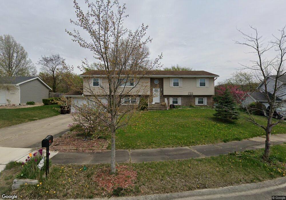
8737 Edison Ct Crown Point, IN 46307
Estimated Value: $384,145 - $438,000
5
Beds
2
Baths
2,970
Sq Ft
$136/Sq Ft
Est. Value
About This Home
This home is located at 8737 Edison Ct, Crown Point, IN 46307 and is currently estimated at $404,036, approximately $136 per square foot. 8737 Edison Ct is a home located in Lake County with nearby schools including Hal E Clark Middle School, Peifer Elementary School, and Lake Central High School.
Ownership History
Date
Name
Owned For
Owner Type
Purchase Details
Closed on
Feb 26, 2010
Sold by
Muskin Michael and Muskin Denise
Bought by
Lund Bradley R and Springer Rebecca A
Current Estimated Value
Home Financials for this Owner
Home Financials are based on the most recent Mortgage that was taken out on this home.
Original Mortgage
$193,500
Outstanding Balance
$102,066
Interest Rate
5.02%
Mortgage Type
New Conventional
Estimated Equity
$301,970
Create a Home Valuation Report for This Property
The Home Valuation Report is an in-depth analysis detailing your home's value as well as a comparison with similar homes in the area
Home Values in the Area
Average Home Value in this Area
Purchase History
| Date | Buyer | Sale Price | Title Company |
|---|---|---|---|
| Lund Bradley R | -- | Multiple |
Source: Public Records
Mortgage History
| Date | Status | Borrower | Loan Amount |
|---|---|---|---|
| Open | Lund Bradley R | $193,500 |
Source: Public Records
Tax History Compared to Growth
Tax History
| Year | Tax Paid | Tax Assessment Tax Assessment Total Assessment is a certain percentage of the fair market value that is determined by local assessors to be the total taxable value of land and additions on the property. | Land | Improvement |
|---|---|---|---|---|
| 2024 | $5,197 | $325,700 | $63,800 | $261,900 |
| 2023 | $2,297 | $314,700 | $63,800 | $250,900 |
| 2022 | $2,248 | $277,400 | $50,200 | $227,200 |
| 2021 | $2,023 | $260,500 | $50,200 | $210,300 |
| 2020 | $2,038 | $256,300 | $53,000 | $203,300 |
| 2019 | $2,194 | $247,400 | $49,700 | $197,700 |
| 2018 | $2,104 | $237,500 | $49,700 | $187,800 |
| 2017 | $1,883 | $228,300 | $49,700 | $178,600 |
| 2016 | $1,737 | $217,400 | $49,700 | $167,700 |
| 2014 | $1,628 | $219,300 | $49,600 | $169,700 |
| 2013 | $1,575 | $213,000 | $49,700 | $163,300 |
Source: Public Records
Map
Nearby Homes
- 8521 Morse Place
- 8903 Edison St
- 6440 W 89th Ave
- 7403 W 85th Ave
- 6501 W 89th Ave
- 7605 W 86th Ave
- 6640 W 89th Ave
- 6076 Wexford Way
- 8355 Blaine Place
- 8849 Calhoun Place
- 2914 Morningside Dr
- 2921 Morningside Dr
- 6308 W 91st Ave
- 6915 W 93rd Ave
- 2756 Autumn Dr
- 2720 Painted Leaf Ct
- 2609 Autumn Dr
- 1813 Redwood Ct
- 8748 Durbin Ln
- 1881 Orchard Ct