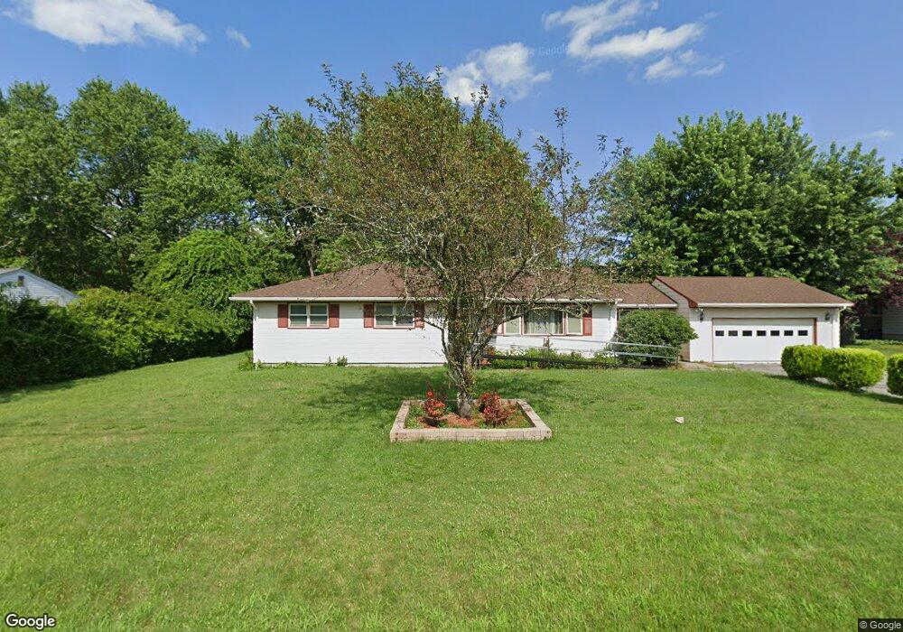
874 Sanford Rd Westport, MA 02790
North Westport NeighborhoodEstimated Value: $513,471 - $558,000
3
Beds
--
Bath
1,665
Sq Ft
$322/Sq Ft
Est. Value
About This Home
This home is located at 874 Sanford Rd, Westport, MA 02790 and is currently estimated at $536,618, approximately $322 per square foot. 874 Sanford Rd is a home located in Bristol County with nearby schools including Alice A. Macomber Primary School, Westport Elementary School, and Westport Middle-High School.
Ownership History
Date
Name
Owned For
Owner Type
Purchase Details
Closed on
Jul 2, 2024
Sold by
Ouellette Donald G
Bought by
874 Sanford Rd Rt and Ouellette
Current Estimated Value
Purchase Details
Closed on
Nov 14, 1979
Bought by
Ouellette Donald G and Ouellette Vivian P
Create a Home Valuation Report for This Property
The Home Valuation Report is an in-depth analysis detailing your home's value as well as a comparison with similar homes in the area
Home Values in the Area
Average Home Value in this Area
Purchase History
| Date | Buyer | Sale Price | Title Company |
|---|---|---|---|
| 874 Sanford Rd Rt | -- | None Available | |
| 874 Sanford Rd Rt | -- | None Available | |
| Ouellette Donald G | -- | -- |
Source: Public Records
Tax History Compared to Growth
Tax History
| Year | Tax Paid | Tax Assessment Tax Assessment Total Assessment is a certain percentage of the fair market value that is determined by local assessors to be the total taxable value of land and additions on the property. | Land | Improvement |
|---|---|---|---|---|
| 2025 | $3,120 | $418,800 | $178,200 | $240,600 |
| 2024 | $3,057 | $395,500 | $158,200 | $237,300 |
| 2023 | $2,960 | $362,700 | $144,100 | $218,600 |
| 2022 | $2,629 | $330,000 | $144,100 | $185,900 |
| 2021 | $2,629 | $305,000 | $119,100 | $185,900 |
| 2020 | $2,531 | $300,200 | $114,300 | $185,900 |
| 2019 | $2,433 | $294,200 | $114,300 | $179,900 |
| 2018 | $2,395 | $293,100 | $114,300 | $178,800 |
| 2017 | $2,277 | $285,700 | $110,600 | $175,100 |
| 2016 | $2,107 | $266,400 | $107,000 | $159,400 |
| 2015 | $1,992 | $251,200 | $109,400 | $141,800 |
Source: Public Records
Map
Nearby Homes
- 878 Sanford Rd
- 872 Sanford Rd
- 873 Sanford Rd
- 880 Sanford Rd
- 868 Sanford Rd
- 859 Sanford Rd
- 859 Sanford Rd Unit 2 Rear
- 864 Sanford Rd
- 903 Sanford Rd
- 890 Sanford Rd
- 883 Sanford Rd
- 896 Sanford Rd
- 907 Sanford Rd
- 849 Sanford Rd
- 904 Sanford Rd
- 908 Sanford Rd
- 837 Sanford Rd
- 840 Sanford Rd
- 836 Sanford Rd
- 829 Sanford Rd