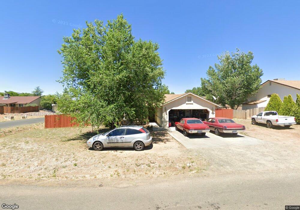
8740 E Volcano Dr Prescott Valley, AZ 86314
Estimated Value: $323,877 - $380,000
Studio
--
Bath
1,188
Sq Ft
$301/Sq Ft
Est. Value
About This Home
This home is located at 8740 E Volcano Dr, Prescott Valley, AZ 86314 and is currently estimated at $357,719, approximately $301 per square foot. 8740 E Volcano Dr is a home located in Yavapai County with nearby schools including Coyote Springs Elementary School, Glassford Hill Middle School, and Bradshaw Mountain High School.
Ownership History
Date
Name
Owned For
Owner Type
Purchase Details
Closed on
Jun 20, 2018
Sold by
Raskin Jeffrey T and Raskin Norie
Bought by
8707 Volcano Llc
Current Estimated Value
Purchase Details
Closed on
Dec 18, 2000
Sold by
Raskin Jeffrey T and Raskin Norie
Bought by
Raskin Jeffrey T and Raskin Norie
Purchase Details
Closed on
Oct 10, 2000
Sold by
Fujinaga Mieko
Bought by
Raskin Jeffrey and Raskin Norie
Purchase Details
Closed on
Dec 9, 1998
Sold by
Shuey Stephanie and Raskin Stephanie
Bought by
Fujinaga Mieko
Purchase Details
Closed on
Dec 24, 1996
Sold by
Raskin Jeffrey T and Raskin Norie
Bought by
Raskin Stephanie A
Purchase Details
Closed on
Apr 10, 1995
Sold by
Withers W T and Withers Sherry J
Bought by
Raskin Jeffrey Tyler and Raskin Norie
Purchase Details
Closed on
Jan 12, 1995
Sold by
Kerl Claude L and Kerl Dorothy M
Bought by
Withers W T and Withers Sherry J
Create a Home Valuation Report for This Property
The Home Valuation Report is an in-depth analysis detailing your home's value as well as a comparison with similar homes in the area
Purchase History
| Date | Buyer | Sale Price | Title Company |
|---|---|---|---|
| 8707 Volcano Llc | -- | None Available | |
| Raskin Jeffrey T | -- | -- | |
| Raskin Jeffrey | -- | -- | |
| Fujinaga Mieko | -- | -- | |
| Raskin Stephanie A | -- | -- | |
| Raskin Jeffrey Tyler | $81,000 | First American Title Ins | |
| Withers W T | $13,500 | Yavapai Title Company |
Source: Public Records
Tax History
| Year | Tax Paid | Tax Assessment Tax Assessment Total Assessment is a certain percentage of the fair market value that is determined by local assessors to be the total taxable value of land and additions on the property. | Land | Improvement |
|---|---|---|---|---|
| 2026 | $1,421 | $28,255 | -- | -- |
| 2024 | $1,318 | $29,129 | -- | -- |
| 2023 | $1,318 | $24,283 | $0 | $0 |
| 2022 | $1,297 | $19,461 | $2,868 | $16,593 |
| 2021 | $1,332 | $18,037 | $2,883 | $15,154 |
| 2020 | $1,285 | $0 | $0 | $0 |
| 2019 | $1,268 | $0 | $0 | $0 |
| 2018 | $1,213 | $0 | $0 | $0 |
| 2017 | $1,189 | $0 | $0 | $0 |
| 2016 | $1,151 | $0 | $0 | $0 |
| 2015 | -- | $0 | $0 | $0 |
| 2014 | -- | $0 | $0 | $0 |
Source: Public Records
Map
Nearby Homes
- 5344 N Cord Dr
- 5575 E Magpie Dr
- 5440 N Roadrunner Dr
- 5649 N Squaw Dr
- 5317 N Cattlemen Dr
- 5168 N Ranger Rd
- 8835 E Totem Cir
- 8850 E Roadrunner Dr
- 000 Moblie Home Portfolio
- 5301 N Robert Rd
- 5261 N Robert Rd
- 5259 N Long Rifle Rd
- 5088 N Desert Ln
- 8920 E Cheryl Dr
- 8517 Roundup Dr
- 8501 Roundup Dr
- 8485 Roundup Dr
- 4857 N Ranger Rd
- 4870 N Meixner Rd Unit 4
- 4767 N Stallion Dr
- 8731 E Rowel Dr
- 5621 N Mission Ln Unit 6380
- 8745 E Rowel Dr
- 8741 E Volcano Dr
- 8720 E Mission Cir
- 8720 E Mission Cir Unit 9
- 8720 E Mission Cir Unit 19
- 8715 E Rowel Dr
- 8715 E Rowel Ct
- 8715 E Rowel Ct Unit 9
- 8715 E Rowel Cir
- 8761 E Volcano Dr
- 8761 E Volcano Dr Unit 9
- 8780 E Volcano Dr
- 8721 E Mission Cir
- 8721 E Mission Cir Unit 9
- 8721 E Mission Cir Unit 6230
- 8761 E Rowel Dr
- 8781 E Volcano Dr
- 8781 E Volcano Dr Unit 9
Your Personal Tour Guide
Ask me questions while you tour the home.