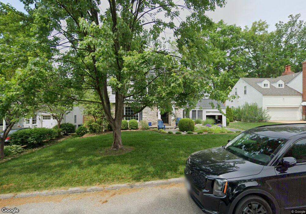
875 Brookside Dr Saint Louis, MO 63122
Estimated Value: $471,798 - $549,000
3
Beds
3
Baths
1,620
Sq Ft
$316/Sq Ft
Est. Value
About This Home
This home is located at 875 Brookside Dr, Saint Louis, MO 63122 and is currently estimated at $512,200, approximately $316 per square foot. 875 Brookside Dr is a home located in St. Louis County with nearby schools including North Glendale Elementary School, Nipher Middle School, and Kirkwood Senior High School.
Ownership History
Date
Name
Owned For
Owner Type
Purchase Details
Closed on
Aug 25, 2010
Sold by
Walker Nick and Walker Nancy
Bought by
Hermann James A and Hermann Kathryn A
Current Estimated Value
Home Financials for this Owner
Home Financials are based on the most recent Mortgage that was taken out on this home.
Original Mortgage
$202,500
Outstanding Balance
$134,277
Interest Rate
4.6%
Mortgage Type
New Conventional
Estimated Equity
$377,923
Purchase Details
Closed on
Oct 7, 2003
Sold by
Wehnes Family Revocable Living Trust and Wehnes Harold L
Bought by
Walker Nick and Walker Nancy
Home Financials for this Owner
Home Financials are based on the most recent Mortgage that was taken out on this home.
Original Mortgage
$156,000
Interest Rate
6.1%
Mortgage Type
Purchase Money Mortgage
Create a Home Valuation Report for This Property
The Home Valuation Report is an in-depth analysis detailing your home's value as well as a comparison with similar homes in the area
Home Values in the Area
Average Home Value in this Area
Purchase History
| Date | Buyer | Sale Price | Title Company |
|---|---|---|---|
| Hermann James A | $320,000 | None Available | |
| Walker Nick | $236,000 | -- |
Source: Public Records
Mortgage History
| Date | Status | Borrower | Loan Amount |
|---|---|---|---|
| Open | Hermann James A | $202,500 | |
| Previous Owner | Walker Nick | $156,000 | |
| Closed | Walker Nick | $68,200 |
Source: Public Records
Tax History
| Year | Tax Paid | Tax Assessment Tax Assessment Total Assessment is a certain percentage of the fair market value that is determined by local assessors to be the total taxable value of land and additions on the property. | Land | Improvement |
|---|---|---|---|---|
| 2025 | $5,555 | $97,910 | $66,500 | $31,410 |
| 2024 | $5,555 | $85,080 | $47,500 | $37,580 |
| 2023 | $5,473 | $85,080 | $47,500 | $37,580 |
| 2022 | $5,138 | $74,420 | $42,180 | $32,240 |
| 2021 | $5,066 | $74,420 | $42,180 | $32,240 |
| 2020 | $4,750 | $66,750 | $42,750 | $24,000 |
| 2019 | $4,631 | $66,750 | $42,750 | $24,000 |
| 2018 | $4,769 | $61,520 | $34,200 | $27,320 |
| 2017 | $4,805 | $61,520 | $34,200 | $27,320 |
| 2016 | $4,469 | $57,590 | $26,600 | $30,990 |
Source: Public Records
Map
Nearby Homes
- 815 Brookside Dr
- 1306 Glendale Gardens Dr Unit C
- 918 Nancy Carol Ln
- 1009 Joanna Ave
- 829 Renderer Dr
- 1031 Glenway Dr
- 1104 Mariedale Ct Unit C
- 621 Meadowridge Ln
- 1171 Ascot Ln
- 1026 Kirkham Ave
- 582 Brookhaven Ct
- 887 Dickson St
- 18 Southridge Dr
- 754 Brownell Ave
- 582 Drury Ln
- 686 Brownell Ave
- 525 Beaucaire Dr
- 9840 Madison Ave
- 789 Glenvista Place
- 739 Glenvista Place
- 885 Brookside Dr
- 865 Brookside Dr
- 895 Brookside Dr
- 855 Brookside Dr
- 874 Brookside Dr
- 884 Brookside Dr
- 864 Brookside Dr
- 894 Brookside Dr
- 854 Brookside Dr
- 845 Brookside Dr
- 875 Glen Elm Dr
- 885 Glen Elm Dr
- 865 Glen Elm Dr
- 844 Brookside Dr
- 1270 N Sappington Rd
- 900 Joanna Ave
- 895 Glen Elm Dr
- 855 Glen Elm Dr
- 835 Brookside Dr
- 1330 N Sappington Rd
Your Personal Tour Guide
Ask me questions while you tour the home.