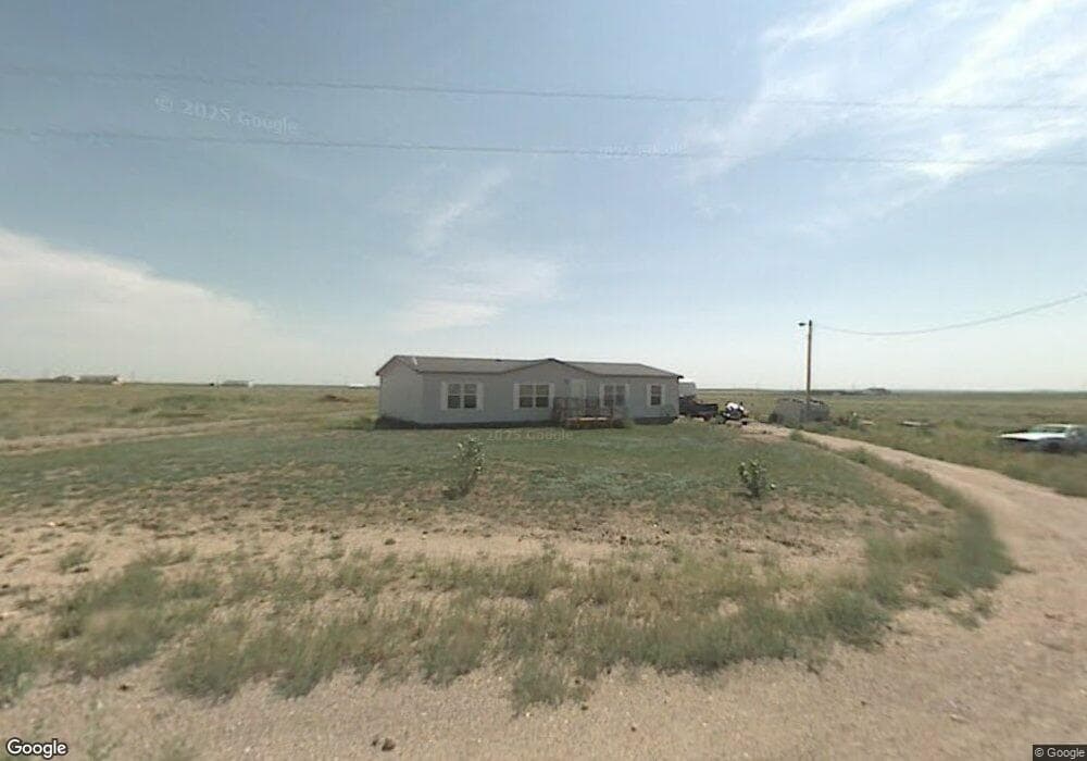
875 West Rd Carpenter, WY 82054
Estimated Value: $378,000 - $472,000
--
Bed
--
Bath
1,512
Sq Ft
$286/Sq Ft
Est. Value
About This Home
This home is located at 875 West Rd, Carpenter, WY 82054 and is currently estimated at $431,865, approximately $285 per square foot. 875 West Rd is a home located in Laramie County.
Ownership History
Date
Name
Owned For
Owner Type
Purchase Details
Closed on
Jul 10, 2025
Sold by
Messer James and Stierle Daniell
Bought by
Messer James and Stierle Daniell
Current Estimated Value
Home Financials for this Owner
Home Financials are based on the most recent Mortgage that was taken out on this home.
Original Mortgage
$125,000
Outstanding Balance
$124,137
Interest Rate
5.99%
Mortgage Type
Credit Line Revolving
Estimated Equity
$307,728
Purchase Details
Closed on
Jun 30, 2025
Sold by
Messer James David and Barker Andrea
Bought by
Messer James and Barker Andrea
Home Financials for this Owner
Home Financials are based on the most recent Mortgage that was taken out on this home.
Original Mortgage
$125,000
Outstanding Balance
$124,137
Interest Rate
5.99%
Mortgage Type
Credit Line Revolving
Estimated Equity
$307,728
Purchase Details
Closed on
Nov 30, 2018
Sold by
Barker Andrea
Bought by
Messer James David and Barker Andrea
Purchase Details
Closed on
Oct 10, 2017
Sold by
Engel Travis
Bought by
Barker Andrea
Home Financials for this Owner
Home Financials are based on the most recent Mortgage that was taken out on this home.
Original Mortgage
$97,206
Interest Rate
3.82%
Mortgage Type
FHA
Purchase Details
Closed on
Jun 15, 2001
Sold by
Engel Travis
Bought by
Engel Travis R
Home Financials for this Owner
Home Financials are based on the most recent Mortgage that was taken out on this home.
Original Mortgage
$87,200
Interest Rate
7.11%
Mortgage Type
Purchase Money Mortgage
Purchase Details
Closed on
Mar 2, 2001
Sold by
Halle Ernest W and Halle Bernadene L
Bought by
Rocky Mountain Well Drillers Inc
Create a Home Valuation Report for This Property
The Home Valuation Report is an in-depth analysis detailing your home's value as well as a comparison with similar homes in the area
Home Values in the Area
Average Home Value in this Area
Purchase History
| Date | Buyer | Sale Price | Title Company |
|---|---|---|---|
| Messer James | -- | None Listed On Document | |
| Messer James | -- | None Listed On Document | |
| Messer James | -- | None Listed On Document | |
| Messer James David | -- | None Available | |
| Barker Andrea | -- | Summit Title Services | |
| Barker Andrea | -- | Summit Title Services | |
| Engel Travis R | -- | -- | |
| Rocky Mountain Well Drillers Inc | -- | -- |
Source: Public Records
Mortgage History
| Date | Status | Borrower | Loan Amount |
|---|---|---|---|
| Open | Messer James | $125,000 | |
| Previous Owner | Barker Andrea | $97,206 | |
| Previous Owner | Engel Travis R | $87,200 |
Source: Public Records
Tax History Compared to Growth
Tax History
| Year | Tax Paid | Tax Assessment Tax Assessment Total Assessment is a certain percentage of the fair market value that is determined by local assessors to be the total taxable value of land and additions on the property. | Land | Improvement |
|---|---|---|---|---|
| 2025 | $2,064 | $22,793 | $6,048 | $16,745 |
| 2024 | $2,064 | $30,040 | $8,572 | $21,468 |
| 2023 | $2,020 | $29,403 | $8,572 | $20,831 |
| 2022 | $1,598 | $22,772 | $5,382 | $17,390 |
| 2021 | $1,487 | $21,140 | $5,382 | $15,758 |
| 2020 | $1,343 | $19,366 | $5,382 | $13,984 |
| 2019 | $1,320 | $18,806 | $5,382 | $13,424 |
| 2018 | $1,222 | $17,689 | $5,382 | $12,307 |
| 2017 | $1,185 | $16,888 | $5,110 | $11,778 |
| 2016 | $1,085 | $15,451 | $3,845 | $11,606 |
| 2015 | $1,053 | $14,991 | $3,845 | $11,146 |
| 2014 | $1,040 | $14,711 | $3,421 | $11,290 |
Source: Public Records
Map
Nearby Homes
- 876 West Rd
- S 1/2 Tract 7 East Rd
- 4154 Antelope Meadows Dr
- 3870 Blue Sky Rd
- Tract 4 Road 143
- Tract 3 Road 143
- Tract 2 Road 143
- Tract 1 Road 143
- Tract 10 Road 143
- 3888 Road 207
- Tract 16 Blue Duck Trail
- Tract 19 Lonesome Dove Trail
- Tract 5 Jake Spoon Trail
- Tract 2 Jake Spoon Trail
- Tract 20 Lonesome Dove Trail
- Tract 18 Lonesome Dove Trail
- Tract 15 Blue Duck Trail
- Tract 23 Lonesome Dove Trail
- Tract 21 Lonesome Dove Trail
- Tract 7 Blue Duck Trail