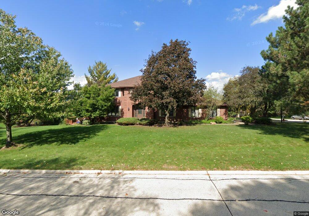
8750 S Grant St Burr Ridge, IL 60527
Burr Ridge West NeighborhoodEstimated Value: $805,740 - $971,000
--
Bed
1
Bath
3,219
Sq Ft
$275/Sq Ft
Est. Value
About This Home
This home is located at 8750 S Grant St, Burr Ridge, IL 60527 and is currently estimated at $886,685, approximately $275 per square foot. 8750 S Grant St is a home located in DuPage County with nearby schools including Anne M. Jeans Elementary School, Burr Ridge Middle School, and Hinsdale South High School.
Ownership History
Date
Name
Owned For
Owner Type
Purchase Details
Closed on
Dec 8, 2008
Sold by
Mccormack Colleen
Bought by
Mccormack Colleen M and The Colleen M Mccormack Trust
Current Estimated Value
Purchase Details
Closed on
Mar 16, 2006
Sold by
Mccormack John J
Bought by
Mccormack Colleen
Purchase Details
Closed on
Apr 15, 1998
Sold by
Koehn Gary L and Koehn Elizabeth
Bought by
Mccormack John J and Mccormack Colleen M
Home Financials for this Owner
Home Financials are based on the most recent Mortgage that was taken out on this home.
Original Mortgage
$300,000
Interest Rate
6.12%
Purchase Details
Closed on
Nov 1, 1995
Sold by
Koehn Gary L and Koehn Elizabeth
Bought by
Koehn Gary L and Koehn Elizabeth
Create a Home Valuation Report for This Property
The Home Valuation Report is an in-depth analysis detailing your home's value as well as a comparison with similar homes in the area
Home Values in the Area
Average Home Value in this Area
Purchase History
| Date | Buyer | Sale Price | Title Company |
|---|---|---|---|
| Mccormack Colleen M | -- | None Available | |
| Mccormack Colleen | -- | None Available | |
| Mccormack John J | $425,000 | Premier Title Company | |
| Koehn Gary L | -- | -- |
Source: Public Records
Mortgage History
| Date | Status | Borrower | Loan Amount |
|---|---|---|---|
| Previous Owner | Mccormack John J | $300,000 |
Source: Public Records
Tax History Compared to Growth
Tax History
| Year | Tax Paid | Tax Assessment Tax Assessment Total Assessment is a certain percentage of the fair market value that is determined by local assessors to be the total taxable value of land and additions on the property. | Land | Improvement |
|---|---|---|---|---|
| 2024 | $13,494 | $239,817 | $95,596 | $144,221 |
| 2023 | $12,987 | $220,460 | $87,880 | $132,580 |
| 2022 | $10,484 | $181,570 | $90,500 | $91,070 |
| 2021 | $10,060 | $179,500 | $89,470 | $90,030 |
| 2020 | $9,899 | $175,950 | $87,700 | $88,250 |
| 2019 | $11,978 | $211,110 | $84,150 | $126,960 |
| 2018 | $11,827 | $216,730 | $83,690 | $133,040 |
| 2017 | $11,742 | $208,550 | $80,530 | $128,020 |
| 2016 | $11,466 | $199,040 | $76,860 | $122,180 |
| 2015 | $11,455 | $187,260 | $72,310 | $114,950 |
| 2014 | $10,901 | $175,740 | $70,310 | $105,430 |
| 2013 | $10,554 | $174,920 | $69,980 | $104,940 |
Source: Public Records
Map
Nearby Homes
- 15W601 89th Place
- 15W601 S Grant St
- 430 Westminster Dr
- 16W130 89th St
- 8673 Timber Ridge Dr
- 10S370 Madison St
- 8980 Enclave Dr
- 16W122 91st St
- 15 Laurel Oak Ct
- 8625 Meadowbrook Dr
- 16W234 91st St
- 15W670 83rd St
- 4 Keri Ln
- 9233 Falling Waters Dr W
- 10S641 S Garfield Ave
- 8850 S County Line Rd
- 8170 Lake Ridge Dr
- 10S641 Garfield Ave
- 1 Hidden Lake Dr
- 8886 Johnston Rd
- 8740 S Grant St
- 8749 Aintree Ln
- 600 Devon Dr
- 8730 S Grant St
- 8737 Aintree Ln
- 549 Devon Dr
- 610 Devon Dr
- 620 Devon Dr
- 8720 S Grant St
- 8725 Aintree Ln
- 8810 S Grant St
- 541 Devon Dr
- 540 Devon Dr
- 8750 Aintree Ln
- 8815 Aintree Ln
- 4 Hunter Ct
- 8811 S Grant St
- 8710 S Grant St
- 531 Devon Dr Unit 1
- 8726 Aintree Ln
