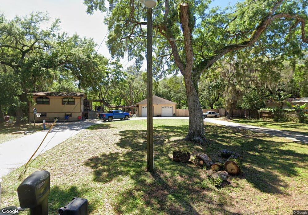
8751 Doris Ln New Port Richey, FL 34654
Estimated Value: $319,000 - $446,000
3
Beds
3
Baths
2,781
Sq Ft
$133/Sq Ft
Est. Value
About This Home
This home is located at 8751 Doris Ln, New Port Richey, FL 34654 and is currently estimated at $369,901, approximately $133 per square foot. 8751 Doris Ln is a home located in Pasco County with nearby schools including Cypress Elementary School, River Ridge High School, and River Ridge Middle School.
Ownership History
Date
Name
Owned For
Owner Type
Purchase Details
Closed on
Jan 2, 2024
Sold by
Unknown
Bought by
Santana Tiffany Mazie
Current Estimated Value
Purchase Details
Closed on
Dec 13, 2005
Sold by
Mcilwain Scott
Bought by
Pleickhardt Glenn
Purchase Details
Closed on
Nov 3, 2005
Sold by
Mcilwain Scott and Mcilwain Kimberly
Bought by
Mcilwain Scott
Create a Home Valuation Report for This Property
The Home Valuation Report is an in-depth analysis detailing your home's value as well as a comparison with similar homes in the area
Home Values in the Area
Average Home Value in this Area
Purchase History
| Date | Buyer | Sale Price | Title Company |
|---|---|---|---|
| Santana Tiffany Mazie | -- | None Listed On Document | |
| Pleickhardt Glenn | $108,821 | First American Title Ins Co | |
| Mcilwain Scott | -- | -- |
Source: Public Records
Tax History Compared to Growth
Tax History
| Year | Tax Paid | Tax Assessment Tax Assessment Total Assessment is a certain percentage of the fair market value that is determined by local assessors to be the total taxable value of land and additions on the property. | Land | Improvement |
|---|---|---|---|---|
| 2025 | $4,640 | $262,317 | $88,492 | $173,825 |
| 2024 | $4,640 | $303,248 | $88,492 | $214,756 |
| 2023 | $4,257 | $281,204 | $63,180 | $218,024 |
| 2022 | $3,509 | $240,391 | $63,180 | $177,211 |
| 2021 | $3,263 | $219,705 | $56,700 | $163,005 |
| 2020 | $2,760 | $162,076 | $32,400 | $129,676 |
| 2019 | $2,673 | $162,777 | $32,400 | $130,377 |
| 2018 | $2,555 | $164,868 | $32,400 | $132,468 |
| 2017 | $2,441 | $158,548 | $32,400 | $126,148 |
| 2016 | $2,018 | $113,382 | $32,400 | $80,982 |
| 2015 | $2,463 | $137,030 | $58,726 | $78,304 |
| 2014 | $2,379 | $135,014 | $58,726 | $76,288 |
Source: Public Records
Map
Nearby Homes
- 0 Royal Palm Ave Unit MFRW7858646
- 8624 Brookwood Dr
- 9217 Maynard Ave
- 9210 Maynard Ave
- 9240 Creston Ave
- 9229 Creston Ave
- 8531 Bass Lake Dr
- 9166 Sunshine Blvd
- 9911 Mendel Dr
- 8617 Broad St
- 8518 Thrasher Ct
- 8522 Cranes Roost Dr
- 8057 Moonlight Ln
- 9520 Indale Dr
- 8248 Tanglewood Dr
- 0 0 Unit MFRTB8421780
- 7946 Callan Ct
- 8823 Crescent Forest Blvd
- 8741 Planters Ln
- 7941 Sycamore Dr
- 8765 Doris Ln
- 8801 Doris Ln
- 8752 Doris Ln
- 8760 Doris Ln
- 8720 Brookwood Dr
- 8811 Doris Ln
- 8728 Brookwood Dr
- 8802 Doris Ln
- 8656 Brookwood Dr
- 8740 Brookwood Dr
- 8810 Doris Ln
- 0 Royal Palm Ave
- 8632 Brookwood Dr
- 8640 Brookwood Dr
- 9208 Outpost Dr
- 9231 Royal Palm Ave
- 9241 Royal Palm Ave
- 8725 Brookwood Dr
- 8651 Brookwood Dr
- 8881 Bass Lake Dr