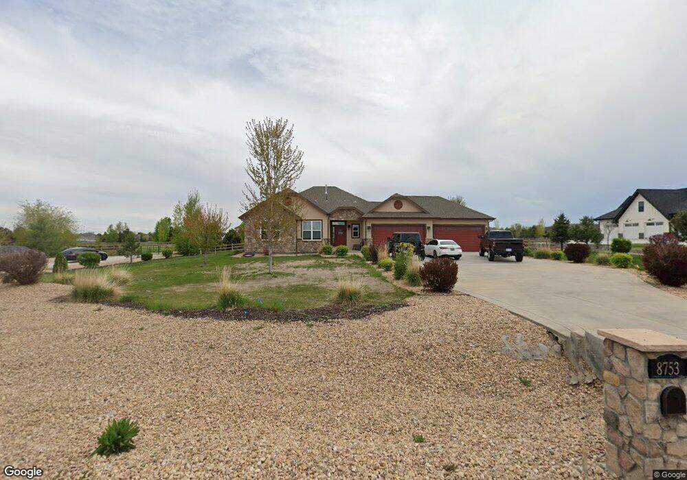
8753 Longs Peak Cir Unit (Lot 16) Windsor, CO 80550
Estimated Value: $1,430,748 - $1,538,000
4
Beds
5
Baths
2,512
Sq Ft
$588/Sq Ft
Est. Value
About This Home
This home is located at 8753 Longs Peak Cir Unit (Lot 16), Windsor, CO 80550 and is currently estimated at $1,476,937, approximately $587 per square foot. 8753 Longs Peak Cir Unit (Lot 16) is a home located in Larimer County with nearby schools including High Plains School, Mountain View High School, and Resurrection Christian School.
Ownership History
Date
Name
Owned For
Owner Type
Purchase Details
Closed on
Sep 9, 2021
Sold by
Hendry Bradford M and Hendry Heather D
Bought by
Skov Joshua and Skov Brogan
Current Estimated Value
Home Financials for this Owner
Home Financials are based on the most recent Mortgage that was taken out on this home.
Original Mortgage
$1,031,600
Outstanding Balance
$938,679
Interest Rate
2.8%
Mortgage Type
New Conventional
Estimated Equity
$538,258
Purchase Details
Closed on
Jan 30, 2017
Sold by
New Expression Homes Llc
Bought by
Hendry Bradford M and Hendry Heather D
Home Financials for this Owner
Home Financials are based on the most recent Mortgage that was taken out on this home.
Original Mortgage
$560,000
Interest Rate
4.16%
Mortgage Type
New Conventional
Create a Home Valuation Report for This Property
The Home Valuation Report is an in-depth analysis detailing your home's value as well as a comparison with similar homes in the area
Home Values in the Area
Average Home Value in this Area
Purchase History
| Date | Buyer | Sale Price | Title Company |
|---|---|---|---|
| Skov Joshua | $1,289,500 | Land Title Guarantee Company | |
| Hendry Bradford M | $699,999 | Heritage Title Co |
Source: Public Records
Mortgage History
| Date | Status | Borrower | Loan Amount |
|---|---|---|---|
| Open | Skov Joshua | $1,031,600 | |
| Previous Owner | Hendry Bradford M | $560,000 |
Source: Public Records
Tax History Compared to Growth
Tax History
| Year | Tax Paid | Tax Assessment Tax Assessment Total Assessment is a certain percentage of the fair market value that is determined by local assessors to be the total taxable value of land and additions on the property. | Land | Improvement |
|---|---|---|---|---|
| 2025 | $7,327 | $83,428 | $27,470 | $55,958 |
| 2024 | $7,097 | $83,428 | $27,470 | $55,958 |
| 2022 | $5,358 | $58,374 | $17,723 | $40,651 |
| 2021 | $5,491 | $60,053 | $18,233 | $41,820 |
| 2020 | $4,741 | $51,795 | $15,158 | $36,637 |
| 2019 | $4,672 | $51,795 | $15,158 | $36,637 |
| 2018 | $4,375 | $46,634 | $11,232 | $35,402 |
| 2017 | $3,365 | $40,766 | $11,232 | $29,534 |
| 2016 | $3,543 | $41,671 | $10,030 | $31,641 |
| 2015 | $3,068 | $36,540 | $36,540 | $0 |
| 2014 | $2,259 | $25,960 | $25,960 | $0 |
Source: Public Records
Map
Nearby Homes
- 8313 Cherry Blossom Dr
- 8736 Blackwood Dr
- 1764 Branching Canopy Dr
- 1867 Abundance Dr
- 1830 Thrive Dr
- 7880 Cherry Blossom Dr
- 8881 Longs Peak Cir
- 1813 Garden Flourish Ct
- 1854 Equinox Dr
- 2071 Dusk Ct
- 1730 Lucent Ct
- 1757 Covered Bridge Pkwy
- 1961 Rose Petal Dr
- 1728 Center Pivot Dr
- 1653 Flourish Dr
- 1716 Branching Canopy Dr
- 1746 Abundance Dr
- 1759 Abundance Dr
- 1802 Rise Dr
- 1811 Bounty Dr Unit 8
- 8753 Longs Peak Cir
- 8755 Longs Peak Cir
- 8755 Longs Peak Cir Unit (Lot 15)
- 8751 Longs Peak Cir
- 8752 Longs Peak Cir
- 8754 Longs Peak Cir
- 8750 Longs Peak Cir
- 8757 Longs Peak Cir
- 8747 Longs Peak Cir
- 8756 Longs Peak Cir
- 8748 Longs Peak Cir
- 8759 Longs Peak Cir
- 8759 Longs Peak Cir Unit (Lot 13)
- 5220 Shavano Ct
- 8758 Longs Peak Cir
- 8743 Longs Peak Cir
- 8746 Longs Peak Cir
- 5212 Shavano Ct
- 8760 Longs Peak Cir Unit (Lot 33)
- 8760 Longs Peak Cir
