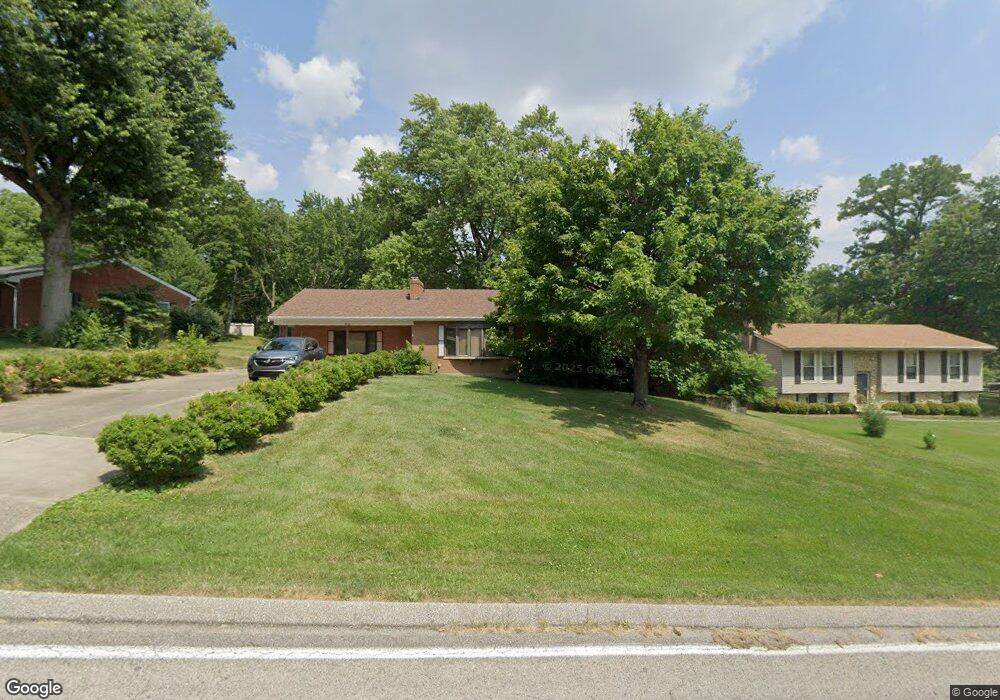
8756 Wuest Rd Cincinnati, OH 45251
Estimated Value: $328,846 - $361,000
3
Beds
2
Baths
2,490
Sq Ft
$139/Sq Ft
Est. Value
About This Home
This home is located at 8756 Wuest Rd, Cincinnati, OH 45251 and is currently estimated at $345,712, approximately $138 per square foot. 8756 Wuest Rd is a home located in Hamilton County with nearby schools including Colerain Elementary School, Colerain Middle School, and Colerain High School.
Ownership History
Date
Name
Owned For
Owner Type
Purchase Details
Closed on
Mar 21, 2022
Sold by
Pike Gregory C and Pike Deborah Jane
Bought by
Pike Gregory C
Current Estimated Value
Home Financials for this Owner
Home Financials are based on the most recent Mortgage that was taken out on this home.
Original Mortgage
$200,000
Interest Rate
6.92%
Mortgage Type
New Conventional
Purchase Details
Closed on
Sep 14, 2011
Sold by
Estate Of Dorothy Mae Farmer
Bought by
Farmer Donald and Farmer Gary
Purchase Details
Closed on
Jun 28, 2003
Sold by
Patricia Hill and Patricia Timothy
Bought by
Pike Gregory C and Pike Susan
Purchase Details
Closed on
Sep 15, 1997
Sold by
Soell Timothy A
Bought by
Hill Patricia and Soell Timothy
Home Financials for this Owner
Home Financials are based on the most recent Mortgage that was taken out on this home.
Original Mortgage
$120,513
Interest Rate
7.54%
Mortgage Type
FHA
Purchase Details
Closed on
Jul 9, 1997
Sold by
Soell Peter A
Bought by
Soell Timothy A
Purchase Details
Closed on
Jul 27, 1996
Sold by
Mendenhall Robert
Bought by
Soell Peter A
Home Financials for this Owner
Home Financials are based on the most recent Mortgage that was taken out on this home.
Original Mortgage
$109,958
Interest Rate
8.33%
Create a Home Valuation Report for This Property
The Home Valuation Report is an in-depth analysis detailing your home's value as well as a comparison with similar homes in the area
Home Values in the Area
Average Home Value in this Area
Purchase History
| Date | Buyer | Sale Price | Title Company |
|---|---|---|---|
| Pike Gregory C | $150,105 | -- | |
| Farmer Donald | -- | Attorney | |
| Pike Gregory C | $190,000 | -- | |
| Hill Patricia | -- | -- | |
| Soell Timothy A | -- | -- | |
| Soell Peter A | $119,000 | -- |
Source: Public Records
Mortgage History
| Date | Status | Borrower | Loan Amount |
|---|---|---|---|
| Previous Owner | Pike Gregory C | $200,000 | |
| Previous Owner | Hill Patricia | $120,513 | |
| Previous Owner | Soell Peter A | $109,958 |
Source: Public Records
Tax History
| Year | Tax Paid | Tax Assessment Tax Assessment Total Assessment is a certain percentage of the fair market value that is determined by local assessors to be the total taxable value of land and additions on the property. | Land | Improvement |
|---|---|---|---|---|
| 2025 | $5,398 | $93,506 | $15,589 | $77,917 |
| 2024 | $5,011 | $93,506 | $15,589 | $77,917 |
| 2023 | $5,037 | $93,506 | $15,589 | $77,917 |
| 2022 | $4,859 | $73,574 | $14,648 | $58,926 |
| 2021 | $4,822 | $73,574 | $14,648 | $58,926 |
| 2020 | $4,866 | $73,574 | $14,648 | $58,926 |
| 2019 | $4,421 | $62,353 | $12,415 | $49,938 |
| 2018 | $3,967 | $62,353 | $12,415 | $49,938 |
| 2017 | $3,761 | $62,353 | $12,415 | $49,938 |
| 2016 | $3,717 | $60,788 | $12,341 | $48,447 |
| 2015 | $3,750 | $60,788 | $12,341 | $48,447 |
| 2014 | $3,757 | $60,788 | $12,341 | $48,447 |
| 2013 | $3,763 | $63,987 | $12,992 | $50,995 |
Source: Public Records
Map
Nearby Homes
- 8877 Wuest Rd
- 8530 Wuest Rd
- 9136 Yellowwood Dr
- 9111 Cobblechase Ct
- 8747 Cheviot Rd
- 3760 Brockton Dr
- 3937 Olde Savannah Dr Unit 3937
- 3970 Olde Savannah Dr
- 8261 Cheviot Rd
- 5613 Old Blue Rock Rd
- 3494 Poole Rd
- 9125 Round Top Rd
- 3701 W Galbraith Rd
- 3691 W Galbraith Rd
- 3693 W Galbraith Rd
- 5658 Springdale Rd
- 3798 Philnoll Dr
- 3408 Rocker Dr
- 3467 Amberway Ct Unit 85
- 7630 Cheviot Rd
- 8744 Wuest Rd
- 8770 Wuest Rd
- 8798 Wuest Rd
- 8738 Wuest Rd
- 8683 Indianwoods Dr
- 8816 Wuest Rd
- 8689 Indianwoods Dr
- 8751 Wuest Rd
- 8697 Indianwoods Dr
- 8677 Indianwoods Dr
- 14 Blue Meadow Ln
- 8703 Indianwoods Dr
- 8669 Indianwoods Dr
- 8737 Wuest Rd
- 8835 Wuest Rd
- 8663 Indianwoods Dr
- 8830 Wuest Rd
- 8709 Indianwoods Dr
- 8793 Wuest Rd
- 8709 Wuest Rd
Your Personal Tour Guide
Ask me questions while you tour the home.