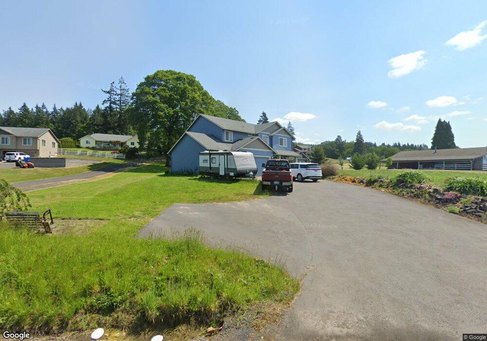
876 Cloverdale Rd Kalama, WA 98625
Estimated Value: $596,815 - $791,000
3
Beds
3
Baths
2,263
Sq Ft
$319/Sq Ft
Est. Value
About This Home
This home is located at 876 Cloverdale Rd, Kalama, WA 98625 and is currently estimated at $721,454, approximately $318 per square foot. 876 Cloverdale Rd is a home located in Cowlitz County with nearby schools including Kalama Elementary School, Kalama Middle School, and Kalama High School.
Ownership History
Date
Name
Owned For
Owner Type
Purchase Details
Closed on
Oct 22, 2016
Sold by
Furlong Betsy M and Preheim Betsy M
Bought by
Furlong Betsy M and Furlong Joshua J
Current Estimated Value
Home Financials for this Owner
Home Financials are based on the most recent Mortgage that was taken out on this home.
Original Mortgage
$226,150
Outstanding Balance
$181,071
Interest Rate
3.42%
Mortgage Type
VA
Estimated Equity
$540,383
Purchase Details
Closed on
Nov 30, 2010
Sold by
Alkor Construction Nw Inc
Bought by
Preheim Betsy M
Home Financials for this Owner
Home Financials are based on the most recent Mortgage that was taken out on this home.
Original Mortgage
$250,000
Interest Rate
4.17%
Mortgage Type
VA
Create a Home Valuation Report for This Property
The Home Valuation Report is an in-depth analysis detailing your home's value as well as a comparison with similar homes in the area
Home Values in the Area
Average Home Value in this Area
Purchase History
| Date | Buyer | Sale Price | Title Company |
|---|---|---|---|
| Furlong Betsy M | -- | Cowlitz Co Title | |
| Preheim Betsy M | $250,000 | Cascade Title Co |
Source: Public Records
Mortgage History
| Date | Status | Borrower | Loan Amount |
|---|---|---|---|
| Open | Furlong Betsy M | $226,150 | |
| Closed | Preheim Betsy M | $250,000 |
Source: Public Records
Tax History Compared to Growth
Tax History
| Year | Tax Paid | Tax Assessment Tax Assessment Total Assessment is a certain percentage of the fair market value that is determined by local assessors to be the total taxable value of land and additions on the property. | Land | Improvement |
|---|---|---|---|---|
| 2024 | $5,003 | $559,830 | $94,250 | $465,580 |
| 2023 | $4,841 | $558,510 | $88,080 | $470,430 |
| 2022 | $4,304 | $551,880 | $76,590 | $475,290 |
| 2021 | $4,109 | $425,450 | $58,920 | $366,530 |
| 2020 | $4,278 | $393,040 | $56,060 | $336,980 |
| 2019 | $3,997 | $397,246 | $53,391 | $343,855 |
| 2018 | $3,027 | $363,170 | $53,390 | $309,780 |
| 2017 | $2,410 | $299,780 | $50,850 | $248,930 |
| 2016 | $2,266 | $251,270 | $46,230 | $205,040 |
| 2015 | $2,297 | $239,070 | $45,320 | $193,750 |
| 2013 | -- | $215,520 | $39,500 | $176,020 |
Source: Public Records
Map
Nearby Homes
- 161 Sauer Rd
- 194 River Ridge Ln
- 276 Champion Rd
- 612 Stone View Way
- 324 Champion Rd
- 411 Stepping Stone St
- 0 China Garden Rd Unit A 23261722
- 0 China Garden Rd Unit B 23521969
- 0 China Garden Rd Unit D 23142846
- 0 China Garden Rd Unit NWM2134430
- 0 China Garden Rd Unit NWM2134431
- 0 China Garden Rd Unit NWM2134432
- 202 Rocky Meadow Dr
- 134 Newman Rd
- 105 Cedar Springs Loop
- 1415 Cloverdale Rd
- 406 Chehalis
- 0 Ring Rd
- 900 China Garden Rd
- 100 Nova Ln
- 916 Cloverdale Rd
- 870 Cloverdale Rd
- 902 Cloverdale Rd
- 872 Cloverdale Rd
- 901 Cloverdale Rd
- 874 Cloverdale Rd
- 830 Cloverdale Rd
- 909 Cloverdale Rd
- 156 Vincent Rd
- 904 Cloverdale Rd
- 880 Cloverdale Rd
- 814 Cloverdale Rd
- 148 Vincent Rd
- 1002 Cloverdale Rd
- 838 Cloverdale Rd
- 1004 Cloverdale Rd
- 140 Vincent Rd
- 1014 Cloverdale Rd
- 808 Cloverdale Rd