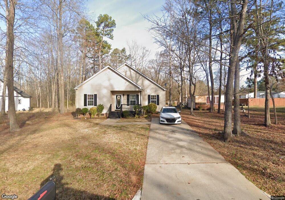
876 Mcclure Cir Rock Hill, SC 29730
Estimated Value: $211,249 - $311,000
--
Bed
--
Bath
1,314
Sq Ft
$202/Sq Ft
Est. Value
About This Home
This home is located at 876 Mcclure Cir, Rock Hill, SC 29730 and is currently estimated at $265,312, approximately $201 per square foot. 876 Mcclure Cir is a home with nearby schools including Castle Heights Middle School, Rock Hill High School, and St. Anne Catholic School.
Ownership History
Date
Name
Owned For
Owner Type
Purchase Details
Closed on
Jun 22, 2007
Sold by
Falle Charles A and Falle Amanda
Bought by
Hubert Gloria N
Current Estimated Value
Home Financials for this Owner
Home Financials are based on the most recent Mortgage that was taken out on this home.
Original Mortgage
$118,146
Outstanding Balance
$72,917
Interest Rate
6.35%
Mortgage Type
FHA
Estimated Equity
$192,395
Purchase Details
Closed on
May 5, 2005
Sold by
Henderson Dorothy M and Seale Dorothy M
Bought by
Faile Charles A and Faile Amanda
Create a Home Valuation Report for This Property
The Home Valuation Report is an in-depth analysis detailing your home's value as well as a comparison with similar homes in the area
Home Values in the Area
Average Home Value in this Area
Purchase History
| Date | Buyer | Sale Price | Title Company |
|---|---|---|---|
| Hubert Gloria N | $120,000 | None Available | |
| Faile Charles A | $1,800 | -- |
Source: Public Records
Mortgage History
| Date | Status | Borrower | Loan Amount |
|---|---|---|---|
| Open | Hubert Gloria N | $118,146 |
Source: Public Records
Tax History Compared to Growth
Tax History
| Year | Tax Paid | Tax Assessment Tax Assessment Total Assessment is a certain percentage of the fair market value that is determined by local assessors to be the total taxable value of land and additions on the property. | Land | Improvement |
|---|---|---|---|---|
| 2024 | $607 | $4,766 | $400 | $4,366 |
| 2023 | $609 | $4,766 | $400 | $4,366 |
| 2022 | $1,056 | $4,766 | $400 | $4,366 |
| 2021 | -- | $4,766 | $400 | $4,366 |
| 2020 | $1,058 | $4,766 | $0 | $0 |
| 2019 | $953 | $4,160 | $0 | $0 |
| 2018 | $951 | $4,160 | $0 | $0 |
| 2017 | $916 | $4,160 | $0 | $0 |
| 2016 | $908 | $4,160 | $0 | $0 |
| 2014 | $936 | $4,160 | $400 | $3,760 |
| 2013 | $936 | $4,500 | $480 | $4,020 |
Source: Public Records
Map
Nearby Homes
- 411 Mint St
- 366 Catherine St
- 350 Catherine St
- 348 Catherine St
- 369 S Workman St
- 1343 Christopher Cir
- 1447 Sullivan St
- Tract A Porter Rd
- Tract 4 Porter Rd
- 1233 Pinewood Rd
- 234 Marshall St
- 1066 Tremont Ave
- 210 Marshall St
- 1033 Christopher Cir Unit 15
- 215 Keels Ave
- 402 Keels Ave
- 724 Chestnut St
- 315 High St
- 773 Briarcliff Rd
- 1005 Clarkson St
- 886 Mcclure Cir
- 858 Mcclure Cir Unit 27
- 857 Mcclure Cir
- 488 Porter Rd
- 482 Porter Rd
- 846 Mcclure Cir Unit 29
- 838 Mcclure Cir
- 424 Castlewood Cir
- 476 Porter Rd
- 412 Castlewood Cir
- 524 Porter Rd
- 428 Castlewood Cir
- 470 Porter Rd
- 464 Porter Rd
- 436 Castlewood Cir
- 473 Porter Rd
- 505 Porter Rd
- 448 Castlewood Cir Unit 40
- 448 Castlewood Cir
- 557 Castlewood Cir