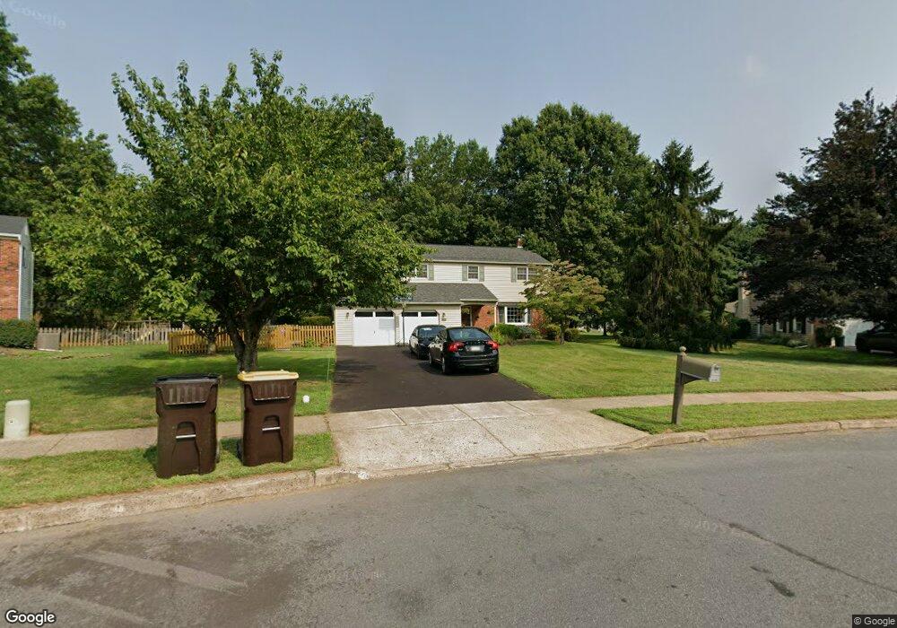
876 Patterson Dr Unit B Lansdale, PA 19446
Upper Gwynedd Township NeighborhoodEstimated Value: $598,574 - $650,000
4
Beds
3
Baths
2,328
Sq Ft
$266/Sq Ft
Est. Value
About This Home
This home is located at 876 Patterson Dr Unit B, Lansdale, PA 19446 and is currently estimated at $620,144, approximately $266 per square foot. 876 Patterson Dr Unit B is a home located in Montgomery County with nearby schools including Gwynedd Square Elementary School, Penndale Middle School, and North Penn Senior High School.
Ownership History
Date
Name
Owned For
Owner Type
Purchase Details
Closed on
Sep 7, 2001
Sold by
Bixby H William and Bixby Sandra B
Bought by
Bowers Herbert E and Bowers Patricia J
Current Estimated Value
Purchase Details
Closed on
Jan 27, 1995
Sold by
Davidson James Scott and Davidson Iris Arlene
Bought by
Bixby H William and Bixby Sandra B
Create a Home Valuation Report for This Property
The Home Valuation Report is an in-depth analysis detailing your home's value as well as a comparison with similar homes in the area
Home Values in the Area
Average Home Value in this Area
Purchase History
| Date | Buyer | Sale Price | Title Company |
|---|---|---|---|
| Bowers Herbert E | $241,100 | -- | |
| Bixby H William | $197,500 | -- |
Source: Public Records
Tax History Compared to Growth
Tax History
| Year | Tax Paid | Tax Assessment Tax Assessment Total Assessment is a certain percentage of the fair market value that is determined by local assessors to be the total taxable value of land and additions on the property. | Land | Improvement |
|---|---|---|---|---|
| 2025 | $6,279 | $171,130 | $60,530 | $110,600 |
| 2024 | $6,279 | $171,130 | $60,530 | $110,600 |
| 2023 | $5,985 | $171,130 | $60,530 | $110,600 |
| 2022 | $5,771 | $171,130 | $60,530 | $110,600 |
| 2021 | $5,619 | $171,130 | $60,530 | $110,600 |
| 2020 | $5,474 | $171,130 | $60,530 | $110,600 |
| 2019 | $5,373 | $171,130 | $60,530 | $110,600 |
| 2018 | $5,373 | $171,130 | $60,530 | $110,600 |
| 2017 | $5,147 | $171,130 | $60,530 | $110,600 |
| 2016 | $5,080 | $171,130 | $60,530 | $110,600 |
| 2015 | $4,850 | $171,130 | $60,530 | $110,600 |
| 2014 | $4,850 | $171,130 | $60,530 | $110,600 |
Source: Public Records
Map
Nearby Homes
- 980 Jacks Ln
- 1959 Supplee Rd
- 1627 Clearbrook Rd
- 911 Tricorn Dr
- 210 Berwick Place Unit 20E
- 1040 Hunter Hill Dr
- 1622 Samantha Ct
- 108 Hickory Ct
- 144 Oberlin Terrace Unit 15-B
- 172 Oberlin Terrace
- 2806 Morris Rd
- 177 Oberlin Terrace Unit 18-L
- 1653 Bridle Path Dr
- 749 Aldrin Ave
- 2015 Creek Way
- 846 Fulton Ave
- 825 Morris Rd
- 10 Wheatley Walk
- 1255 Scobee Dr
- 4 Anglesey
- 872 Patterson Dr
- 880 Patterson Dr
- 1819 Supplee Rd
- 1823 Supplee Rd
- 1815 Supplee Rd
- 868 Patterson Dr
- 865 Sullivan Dr
- 871 Patterson Dr
- 1827 Supplee Rd
- 1811 Supplee Rd
- 1831 Supplee Rd
- 865 Patterson Dr
- 864 Patterson Dr
- 861 Sullivan Dr
- 860 Sullivan Dr
- 1733 Supplee Rd
- 1735 Supplee Rd
- 897 Garfield Ave
- 1826 Supplee Rd
- 861 Patterson Dr