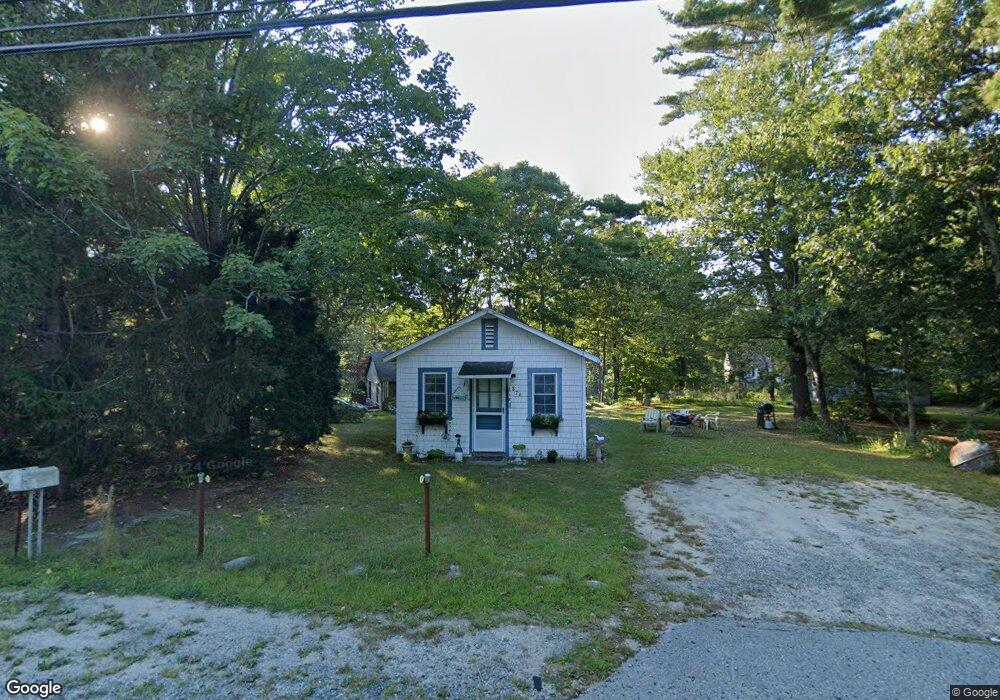
876 Route 6a Yarmouth Port, MA 02675
Yarmouth Port NeighborhoodEstimated Value: $418,654 - $551,000
2
Beds
1
Bath
672
Sq Ft
$751/Sq Ft
Est. Value
About This Home
This home is located at 876 Route 6a, Yarmouth Port, MA 02675 and is currently estimated at $504,664, approximately $750 per square foot. 876 Route 6a is a home located in Barnstable County with nearby schools including Dennis-Yarmouth Regional High School and St. Pius X. School.
Create a Home Valuation Report for This Property
The Home Valuation Report is an in-depth analysis detailing your home's value as well as a comparison with similar homes in the area
Home Values in the Area
Average Home Value in this Area
Tax History Compared to Growth
Tax History
| Year | Tax Paid | Tax Assessment Tax Assessment Total Assessment is a certain percentage of the fair market value that is determined by local assessors to be the total taxable value of land and additions on the property. | Land | Improvement |
|---|---|---|---|---|
| 2025 | $2,358 | $333,100 | $146,200 | $186,900 |
| 2024 | $2,402 | $325,500 | $154,100 | $171,400 |
| 2023 | $2,344 | $289,000 | $137,400 | $151,600 |
| 2022 | $2,237 | $243,700 | $123,600 | $120,100 |
| 2021 | $2,150 | $224,900 | $123,600 | $101,300 |
| 2020 | $2,138 | $213,800 | $123,700 | $90,100 |
| 2019 | $2,023 | $200,300 | $123,700 | $76,600 |
| 2018 | $1,825 | $177,400 | $100,800 | $76,600 |
| 2017 | $1,778 | $177,400 | $100,800 | $76,600 |
| 2016 | $1,679 | $168,200 | $91,600 | $76,600 |
| 2015 | $1,582 | $157,600 | $91,600 | $66,000 |
Source: Public Records
Map
Nearby Homes
- 44 Stratford Ln
- 43 Canterbury Rd
- 34 Kates Path
- 34 Kates Path Unit 34
- 64 Kates Path
- 17 Kates Path Unit A
- 228 Kates Path
- 86 Pompano Rd
- 6 Nimble Hill Dr
- 42 John Hall Cartway Unit 42
- 50 John Hall Cartway
- 50 John Hall Cartway Unit 50
- 25 Oak Glen Village Unit 25
- 25 Oak Glen
- 7 Forest Gate Unit 7
- 51 Bray Farm Rd N
- 59 Main St Unit 19-2
- 59 Route 6a Unit 29-4
- 2 Pine Grove
- 30 W Woods