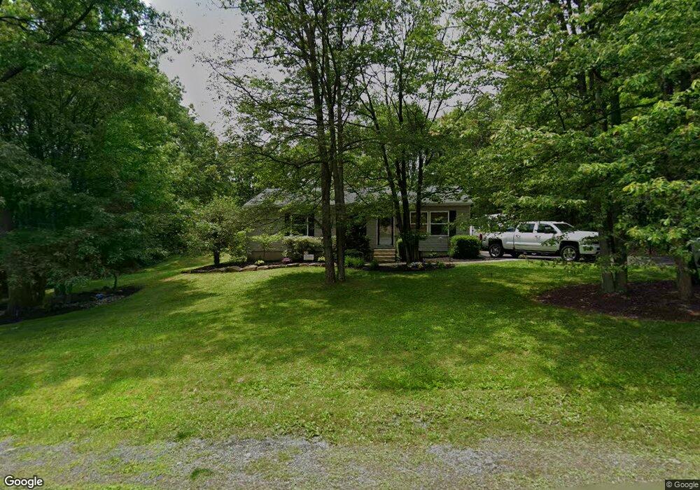
8763 Summit Cir Slatington, PA 18080
Estimated Value: $286,000 - $362,000
3
Beds
2
Baths
1,056
Sq Ft
$308/Sq Ft
Est. Value
About This Home
This home is located at 8763 Summit Cir, Slatington, PA 18080 and is currently estimated at $325,264, approximately $308 per square foot. 8763 Summit Cir is a home located in Lehigh County with nearby schools including Slatington Elementary School, Peters Elementary School, and Northern Lehigh Middle School.
Ownership History
Date
Name
Owned For
Owner Type
Purchase Details
Closed on
Dec 15, 2006
Sold by
Christopher Todd and Christopher Nicole
Bought by
Lipsky Joshua and Lipsky Cheryl
Current Estimated Value
Home Financials for this Owner
Home Financials are based on the most recent Mortgage that was taken out on this home.
Original Mortgage
$202,086
Outstanding Balance
$161,977
Interest Rate
6.29%
Mortgage Type
Purchase Money Mortgage
Estimated Equity
$163,287
Purchase Details
Closed on
Jul 29, 2004
Sold by
Miller Jason S and Miller Tracey L
Bought by
Christopher Todd and Christopher Nicole
Home Financials for this Owner
Home Financials are based on the most recent Mortgage that was taken out on this home.
Original Mortgage
$140,882
Interest Rate
6.33%
Mortgage Type
FHA
Purchase Details
Closed on
Nov 27, 1996
Sold by
Charge-A-Car Inc
Bought by
Miller Jason S and Miller Tracy L
Purchase Details
Closed on
Oct 28, 1992
Bought by
Charge-A-Car Inc
Create a Home Valuation Report for This Property
The Home Valuation Report is an in-depth analysis detailing your home's value as well as a comparison with similar homes in the area
Home Values in the Area
Average Home Value in this Area
Purchase History
| Date | Buyer | Sale Price | Title Company |
|---|---|---|---|
| Lipsky Joshua | $218,000 | None Available | |
| Christopher Todd | $142,000 | -- | |
| Miller Jason S | $98,900 | -- | |
| Charge-A-Car Inc | $99,200 | -- |
Source: Public Records
Mortgage History
| Date | Status | Borrower | Loan Amount |
|---|---|---|---|
| Open | Lipsky Joshua | $202,086 | |
| Previous Owner | Christopher Todd | $140,882 |
Source: Public Records
Tax History
| Year | Tax Paid | Tax Assessment Tax Assessment Total Assessment is a certain percentage of the fair market value that is determined by local assessors to be the total taxable value of land and additions on the property. | Land | Improvement |
|---|---|---|---|---|
| 2025 | $4,029 | $136,800 | $62,100 | $74,700 |
| 2024 | $3,960 | $136,800 | $62,100 | $74,700 |
| 2023 | $3,851 | $136,800 | $62,100 | $74,700 |
| 2022 | $3,782 | $136,800 | $74,700 | $62,100 |
| 2021 | $3,717 | $136,800 | $62,100 | $74,700 |
| 2020 | $3,638 | $136,800 | $62,100 | $74,700 |
| 2019 | $3,543 | $136,800 | $62,100 | $74,700 |
| 2018 | $3,459 | $136,800 | $62,100 | $74,700 |
| 2017 | $3,449 | $136,800 | $62,100 | $74,700 |
| 2016 | -- | $136,800 | $62,100 | $74,700 |
| 2015 | -- | $136,800 | $62,100 | $74,700 |
| 2014 | -- | $136,800 | $62,100 | $74,700 |
Source: Public Records
Map
Nearby Homes
- 1403 Seville Dr
- 1060 Arbor Ln
- 4849 Lehigh Dr Unit 27
- 422 Center St
- 47 Cherry St
- 44 N Canal St
- 207 Chestnut St
- 361 Main St
- 30 2nd St Unit 30-32
- 530 Old Main St
- 334 W Church St
- 515 E Church St
- 40 Lafayette Ave
- 319 1st St
- 787 Princeton Ave
- 210 2nd St
- 408 Lehigh Ave
- 319 Washington St
- 788 Edgemont Ave
- 321 Washington St
- 8755 Summit Cir
- 2167 Mountain Rd
- 8715 Summit Cir
- 2158 Mountain Rd
- 2146 Mountain Rd
- 8723 Summit Cir
- 8707 Summit Cir
- 2168 Mountain Rd
- 8747 Summit Cir
- 2122 Mountain Rd
- 8731 Summit Cir
- 2176 Mountain Rd
- 2183 Mountain Rd
- 8739 Summit Cir
- 2116 Mountain Rd
- 2121 Mountain Rd
- 2186 Mountain Rd
- 2197 Acorn Ct
- 2082 Mountain Rd
- 2217 Mountain Rd
Your Personal Tour Guide
Ask me questions while you tour the home.