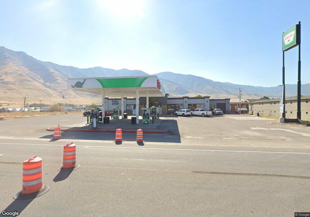
8764 Highway 36 Tooele, UT 84074
--
Bed
--
Bath
5,433
Sq Ft
1.11
Acres
About This Home
This home is located at 8764 Highway 36, Tooele, UT 84074. 8764 Highway 36 is a home located in Tooele County with nearby schools including Old Mill Elementary School, Clarke N. Johnsen Junior High School, and Stansbury High School.
Ownership History
Date
Name
Owned For
Owner Type
Purchase Details
Closed on
May 7, 2021
Sold by
Khanani And Sons Incorporated
Bought by
Lower Willow Llc
Purchase Details
Closed on
Nov 6, 2007
Sold by
Rhinold Development Llc
Bought by
Khanani And Sons Incorporated
Home Financials for this Owner
Home Financials are based on the most recent Mortgage that was taken out on this home.
Original Mortgage
$600,000
Interest Rate
6.21%
Mortgage Type
Commercial
Create a Home Valuation Report for This Property
The Home Valuation Report is an in-depth analysis detailing your home's value as well as a comparison with similar homes in the area
Home Values in the Area
Average Home Value in this Area
Purchase History
| Date | Buyer | Sale Price | Title Company |
|---|---|---|---|
| Lower Willow Llc | -- | Vanguard Title Ins Agcy Llc | |
| Khanani And Sons Incorporated | -- | Atlas Title Las Lake |
Source: Public Records
Mortgage History
| Date | Status | Borrower | Loan Amount |
|---|---|---|---|
| Previous Owner | Khanani And Sons Incorporated | $600,000 |
Source: Public Records
Tax History Compared to Growth
Tax History
| Year | Tax Paid | Tax Assessment Tax Assessment Total Assessment is a certain percentage of the fair market value that is determined by local assessors to be the total taxable value of land and additions on the property. | Land | Improvement |
|---|---|---|---|---|
| 2022 | $14,534 | $1,284,736 | $555,000 | $729,736 |
| 2021 | $14,534 | $1,032,440 | $388,500 | $643,940 |
| 2020 | $14,443 | $1,032,440 | $388,500 | $643,940 |
| 2019 | $14,589 | $1,032,440 | $388,500 | $643,940 |
| 2018 | $14,031 | $935,385 | $291,445 | $643,940 |
| 2017 | $13,117 | $935,385 | $291,445 | $643,940 |
| 2016 | $11,140 | $935,385 | $291,445 | $643,940 |
| 2015 | $11,140 | $801,276 | $0 | $0 |
| 2014 | -- | $801,276 | $0 | $0 |
Source: Public Records
Map
Nearby Homes
- 1885 E Burger St Unit 1415
- 1835 E Burger St Unit 1419
- 1921 E Burger St Unit 1418
- 1971 E Burger St
- 1971 E Burger St Unit 1239
- 1991 E Burger St Unit 1241
- 1991 E Burger St
- 1992 E Burger St Unit 1234
- 1992 E Burger St
- 2003 E Burger St Unit 1242
- 2003 E Burger St
- 2018 E Burger St
- 2018 E Burger St Unit 1232
- 2029 E Burger St
- 2090 E Burger St Unit 1244
- 2041 E Burger St Unit 1245
- 2041 E Burger St
- 8537 N Tiffany Ln
- 2065 E Burger St Unit 1247
- 2065 E Burger St
- 1874 Pheasant Ln
- 1656 Saddleback Blvd Unit 3
- 1656 Saddleback Blvd Unit 3
- 1874 E Pheasant Ln
- 1581 Pheasant Ln
- 1889 Pheasant Ln
- 1913 Pheasant Ln
- 8580 N Commerce Dr
- 1947 E Burger St
- 1946 E Burger St
- 1947 Antonio Dr
- 8400 Hwy 36
- 1981 E Antonio Dr
- 8472 Mountain View Rd
- 1795 E Davies Place Unit 12
- 1982 Antonio Dr
- 1982 Antonio Dr Unit 1218
- 1779 E Davies Place Unit 13
- 8435 Sage Ln
- 1809 E Davies Place