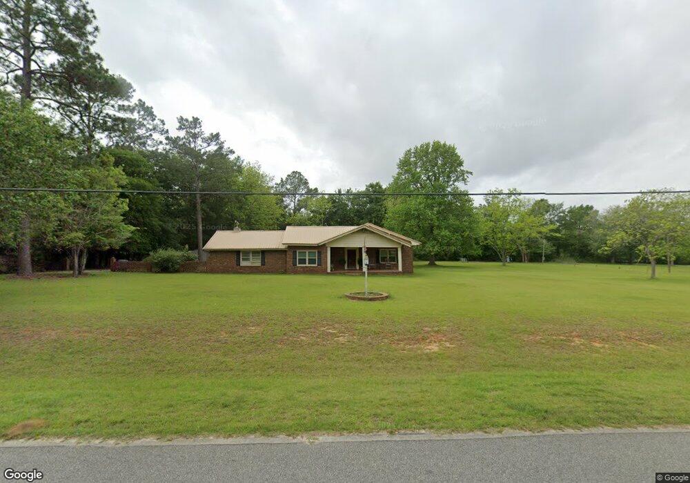
877 Mcelroy Rd Moultrie, GA 31768
Estimated Value: $230,000 - $246,000
Studio
2
Baths
2,154
Sq Ft
$111/Sq Ft
Est. Value
About This Home
This home is located at 877 Mcelroy Rd, Moultrie, GA 31768 and is currently estimated at $239,287, approximately $111 per square foot. 877 Mcelroy Rd is a home located in Colquitt County with nearby schools including Doerun Elementary School, C.A. Gray Junior High School, and Willie J. Williams Middle School.
Ownership History
Date
Name
Owned For
Owner Type
Purchase Details
Closed on
Nov 6, 2015
Sold by
Bozeman James R
Bought by
Colquitt County Board Of Commi
Current Estimated Value
Purchase Details
Closed on
Mar 7, 2002
Sold by
Bridges Jacqueline
Bought by
Bozeman James R
Purchase Details
Closed on
Mar 6, 1991
Bought by
Bridges Jacqueline
Create a Home Valuation Report for This Property
The Home Valuation Report is an in-depth analysis detailing your home's value as well as a comparison with similar homes in the area
Purchase History
| Date | Buyer | Sale Price | Title Company |
|---|---|---|---|
| Colquitt County Board Of Commi | -- | -- | |
| Bozeman James R | $88,000 | -- | |
| Bridges Jacqueline | $15,000 | -- |
Source: Public Records
Tax History Compared to Growth
Tax History
| Year | Tax Paid | Tax Assessment Tax Assessment Total Assessment is a certain percentage of the fair market value that is determined by local assessors to be the total taxable value of land and additions on the property. | Land | Improvement |
|---|---|---|---|---|
| 2024 | $1,656 | $85,612 | $12,917 | $72,695 |
| 2023 | $1,763 | $70,645 | $12,917 | $57,728 |
| 2022 | $1,204 | $52,570 | $11,480 | $41,090 |
| 2021 | $1,106 | $47,534 | $11,480 | $36,054 |
| 2020 | $1,125 | $47,534 | $11,480 | $36,054 |
| 2019 | $1,216 | $46,230 | $11,480 | $34,750 |
| 2018 | $1,183 | $46,230 | $11,480 | $34,750 |
| 2017 | $1,106 | $42,636 | $7,886 | $34,750 |
| 2016 | $1,121 | $42,636 | $7,886 | $34,750 |
| 2015 | $1,102 | $41,575 | $8,589 | $32,986 |
| 2014 | $1,081 | $41,575 | $8,589 | $32,986 |
| 2013 | -- | $41,574 | $8,589 | $32,985 |
Source: Public Records
Map
Nearby Homes
- 102 Schley Church Rd
- 178 Cool Breeze Dr
- 2186 Old Doerun Rd
- 00 Rossman Dairy Rd
- 378 Old S R 33
- 107 30th Ave NW
- 15,23,27 29th Ave NW
- 372 Westwoods Dr Unit 21
- LOT 29 Merganser Ln
- LOT 32 Merganser Ln
- LOT 28 Merganser Ln
- LOT 26 Merganser Ln
- LOT 30 Merganser Ln
- LOT 39 Westwoods Dr
- LOT 1 Westwoods Dr
- LOT 23 Westwoods Dr
- LOT 35 Westwoods Dr
- LOT 36 Westwoods Dr
- LOT 37 Westwoods Dr
- LOT 41 Westwoods Dr
- 859 Mcelroy Rd
- 540 Old Albany Rd
- 837 Mcelroy Rd
- 440 Old Albany Rd
- 144 Clifton Dr
- 531 Old Albany Rd
- 160 Clifton Dr
- 515 Old Albany Rd
- 1911 Ga Highway 133 N
- 187 Clifton Dr
- 186 Clifton Dr
- 168 Country Ln
- 451 Old Albany Rd
- 817 Mcelroy Rd
- 578 Old Albany Rd
- 144 Country Ln
- 207 Clifton Dr
- 990 Mcelroy Rd
- 1949 Ga Highway 133 N
- 1888 Ga Highway 133 N