Estimated Value: $122,000 - $171,602
--
Bed
1
Bath
1,416
Sq Ft
$106/Sq Ft
Est. Value
About This Home
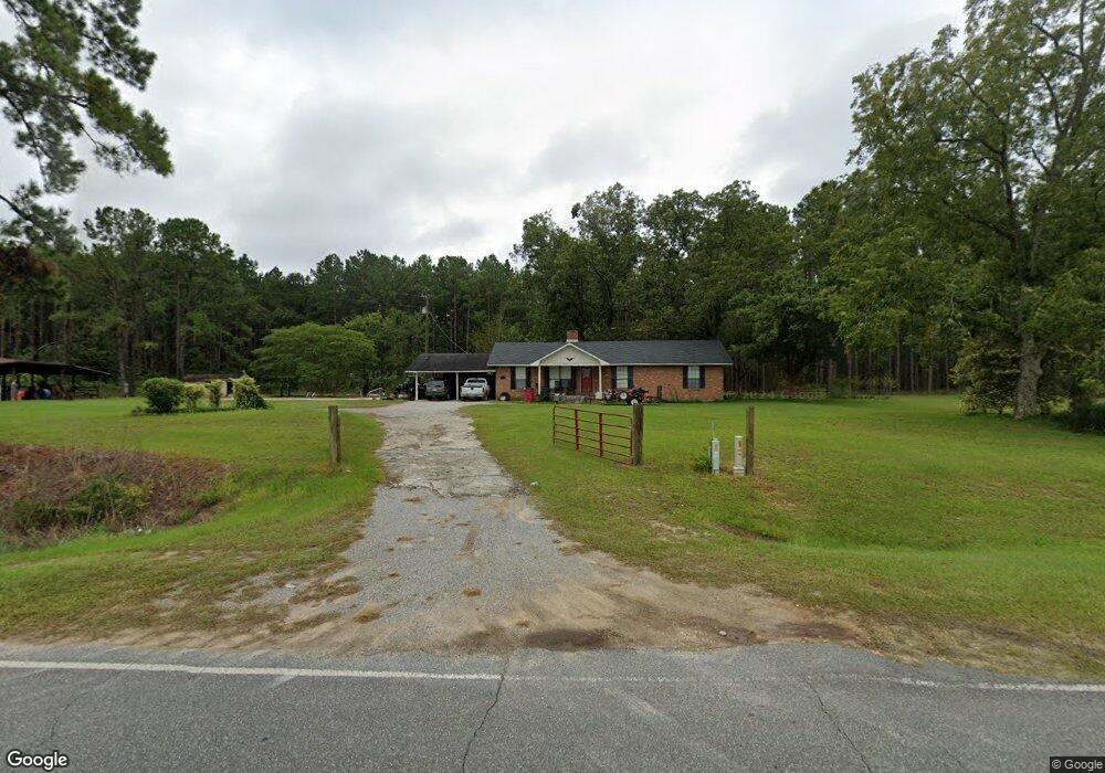
This home is located at 877 Radio Station Rd, Alma, GA 31510 and is currently estimated at $149,651, approximately $105 per square foot. 877 Radio Station Rd is a home located in Bacon County with nearby schools including Bacon County Primary School, Bacon County Elementary School, and Bacon County Middle School.
Ownership History
Date
Name
Owned For
Owner Type
Purchase Details
Closed on
Aug 1, 2013
Sold by
White Edward
Bought by
White Jason Hugh
Current Estimated Value
Home Financials for this Owner
Home Financials are based on the most recent Mortgage that was taken out on this home.
Original Mortgage
$27,085
Interest Rate
4.29%
Mortgage Type
New Conventional
Purchase Details
Closed on
May 24, 2007
Sold by
White Jason
Bought by
White Edward
Purchase Details
Closed on
Sep 15, 2000
Sold by
White Bobby Chad
Bought by
White Jason
Create a Home Valuation Report for This Property
The Home Valuation Report is an in-depth analysis detailing your home's value as well as a comparison with similar homes in the area
Home Values in the Area
Average Home Value in this Area
Purchase History
| Date | Buyer | Sale Price | Title Company |
|---|---|---|---|
| White Jason Hugh | $26,000 | -- | |
| White Edward | -- | -- | |
| White Jason | -- | -- |
Source: Public Records
Mortgage History
| Date | Status | Borrower | Loan Amount |
|---|---|---|---|
| Closed | White Jason Hugh | $27,085 |
Source: Public Records
Tax History Compared to Growth
Tax History
| Year | Tax Paid | Tax Assessment Tax Assessment Total Assessment is a certain percentage of the fair market value that is determined by local assessors to be the total taxable value of land and additions on the property. | Land | Improvement |
|---|---|---|---|---|
| 2024 | $1,422 | $56,480 | $6,200 | $50,280 |
| 2023 | $1,346 | $51,400 | $5,800 | $45,600 |
| 2022 | $1,158 | $37,720 | $5,800 | $31,920 |
| 2021 | $1,004 | $33,400 | $5,800 | $27,600 |
| 2020 | $992 | $29,872 | $4,864 | $25,008 |
| 2019 | $993 | $29,872 | $4,864 | $25,008 |
| 2018 | $878 | $29,014 | $4,864 | $24,150 |
| 2017 | $833 | $29,014 | $4,864 | $24,150 |
| 2016 | $864 | $29,014 | $4,864 | $24,150 |
| 2015 | $743 | $27,912 | $4,864 | $23,048 |
| 2014 | $665 | $27,912 | $4,864 | $23,048 |
| 2013 | $665 | $23,134 | $3,638 | $19,496 |
Source: Public Records
Map
Nearby Homes
- 0 Jasmine Ln
- 301 Taylor Rd
- 1348 U S 1
- 9TH E 417
- 403 S Ware St
- 122 Grace Loop Unit 1
- 118 Grace Loop Unit 1
- 117 Grace Loop Unit 1
- 245 Starling Rd
- 0 E 6th St Unit 114222
- TBD Cartertown Rd
- TBD Cartertown Rd
- Lot 8 Cartertown Rd
- Lot 5 Cartertown Rd
- Lot 6 Cartertown Rd
- Lot 4 Cartertown Rd
- Lot 7 Cartertown Rd
- 314 W 16th St
- 907 N Pierce St
- 0 Oriole Rd Unit 160930
- 831 Radio Station Rd
- 948 Radio Station Rd
- 836 Radio Station Rd
- 958 Radio Station Rd
- 942 Radio Station Rd
- 997 Radio Station Rd
- 976 Radio Station Rd
- 1008 Radio Station Rd
- 120 Victory Ln
- 1020 Radio Station Rd
- 108 Winners Cir
- 1048 Radio Station Rd
- 739 Radio Station Rd
- 728 Radio Station Rd
- 1060 Radio Station Rd
- 722 722 Radio Station Rd
- 155 Rl Taylor Ln
- 611 Radio Station Rd
- 716 Radio Station Rd
- 1127 Radio Station Rd