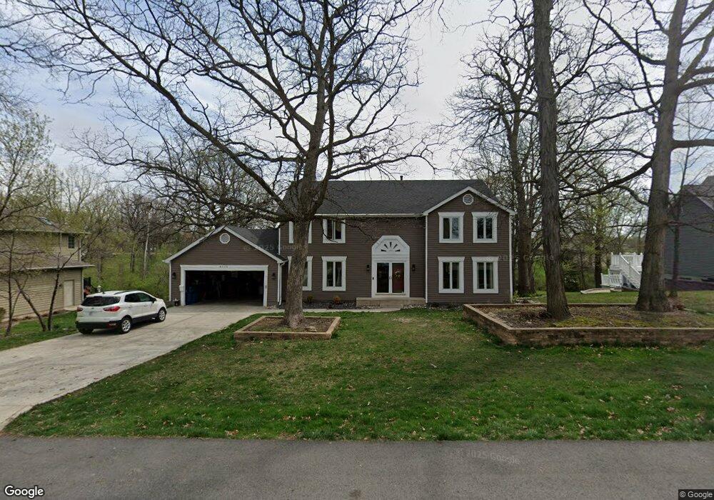
8775 Hanley Ln Crown Point, IN 46307
Estimated Value: $393,000 - $509,000
4
Beds
4
Baths
3,088
Sq Ft
$149/Sq Ft
Est. Value
About This Home
This home is located at 8775 Hanley Ln, Crown Point, IN 46307 and is currently estimated at $460,594, approximately $149 per square foot. 8775 Hanley Ln is a home located in Lake County with nearby schools including Hal E Clark Middle School, Peifer Elementary School, and Lake Central High School.
Ownership History
Date
Name
Owned For
Owner Type
Purchase Details
Closed on
Dec 30, 2011
Sold by
Maldonado Humberto and Maldonado Celia
Bought by
Maldonado Humberto and Maldonado Celia Z
Current Estimated Value
Home Financials for this Owner
Home Financials are based on the most recent Mortgage that was taken out on this home.
Original Mortgage
$238,865
Interest Rate
3.87%
Mortgage Type
FHA
Create a Home Valuation Report for This Property
The Home Valuation Report is an in-depth analysis detailing your home's value as well as a comparison with similar homes in the area
Home Values in the Area
Average Home Value in this Area
Purchase History
| Date | Buyer | Sale Price | Title Company |
|---|---|---|---|
| Maldonado Humberto | -- | Indiana Title Network Co |
Source: Public Records
Mortgage History
| Date | Status | Borrower | Loan Amount |
|---|---|---|---|
| Closed | Maldonado Humberto | $238,865 |
Source: Public Records
Tax History
| Year | Tax Paid | Tax Assessment Tax Assessment Total Assessment is a certain percentage of the fair market value that is determined by local assessors to be the total taxable value of land and additions on the property. | Land | Improvement |
|---|---|---|---|---|
| 2025 | $3,761 | $449,300 | $62,500 | $386,800 |
| 2024 | $8,074 | $423,400 | $62,500 | $360,900 |
| 2023 | $3,716 | $396,500 | $62,500 | $334,000 |
| 2022 | $3,680 | $353,000 | $62,500 | $290,500 |
| 2021 | $3,391 | $332,800 | $62,500 | $270,300 |
| 2020 | $3,361 | $322,700 | $62,500 | $260,200 |
| 2019 | $3,321 | $295,000 | $45,900 | $249,100 |
| 2018 | $3,293 | $287,500 | $45,900 | $241,600 |
| 2017 | $3,084 | $284,300 | $45,900 | $238,400 |
| 2016 | $2,877 | $267,000 | $45,900 | $221,100 |
| 2014 | $2,903 | $283,300 | $45,900 | $237,400 |
| 2013 | $2,890 | $275,800 | $45,900 | $229,900 |
Source: Public Records
Map
Nearby Homes
- 8748 Durbin Ln
- 8777 Burr Ridge Cir
- 9017 Mathews St
- 8845 Clark Place
- 5980 Wexford Way
- 6076 Wexford Way
- 5012 W 92nd Ave
- 9082 Dallas Place
- 6440 W 89th Ave
- 2952 Freedom Cir
- 6308 W 91st Ave
- 9204 Wright St
- 5547 Victoria Place
- 2914 Morningside Dr
- 1874 Springvale Dr
- 8109 Victoria Place
- 1962 Aspen Ct
- 10920 Missouri Place
- 10406 Whitney Place
- 10444 Whitney Place
Your Personal Tour Guide
Ask me questions while you tour the home.