Estimated Value: $186,000 - $298,000
Studio
2
Baths
1,353
Sq Ft
$165/Sq Ft
Est. Value
About This Home
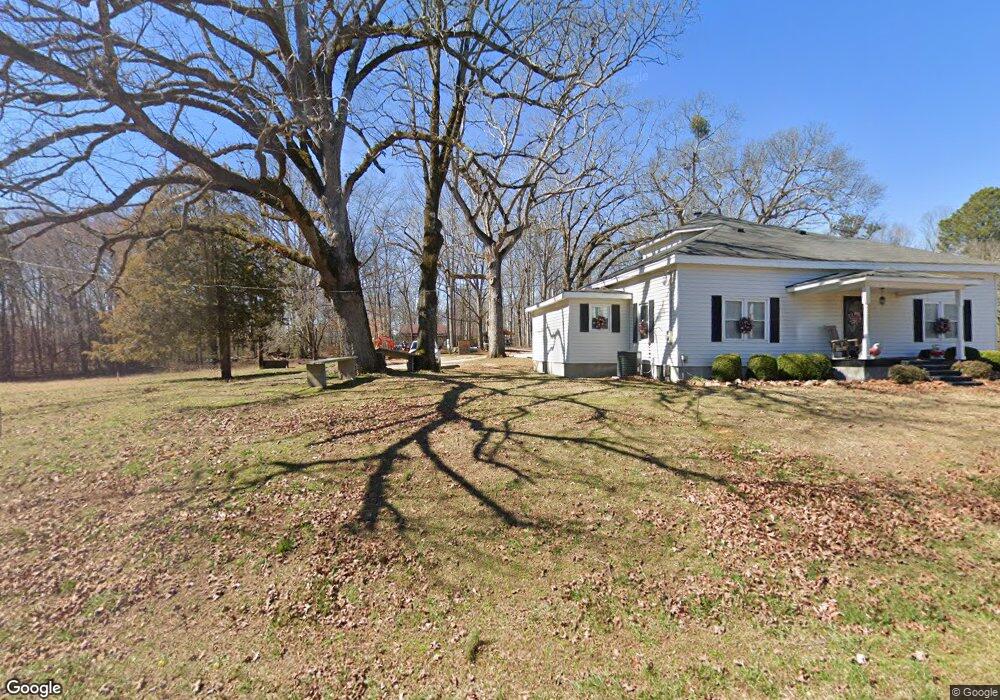
This home is located at 8775 Highway 172, Comer, GA 30629 and is currently estimated at $222,998, approximately $164 per square foot. 8775 Highway 172 is a home located in Madison County with nearby schools including Madison County High School.
Ownership History
Date
Name
Owned For
Owner Type
Purchase Details
Closed on
Feb 2, 2022
Sold by
Russell Tony
Bought by
Russell Brandon and Russell Christy
Current Estimated Value
Purchase Details
Closed on
Jan 25, 2016
Sold by
Russell Tony
Bought by
Smith Tina Michelle and Maxwell Tina R
Purchase Details
Closed on
Jul 27, 2005
Sold by
Moon Mary Ann O
Bought by
Russell Tony and Russell Diane
Purchase Details
Closed on
Jun 20, 2005
Sold by
Moon Joe F
Bought by
Moon Mary Ann
Purchase Details
Closed on
Jan 1, 1977
Bought by
Moon Joe F and Mary An
Create a Home Valuation Report for This Property
The Home Valuation Report is an in-depth analysis detailing your home's value as well as a comparison with similar homes in the area
Purchase History
| Date | Buyer | Sale Price | Title Company |
|---|---|---|---|
| Russell Brandon | $40,000 | -- | |
| Smith Tina Michelle | -- | -- | |
| Russell Tony | $85,000 | -- | |
| Moon Mary Ann | -- | -- | |
| Moon Mary Ann | -- | -- | |
| Moon Joe F | -- | -- |
Source: Public Records
Tax History
| Year | Tax Paid | Tax Assessment Tax Assessment Total Assessment is a certain percentage of the fair market value that is determined by local assessors to be the total taxable value of land and additions on the property. | Land | Improvement |
|---|---|---|---|---|
| 2025 | $1,041 | $42,971 | $16,383 | $26,588 |
| 2024 | $1,046 | $42,198 | $16,383 | $25,815 |
| 2023 | $466 | $37,905 | $13,652 | $24,253 |
| 2022 | $855 | $31,002 | $9,387 | $21,615 |
| 2021 | $804 | $26,336 | $9,386 | $16,950 |
| 2020 | $768 | $24,970 | $8,021 | $16,949 |
| 2019 | $767 | $24,661 | $8,021 | $16,640 |
| 2018 | $735 | $23,570 | $7,339 | $16,231 |
| 2017 | $655 | $22,740 | $6,826 | $15,914 |
| 2016 | $666 | $23,190 | $9,296 | $13,894 |
| 2015 | $666 | $23,190 | $9,296 | $13,894 |
| 2013 | -- | $21,536 | $7,605 | $13,930 |
Source: Public Records
Map
Nearby Homes
- 1271 Della Slaton Rd
- 2285 Cherokee Rd
- 0 Paoli Rd Unit 23882833
- 2660 Parham Town Rd
- 1257 Seymour Rd
- 4115 Georgia 191
- 0 Hwy 191 Unit CL350619
- 2115 Dusty Rd
- 0 Osley Mill Rd Unit 10671196
- 0 Osley Mill Rd Unit CL346762
- 0 Dusty Rd Unit 10569563
- 0 Dusty Rd Unit 7619983
- 0 Sand Hill Rd Unit 10595328
- 3272 Horace Rd
- 8714 Georgia 172
- 1211 Parham Town Rd
- 0 Georgia 191
- 0 Poss Rd Unit 11540856
- 0 Lowe Rd Unit 10614126
- 10 Shannons Ln
- 8943 Highway 172
- 8605 Highway 172
- 8619 Highway 172
- 9009 Highway 172
- 8922 Highway 172
- 3451 Vineyards Creek Church Rd
- 9024 Highway 172
- 3409 Vineyards Creek Church Rd
- 3458 Vineyards Creek Church Rd
- 9131 Highway 172
- 8397 Highway 172
- 3187 Vineyards Creek Church Rd
- 3155 Vineyards Creek Church Rd
- 15 Della Slaton Rd
- 3151 Vineyards Creek Church Rd
- 8315 Highway 172
- 8714 Highway 172
- 8217 Georgia 172
- 8190 Highway 172
- 8190 Highway 172
Your Personal Tour Guide
Ask me questions while you tour the home.