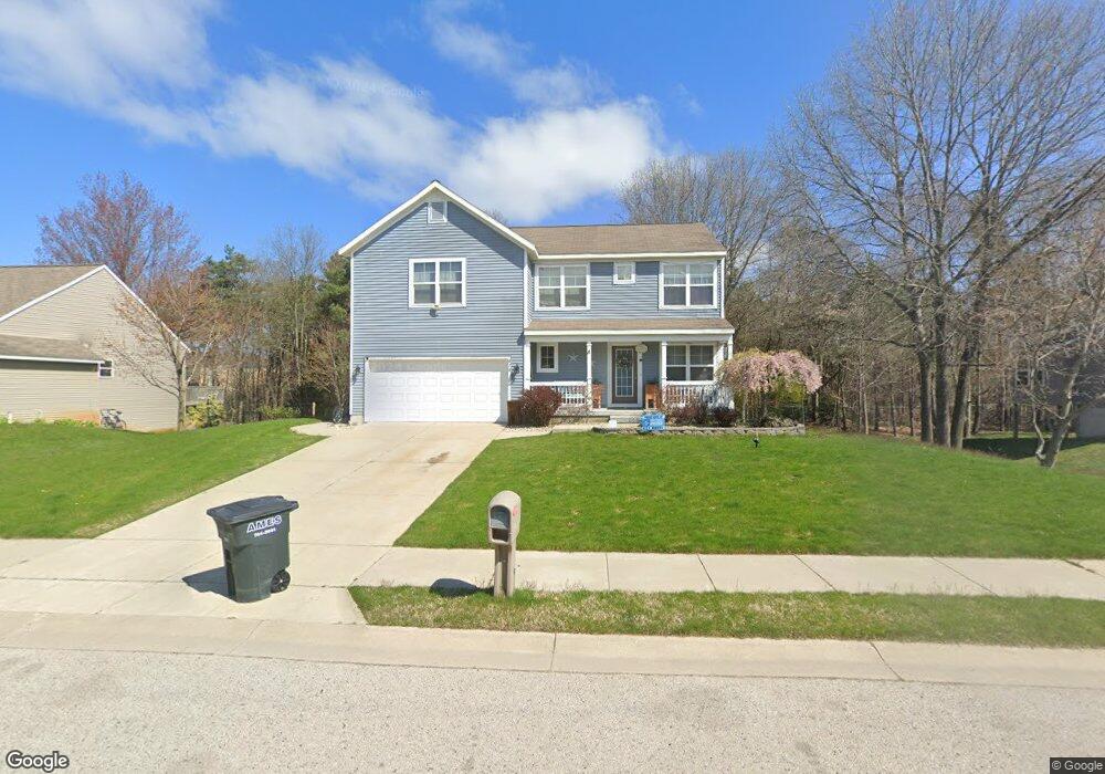
878 Katie Ct Unit 40 Norton Shores, MI 49441
Estimated Value: $360,349 - $465,000
3
Beds
3
Baths
1,984
Sq Ft
$211/Sq Ft
Est. Value
About This Home
This home is located at 878 Katie Ct Unit 40, Norton Shores, MI 49441 and is currently estimated at $418,087, approximately $210 per square foot. 878 Katie Ct Unit 40 is a home located in Muskegon County with nearby schools including Mona Shores High School, Michigan Dunes Montessori School, and West Shore Lutheran School.
Ownership History
Date
Name
Owned For
Owner Type
Purchase Details
Closed on
Oct 2, 2008
Sold by
T Bosgraaf Homes Llc
Bought by
Routt Brandon and Routt Janavive
Current Estimated Value
Home Financials for this Owner
Home Financials are based on the most recent Mortgage that was taken out on this home.
Original Mortgage
$186,247
Outstanding Balance
$123,850
Interest Rate
6.43%
Mortgage Type
Construction
Estimated Equity
$294,237
Create a Home Valuation Report for This Property
The Home Valuation Report is an in-depth analysis detailing your home's value as well as a comparison with similar homes in the area
Home Values in the Area
Average Home Value in this Area
Purchase History
| Date | Buyer | Sale Price | Title Company |
|---|---|---|---|
| Routt Brandon | $47,500 | Metropolitan Title Company | |
| T Bosgraaf Homes Llc | -- | None Available |
Source: Public Records
Mortgage History
| Date | Status | Borrower | Loan Amount |
|---|---|---|---|
| Open | Routt Brandon | $186,247 |
Source: Public Records
Tax History Compared to Growth
Tax History
| Year | Tax Paid | Tax Assessment Tax Assessment Total Assessment is a certain percentage of the fair market value that is determined by local assessors to be the total taxable value of land and additions on the property. | Land | Improvement |
|---|---|---|---|---|
| 2025 | $4,200 | $162,400 | $0 | $0 |
| 2024 | $3,279 | $152,500 | $0 | $0 |
| 2023 | $3,132 | $143,700 | $0 | $0 |
| 2022 | $3,817 | $132,000 | $0 | $0 |
| 2021 | $3,709 | $119,200 | $0 | $0 |
| 2020 | $3,596 | $106,100 | $0 | $0 |
| 2019 | $3,530 | $102,700 | $0 | $0 |
| 2018 | $3,447 | $93,800 | $0 | $0 |
| 2017 | $3,367 | $94,400 | $0 | $0 |
| 2016 | $2,608 | $90,300 | $0 | $0 |
| 2015 | -- | $82,500 | $0 | $0 |
| 2014 | $3,167 | $86,100 | $0 | $0 |
| 2013 | -- | $86,400 | $0 | $0 |
Source: Public Records
Map
Nearby Homes
- 5128 Henry St
- 608 Porter Rd
- 5153 Shady Creek Dr
- 516 Hendrick Rd
- 1087 W Mount Garfield Rd
- 1103 W Mount Garfield Rd
- 5085 Gay St
- 4655 Henry St
- 4666 Heinicke St
- 6023 Henry St
- 263 Churchill Dr
- 5075 Wickham Dr
- 5473 Martin Rd
- 5579 Martin Rd
- 4676 Earl St
- 5959 Lake Harbor Rd
- 1558 Brookwood Dr
- 1769 Bayview Dr
- 1887 Hendrick Rd
- 5043 Maranatha Dr
- 862 Katie Ct Unit 41
- 894 Katie Ct Unit 39
- 873 Katie Ct Unit 27
- 846 Katie Ct
- 908 Katie Ct
- 859 Katie Ct Unit 2413
- 889 Katie Ct
- 903 Katie Ct
- 832 Katie Ct
- 804 Ashlee Dr
- 924 Katie Ct
- 919 Katie Ct
- 872 Ashlee Ct
- 824 Ashlee Dr
- 858 Ashlee Ct
- 5265 Henry St
- 814 Katie Ct Unit 44
- 938 Katie Ct
- 935 Katie Ct Unit 31
- 801 Ashlee Dr Unit 14