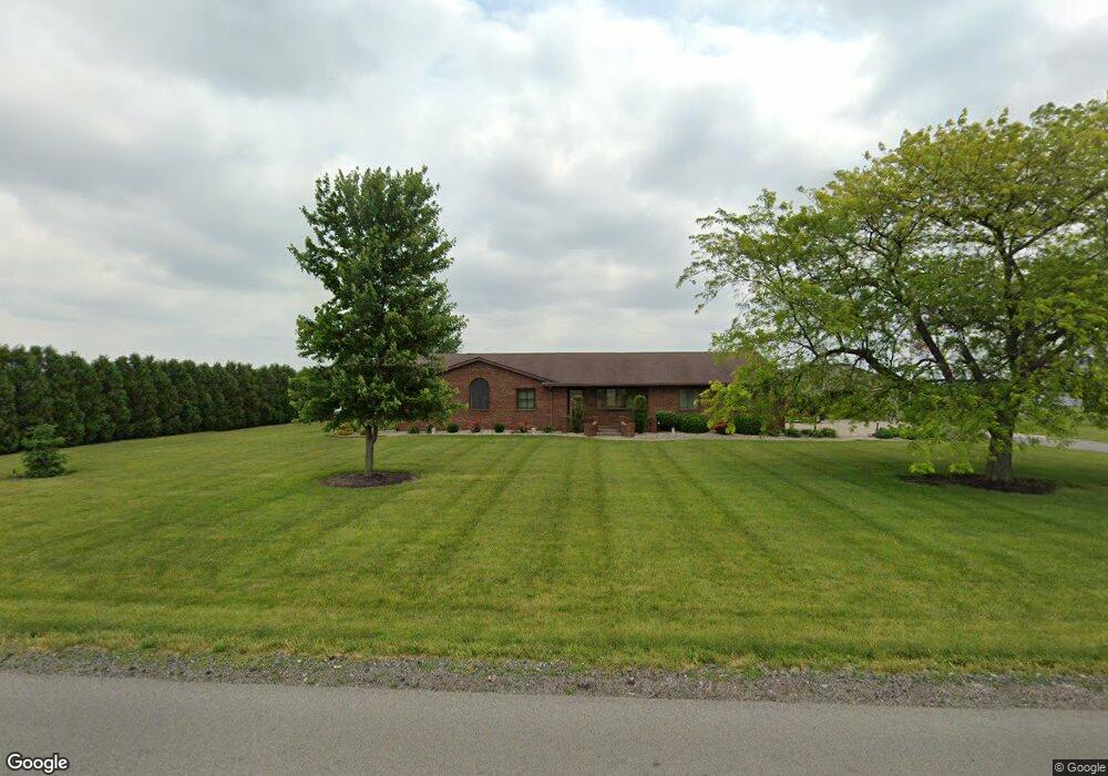
8783 Middle Point Wetzel Rd Middle Point, OH 45863
Estimated Value: $278,000 - $327,962
3
Beds
2
Baths
2,452
Sq Ft
$126/Sq Ft
Est. Value
About This Home
This home is located at 8783 Middle Point Wetzel Rd, Middle Point, OH 45863 and is currently estimated at $308,741, approximately $125 per square foot. 8783 Middle Point Wetzel Rd is a home located in Van Wert County with nearby schools including Lincolnview Elementary School and Lincolnview Junior/Senior High School.
Ownership History
Date
Name
Owned For
Owner Type
Purchase Details
Closed on
Aug 12, 2015
Sold by
Owens Michael D
Bought by
Mueller Ryne N and Mueller Corie R
Current Estimated Value
Home Financials for this Owner
Home Financials are based on the most recent Mortgage that was taken out on this home.
Original Mortgage
$137,600
Outstanding Balance
$82,062
Interest Rate
4.08%
Mortgage Type
Purchase Money Mortgage
Estimated Equity
$226,679
Purchase Details
Closed on
Apr 30, 2008
Sold by
Owens Michael D
Bought by
Owens Michael D
Create a Home Valuation Report for This Property
The Home Valuation Report is an in-depth analysis detailing your home's value as well as a comparison with similar homes in the area
Home Values in the Area
Average Home Value in this Area
Purchase History
| Date | Buyer | Sale Price | Title Company |
|---|---|---|---|
| Mueller Ryne N | $161,250 | Attorney | |
| Owens Michael D | -- | Attorney |
Source: Public Records
Mortgage History
| Date | Status | Borrower | Loan Amount |
|---|---|---|---|
| Open | Mueller Ryne N | $137,600 |
Source: Public Records
Tax History Compared to Growth
Tax History
| Year | Tax Paid | Tax Assessment Tax Assessment Total Assessment is a certain percentage of the fair market value that is determined by local assessors to be the total taxable value of land and additions on the property. | Land | Improvement |
|---|---|---|---|---|
| 2024 | $2,952 | $93,520 | $8,250 | $85,270 |
| 2023 | $2,952 | $93,520 | $8,250 | $85,270 |
| 2022 | $2,832 | $65,910 | $7,120 | $58,790 |
| 2021 | $2,850 | $65,910 | $7,120 | $58,790 |
| 2020 | $2,609 | $60,640 | $7,120 | $53,520 |
| 2019 | $1,892 | $47,120 | $6,330 | $40,790 |
| 2018 | $1,871 | $47,120 | $6,330 | $40,790 |
| 2017 | $1,867 | $47,120 | $6,330 | $40,790 |
| 2016 | $1,716 | $48,670 | $6,190 | $42,480 |
| 2015 | $1,690 | $48,670 | $6,190 | $42,480 |
| 2014 | $1,755 | $48,670 | $6,190 | $42,480 |
| 2013 | $2,111 | $48,670 | $6,190 | $42,480 |
Source: Public Records
Map
Nearby Homes
- 104 W Railroad St
- 112 W Railroad St
- 104 W South St
- TBD Dog Creek Rd
- 8951 Brickner Rd
- 26267 Road R
- 709 W 4th St
- 604 W 6th St
- 409 N Bredeick St
- 332 W 6th St
- 610 N Washington St
- 810 N Franklin St
- 704 N Franklin St
- 405 N Franklin St
- 210 E 3rd St
- 634 S Clay St
- 221 S Main St
- 424 S Canal St
- 1303 Carolyn Dr
- 483 S Franklin St
- 8831 Middle Point Wetzel Rd
- 8615 Middle Point Wetzel Rd
- 19905 Lincoln Hwy
- 8265 Middle Point Wetzel Rd
- 20507 Heist Rd
- 20525 Heist Rd
- 9320 Middle Point Wetzel Rd
- 19626 Lincoln Hwy
- 19565 Lincoln Hwy
- 20255 Lincoln Hwy
- 19532 Lincoln Hwy
- 9146 Middle Point Rd
- 20329 Lincoln Hwy
- 20379 Lincoln Hwy
- 20386 Lincoln Hwy
- 20031 Carpenter Rd
- 7986 Middle Point Wetzel Rd
- 20664 Carpenter Rd