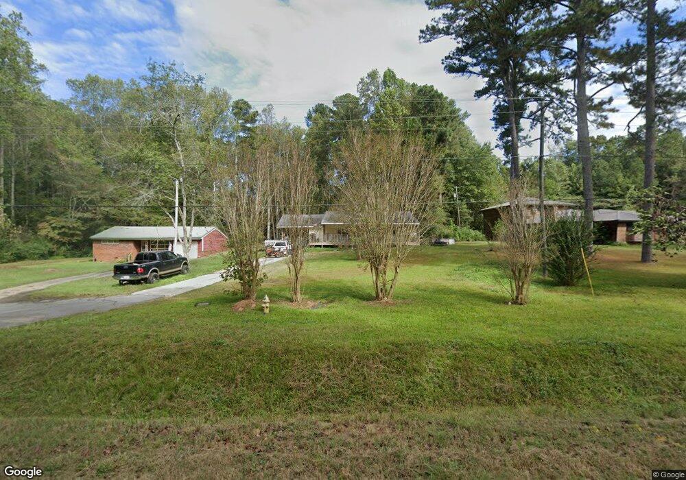
8786 U S Highway 78 Bremen, GA 30110
Estimated Value: $232,000 - $299,000
3
Beds
2
Baths
1,638
Sq Ft
$161/Sq Ft
Est. Value
About This Home
This home is located at 8786 U S Highway 78, Bremen, GA 30110 and is currently estimated at $263,018, approximately $160 per square foot. 8786 U S Highway 78 is a home located in Haralson County with nearby schools including Haralson County High School.
Ownership History
Date
Name
Owned For
Owner Type
Purchase Details
Closed on
Jul 5, 2007
Sold by
Not Provided
Bought by
Cobb William E
Current Estimated Value
Purchase Details
Closed on
Aug 7, 1992
Sold by
Williams Brenda H
Bought by
Cobb William E and Cobb Peggy
Purchase Details
Closed on
May 20, 1986
Sold by
Carrollton Federal Savings & Loan Associ
Bought by
Williams Brenda H
Purchase Details
Closed on
Mar 4, 1986
Sold by
Norton Emory Scott and Donna Kay
Bought by
Carrollton Federal Savings & Loan Associ
Purchase Details
Closed on
Nov 12, 1984
Sold by
Norton William Gordon
Bought by
Norton Emory Scott and Donna Kay
Purchase Details
Closed on
Jul 16, 1983
Sold by
Norton Eula C
Bought by
Norton William Gordon
Create a Home Valuation Report for This Property
The Home Valuation Report is an in-depth analysis detailing your home's value as well as a comparison with similar homes in the area
Home Values in the Area
Average Home Value in this Area
Purchase History
| Date | Buyer | Sale Price | Title Company |
|---|---|---|---|
| Cobb William E | -- | -- | |
| Cobb William E | -- | -- | |
| Williams Brenda H | $34,500 | -- | |
| Carrollton Federal Savings & Loan Associ | -- | -- | |
| Norton Emory Scott | $30,000 | -- | |
| Norton William Gordon | -- | -- |
Source: Public Records
Tax History Compared to Growth
Tax History
| Year | Tax Paid | Tax Assessment Tax Assessment Total Assessment is a certain percentage of the fair market value that is determined by local assessors to be the total taxable value of land and additions on the property. | Land | Improvement |
|---|---|---|---|---|
| 2024 | $1,079 | $41,598 | $2,664 | $38,934 |
| 2023 | $1,109 | $41,372 | $2,214 | $39,158 |
| 2022 | $899 | $33,518 | $2,214 | $31,304 |
| 2021 | $895 | $32,051 | $2,150 | $29,901 |
| 2020 | $579 | $20,634 | $2,150 | $18,484 |
| 2019 | $596 | $20,454 | $2,150 | $18,304 |
| 2018 | $599 | $20,269 | $1,965 | $18,304 |
| 2017 | $582 | $17,895 | $1,965 | $15,930 |
| 2016 | $751 | $24,505 | $3,400 | $21,105 |
| 2015 | $745 | $24,283 | $3,400 | $20,884 |
| 2014 | $744 | $24,644 | $3,400 | $21,244 |
Source: Public Records
Map
Nearby Homes
- 256 Mangham Rd
- 16 Liberty Station Dr
- 92 Liberty Station Dr
- 64 Liberty Station Dr
- 0 Helton Rd Unit 10648273
- 0 Helton Rd Unit 7685463
- 162 Centerpoint Rd
- 89 Autumn Dr
- 43 Old Field Rd
- 9385 U S 78
- 71 Old Field Rd
- 1109 Liberty Church Rd
- 650 N Raburn Rd
- 26 Liberty Station Dr
- 38 Liberty Station Dr
- 1556 Cashtown Rd
- 8778 U S Highway 78
- 8800 U S 78
- 8800 U S Highway 78
- 8760 U S Highway 78
- 8742 Us Highway 78
- 8742 U S Highway 78
- 8742 U S 78
- 8834 U S Highway 78
- 8827 U S Highway 78
- 8751 U S Highway 78
- 8723 Us Highway 78
- 85 Helton Rd
- 8722 Us Highway 78
- 8722 U S Highway 78
- 8722 U S 78
- 8827 U S 78
- 000 Mangham Rd
- 0 Mangham Rd
- 0 Mangham Rd Unit 145239
- 0 Mangham Rd Unit 20172036