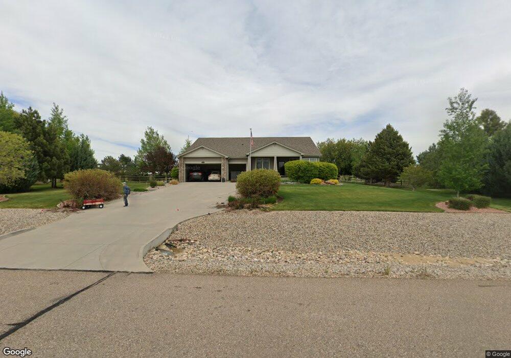
8787 Longs Peak Cir Windsor, CO 80550
Estimated Value: $1,120,849 - $1,347,000
3
Beds
2
Baths
3,062
Sq Ft
$406/Sq Ft
Est. Value
About This Home
This home is located at 8787 Longs Peak Cir, Windsor, CO 80550 and is currently estimated at $1,244,212, approximately $406 per square foot. 8787 Longs Peak Cir is a home located in Larimer County with nearby schools including High Plains School, Mountain View High School, and Colorado Early Colleges Windsor.
Ownership History
Date
Name
Owned For
Owner Type
Purchase Details
Closed on
Feb 27, 2006
Sold by
Lennar Colorado Llc
Bought by
Tolleson Donald W and Tolleson Barbara J
Current Estimated Value
Home Financials for this Owner
Home Financials are based on the most recent Mortgage that was taken out on this home.
Original Mortgage
$390,150
Outstanding Balance
$218,930
Interest Rate
6.05%
Mortgage Type
Fannie Mae Freddie Mac
Estimated Equity
$1,025,282
Purchase Details
Closed on
Jul 1, 2004
Sold by
Muniz Agapita J
Bought by
Guzman Margaret N
Create a Home Valuation Report for This Property
The Home Valuation Report is an in-depth analysis detailing your home's value as well as a comparison with similar homes in the area
Purchase History
| Date | Buyer | Sale Price | Title Company |
|---|---|---|---|
| Tolleson Donald W | $487,741 | North American Title | |
| Guzman Margaret N | -- | Fahtco |
Source: Public Records
Mortgage History
| Date | Status | Borrower | Loan Amount |
|---|---|---|---|
| Open | Tolleson Donald W | $390,150 |
Source: Public Records
Tax History
| Year | Tax Paid | Tax Assessment Tax Assessment Total Assessment is a certain percentage of the fair market value that is determined by local assessors to be the total taxable value of land and additions on the property. | Land | Improvement |
|---|---|---|---|---|
| 2025 | $5,485 | $70,444 | $30,000 | $40,444 |
| 2024 | $5,313 | $70,082 | $27,470 | $42,612 |
| 2022 | $3,815 | $48,518 | $17,723 | $30,795 |
| 2021 | $3,910 | $49,915 | $18,233 | $31,682 |
| 2020 | $4,010 | $50,958 | $15,158 | $35,800 |
| 2019 | $3,951 | $50,958 | $15,158 | $35,800 |
| 2018 | $3,618 | $45,763 | $11,232 | $34,531 |
| 2017 | $3,183 | $45,763 | $11,232 | $34,531 |
| 2016 | $3,810 | $44,815 | $10,030 | $34,785 |
| 2015 | $3,762 | $44,820 | $10,030 | $34,790 |
| 2014 | $3,198 | $36,750 | $7,120 | $29,630 |
Source: Public Records
Map
Nearby Homes
- 8773 Longs Peak Cir
- 7418 Thistledown Dr
- 5204 Mountaineer Dr
- 7414 Ladbroke Dr
- 7401 Turnbull Ct
- 8313 Cherry Blossom Dr
- 7401 Pimlico Dr
- 7982 Rising Sun Ct
- 7027 Ruidoso Dr
- 8241 White Owl Ct
- 1978 Blue Moon Dr
- 2064 Dusk Ct
- 6311 Sanctuary Dr
- 6325 Sanctuary Dr
- 1854 Equinox Dr
- 2071 Dusk Ct
- 1958 Autumn Moon Dr
- 1851 Equinox Dr
- 2088 Falling Leaf Dr
- 6781 Valderrama Ct
- 8789 Longs Peak Cir
- 8785 Longs Peak Cir
- 7784 Big Sky Ct
- 8791 Longs Peak Cir
- 8784 Longs Peak Cir
- 8781 Longs Peak Cir
- 7787 Big Sky Ct
- 7764 Big Sky Ct
- 5151 Blackhawk Dr
- 8793 Longs Peak Cir
- 8782 Longs Peak Cir
- 7769 Big Sky Ct
- 5285 Blackhawk Dr
- 8777 Longs Peak Cir
- 8780 Longs Peak Cir
- 8795 Longs Peak Cir
- 7693 Big Sky Ct
- 5288 Blackhawk Dr
- 8778 Longs Peak Cir
- 5154 Blackhawk Dr
Your Personal Tour Guide
Ask me questions while you tour the home.