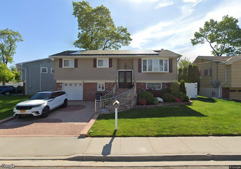
879 Derrick Adkins Ln West Hempstead, NY 11552
Estimated Value: $729,000 - $732,135
4
Beds
2
Baths
1,804
Sq Ft
$405/Sq Ft
Est. Value
About This Home
This home is located at 879 Derrick Adkins Ln, West Hempstead, NY 11552 and is currently estimated at $730,568, approximately $404 per square foot. 879 Derrick Adkins Ln is a home located in Nassau County with nearby schools including Davison Avenue Intermediate School, Maurice W. Downing Primary K-2 School, and Howard T Herber Middle School.
Ownership History
Date
Name
Owned For
Owner Type
Purchase Details
Closed on
Mar 14, 2016
Sold by
Facey Hopeton and Facey Charmaine
Bought by
Kumar Vijay Anil and Kumar Marilyn
Current Estimated Value
Home Financials for this Owner
Home Financials are based on the most recent Mortgage that was taken out on this home.
Original Mortgage
$344,000
Outstanding Balance
$272,274
Interest Rate
3.65%
Mortgage Type
New Conventional
Estimated Equity
$458,294
Purchase Details
Closed on
Jun 23, 2005
Sold by
Chong Guy
Bought by
Facey Hopeton
Create a Home Valuation Report for This Property
The Home Valuation Report is an in-depth analysis detailing your home's value as well as a comparison with similar homes in the area
Home Values in the Area
Average Home Value in this Area
Purchase History
| Date | Buyer | Sale Price | Title Company |
|---|---|---|---|
| Kumar Vijay Anil | $430,000 | None Available | |
| Facey Hopeton | $376,000 | -- |
Source: Public Records
Mortgage History
| Date | Status | Borrower | Loan Amount |
|---|---|---|---|
| Open | Kumar Vijay Anil | $344,000 |
Source: Public Records
Tax History Compared to Growth
Tax History
| Year | Tax Paid | Tax Assessment Tax Assessment Total Assessment is a certain percentage of the fair market value that is determined by local assessors to be the total taxable value of land and additions on the property. | Land | Improvement |
|---|---|---|---|---|
| 2025 | $11,652 | $390 | $152 | $238 |
| 2024 | $3,921 | $399 | $155 | $244 |
| 2023 | $10,848 | $399 | $155 | $244 |
| 2022 | $10,848 | $399 | $155 | $244 |
| 2021 | $14,183 | $399 | $155 | $244 |
| 2020 | $10,883 | $512 | $341 | $171 |
| 2019 | $10,212 | $584 | $389 | $195 |
| 2018 | $10,999 | $584 | $0 | $0 |
| 2017 | $5,073 | $584 | $389 | $195 |
| 2016 | $8,508 | $584 | $342 | $242 |
| 2015 | $3,215 | $584 | $294 | $290 |
| 2014 | $3,215 | $584 | $294 | $290 |
| 2013 | $3,442 | $664 | $334 | $330 |
Source: Public Records
Map
Nearby Homes
- 924 Otsego Ct
- 919 Pinelake Dr
- 9 Coral Ct
- 10 Atlas Ave
- 0 Rhodes Ln
- 486 Champlain Ave
- 401 Ocean Ave
- 1025 Ontario Rd
- 450 Rhodes Ln
- 7 Hopatcong Ave
- 1024 Mahopac Rd
- 899 Cleveland St
- 81 Gerard Ave W
- 1070 Mahopac Rd
- 71 Dogwood Ave
- 841 Woodfield Rd
- 4 Malverne Ave
- 95 Dogwood Ave
- 771 Maple Place
- 461 Pinebrook Ave
- 885 Derrick Adkins Ln
- 1129 Ossipee Rd
- 892 Ossipee Ct
- 886 Ossipee Ct
- 891 Derrick Adkins Ln
- 880 Ossipee Ct
- 1151 Ossipee Rd
- 1138 Ossipee Rd
- 1132 Ossipee Rd
- 898 Ossipee Ct
- 1144 Ossipee Rd
- 897 Derrick Adkins Ln
- 1126 Ossipee Rd
- 1150 Ossipee Rd
- 1159 Ossipee Rd
- 891 Ossipee Ct
- 885 Ossipee Ct
- 904 Ossipee Ct
- 879 Ossipee Ct
- 903 Derrick Adkins Ln