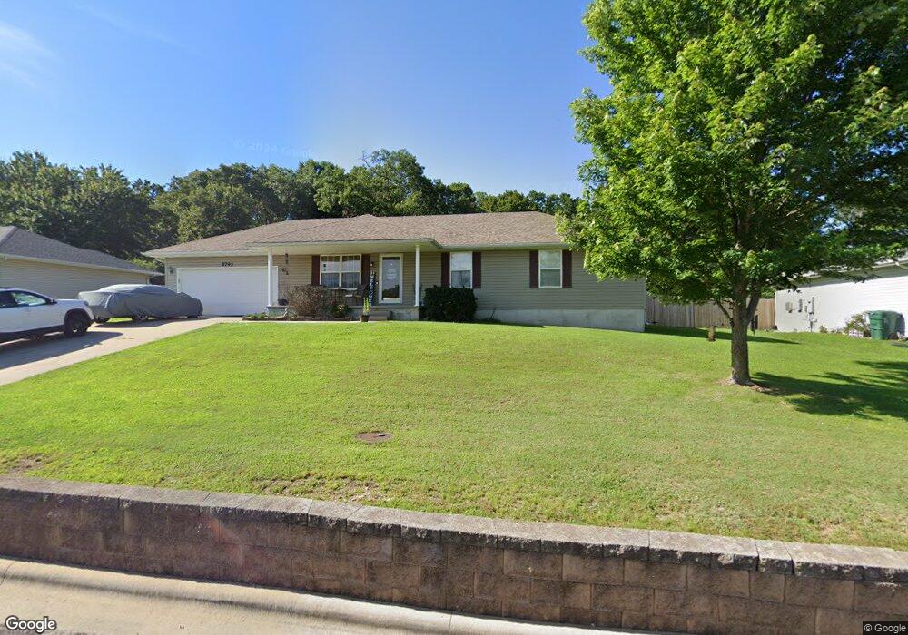
8795 Brookside Cir Monett, MO 65708
Estimated Value: $192,000 - $242,000
3
Beds
2
Baths
1,300
Sq Ft
$163/Sq Ft
Est. Value
About This Home
This home is located at 8795 Brookside Cir, Monett, MO 65708 and is currently estimated at $211,473, approximately $162 per square foot. 8795 Brookside Cir is a home located in Lawrence County with nearby schools including Monett Elementary School, Monett Intermediate School, and Central Park Elementary School.
Ownership History
Date
Name
Owned For
Owner Type
Purchase Details
Closed on
Oct 31, 2006
Sold by
S & B Green Investments Llc
Bought by
Sanders Randy R and Sanders Brenda S
Current Estimated Value
Home Financials for this Owner
Home Financials are based on the most recent Mortgage that was taken out on this home.
Original Mortgage
$5,325
Outstanding Balance
$3,614
Interest Rate
9%
Mortgage Type
Unknown
Estimated Equity
$207,859
Purchase Details
Closed on
Sep 28, 2006
Sold by
Markussen Ron and Markussen Trisha
Bought by
S & B Green Investments Llc
Home Financials for this Owner
Home Financials are based on the most recent Mortgage that was taken out on this home.
Original Mortgage
$5,325
Outstanding Balance
$3,614
Interest Rate
9%
Mortgage Type
Unknown
Estimated Equity
$207,859
Create a Home Valuation Report for This Property
The Home Valuation Report is an in-depth analysis detailing your home's value as well as a comparison with similar homes in the area
Home Values in the Area
Average Home Value in this Area
Purchase History
| Date | Buyer | Sale Price | Title Company |
|---|---|---|---|
| Sanders Randy R | -- | None Available | |
| S & B Green Investments Llc | -- | None Available |
Source: Public Records
Mortgage History
| Date | Status | Borrower | Loan Amount |
|---|---|---|---|
| Open | Sanders Randy R | $5,325 | |
| Open | Sanders Randy R | $101,175 |
Source: Public Records
Tax History Compared to Growth
Tax History
| Year | Tax Paid | Tax Assessment Tax Assessment Total Assessment is a certain percentage of the fair market value that is determined by local assessors to be the total taxable value of land and additions on the property. | Land | Improvement |
|---|---|---|---|---|
| 2025 | $1,012 | $22,710 | $2,360 | $20,350 |
| 2024 | $1,012 | $20,710 | $2,360 | $18,350 |
| 2023 | $953 | $20,710 | $2,360 | $18,350 |
| 2022 | $939 | $19,370 | $2,360 | $17,010 |
| 2021 | $940 | $19,370 | $2,360 | $17,010 |
| 2020 | $933 | $19,060 | $2,050 | $17,010 |
| 2019 | $889 | $19,060 | $2,050 | $17,010 |
| 2018 | $847 | $19,060 | $2,050 | $17,010 |
| 2017 | $841 | $19,060 | $2,050 | $17,010 |
| 2016 | -- | $17,400 | $2,050 | $15,350 |
| 2015 | -- | $17,400 | $2,050 | $15,350 |
| 2014 | -- | $17,400 | $2,050 | $15,350 |
Source: Public Records
Map
Nearby Homes
- 4 Remington Dr
- 1213 Woodland
- 1211 Woodland
- 1202 Woodland Ridge
- 8696 Lawrence 2226
- 1401 Rosewood St
- 1107 Woodland Ridge Dr
- 1124 Woodland Ridge Dr
- 1113 Woodland Ridge Dr
- 8954 Lawrence 2226p
- 917 Hillcrest Dr
- 902 N 16th St
- 000 County Road 1090 Unit 1090
- 000 County Road 1090
- 1404 6th St
- 1108 E Cleveland Ave
- 1214 7th St
- 1508 Northview Dr
- 9426 Business Highway 60
- 000 8th St
- 8785 Brookside Cir
- 8815 Brookside Cir
- 8790 Brookside Cir
- 8835 Brookside Cir
- 8835 Brookside Cir
- 8775 Brookside Cir
- 8830 Brookside Cir
- 8765 Brookside Cir
- 8855 Brookside Cir
- 8850 Brookside Cir
- 8700 Brookside Cir
- 8686 Brookside Cir
- 8660 Brookside Cir
- 8870 Brookside Cir
- 8755 Brookside Cir
- 8640 Brookside Cir
- 8620 Brookside Cir
- 8890 Brookside Cir
- 8899 Brookside Cir
- 8675 Brookside Cir