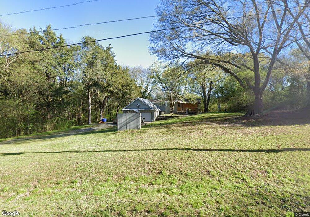
88 Collins Rd Cedartown, GA 30125
Estimated Value: $188,974 - $261,000
2
Beds
1
Bath
1,087
Sq Ft
$215/Sq Ft
Est. Value
About This Home
This home is located at 88 Collins Rd, Cedartown, GA 30125 and is currently estimated at $233,244, approximately $214 per square foot. 88 Collins Rd is a home located in Polk County with nearby schools including Vineyard Harvester Christian Academy.
Ownership History
Date
Name
Owned For
Owner Type
Purchase Details
Closed on
Jul 22, 1996
Sold by
Leslie David (Giving Only 2/3 Int In Le)
Bought by
Dawson Linda L and Takei Joyce L
Current Estimated Value
Purchase Details
Closed on
Jul 26, 1994
Sold by
Leslie Cheryl A
Bought by
Leslie David
Purchase Details
Closed on
Dec 9, 1986
Sold by
Barrett Ii Douglas H
Bought by
Leslie David
Purchase Details
Closed on
Sep 17, 1982
Sold by
Brown Leroy I
Bought by
Barrett Ii Douglas H
Purchase Details
Closed on
Feb 22, 1982
Sold by
Barrett Douglas H
Bought by
Brown Leroy I
Purchase Details
Closed on
Dec 1, 1979
Sold by
Wright Lester S
Bought by
Barrett Douglas H
Purchase Details
Closed on
Dec 13, 1974
Sold by
Knight W J
Bought by
Wright Lester S
Purchase Details
Closed on
Nov 5, 1971
Sold by
Forrister Dewie
Bought by
Knight W J
Purchase Details
Closed on
Aug 23, 1968
Bought by
Forrister Dewie
Create a Home Valuation Report for This Property
The Home Valuation Report is an in-depth analysis detailing your home's value as well as a comparison with similar homes in the area
Home Values in the Area
Average Home Value in this Area
Purchase History
| Date | Buyer | Sale Price | Title Company |
|---|---|---|---|
| Dawson Linda L | $2,000 | -- | |
| Leslie David | -- | -- | |
| Leslie David | -- | -- | |
| Barrett Ii Douglas H | -- | -- | |
| Brown Leroy I | -- | -- | |
| Barrett Douglas H | -- | -- | |
| Wright Lester S | -- | -- | |
| Knight W J | -- | -- | |
| Forrister Dewie | -- | -- |
Source: Public Records
Tax History Compared to Growth
Tax History
| Year | Tax Paid | Tax Assessment Tax Assessment Total Assessment is a certain percentage of the fair market value that is determined by local assessors to be the total taxable value of land and additions on the property. | Land | Improvement |
|---|---|---|---|---|
| 2024 | $1,148 | $62,300 | $10,000 | $52,300 |
| 2023 | $907 | $44,918 | $10,000 | $34,918 |
| 2022 | $618 | $32,748 | $4,000 | $28,748 |
| 2021 | $739 | $32,748 | $4,000 | $28,748 |
| 2020 | $741 | $32,748 | $4,000 | $28,748 |
| 2019 | $575 | $23,404 | $3,000 | $20,404 |
| 2018 | $493 | $19,891 | $1,320 | $18,571 |
| 2017 | $487 | $19,891 | $1,320 | $18,571 |
| 2016 | $487 | $19,891 | $1,320 | $18,571 |
| 2015 | $488 | $19,891 | $1,320 | $18,571 |
| 2014 | $495 | $20,006 | $1,435 | $18,571 |
Source: Public Records
Map
Nearby Homes
- 0 Collins Rd Unit 10627302
- 90 W Meadow Lakes Blvd
- 113 Cherokee Estates Dr
- 2236 Rome Hwy
- 31 Meadow Lakes Terrace
- 88 Sequoyah Ct
- 1250 Adams Rd
- TRACT3 Drummond Rd
- Tract2 Drummond Rd
- 600 Miller Rd
- 0 Rome Hwy Unit 10521649
- 232 Stephens Rd
- 1170 Lake Creek Rd
- 5866 Hwy 27 S
- 5854 Cedartown Hwy SW
- 727 Cherokee Rd
- 0 Colquitt Rd Unit 25175705
- 0 Colquitt Rd Unit 7661475
- 0 Colquitt Rd Unit 10623944
- 0 Booger Hollow Rd