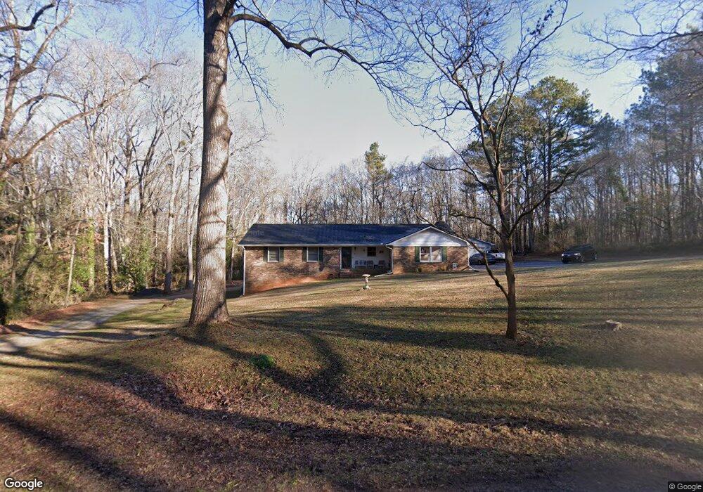
88 Thrasher Dr Watkinsville, GA 30677
Estimated Value: $382,414 - $439,000
--
Bed
--
Bath
1,811
Sq Ft
$224/Sq Ft
Est. Value
About This Home
This home is located at 88 Thrasher Dr, Watkinsville, GA 30677 and is currently estimated at $406,104, approximately $224 per square foot. 88 Thrasher Dr is a home located in Oconee County with nearby schools including Oconee County Elementary School, Oconee County Primary School, and Oconee County Middle School.
Ownership History
Date
Name
Owned For
Owner Type
Purchase Details
Closed on
Apr 17, 2024
Sold by
Verner Nancy B
Bought by
Rebecca Holcomb Living Trust
Current Estimated Value
Purchase Details
Closed on
Aug 8, 2018
Sold by
Verner Nancy B
Bought by
Verner Nanvy B and Holcomb Rebecca Verner
Purchase Details
Closed on
Jul 9, 2018
Sold by
Holcomb Rebecca Verner
Bought by
Fuller Ross A
Purchase Details
Closed on
Dec 4, 2014
Sold by
Verner Nancy B
Bought by
Holcomb V Rebecca
Create a Home Valuation Report for This Property
The Home Valuation Report is an in-depth analysis detailing your home's value as well as a comparison with similar homes in the area
Home Values in the Area
Average Home Value in this Area
Purchase History
| Date | Buyer | Sale Price | Title Company |
|---|---|---|---|
| Rebecca Holcomb Living Trust | -- | -- | |
| Verner Nanvy B | -- | -- | |
| Fuller Ross A | $162,000 | -- | |
| Holcomb V Rebecca | -- | -- |
Source: Public Records
Tax History Compared to Growth
Tax History
| Year | Tax Paid | Tax Assessment Tax Assessment Total Assessment is a certain percentage of the fair market value that is determined by local assessors to be the total taxable value of land and additions on the property. | Land | Improvement |
|---|---|---|---|---|
| 2024 | $2,781 | $112,976 | $26,000 | $86,976 |
| 2023 | $2,265 | $108,660 | $26,000 | $82,660 |
| 2022 | $435 | $97,734 | $26,000 | $71,734 |
| 2021 | $415 | $86,587 | $24,000 | $62,587 |
| 2020 | $432 | $83,476 | $24,000 | $59,476 |
| 2019 | $385 | $80,950 | $24,000 | $56,950 |
| 2018 | $303 | $73,137 | $20,000 | $53,137 |
| 2017 | $302 | $68,351 | $20,000 | $48,351 |
| 2016 | $303 | $65,618 | $18,000 | $47,618 |
| 2015 | $304 | $64,664 | $18,000 | $46,664 |
| 2014 | $255 | $62,918 | $18,000 | $44,918 |
| 2013 | -- | $61,124 | $18,000 | $43,124 |
Source: Public Records
Map
Nearby Homes
- 170 Elliot Cir
- 2051 Simonton Bridge Rd
- 86 Cedar Dr
- 88 Cedar Dr
- 1001 Moreland Dr
- 1051 Simonton Way
- 1320 Katie Ln
- 1240 Summit Dr
- 1010 Jeremy Dr
- 1040 Thomas Ave
- 1050 Summit Oaks Dr
- 96 Morrison St Unit 53
- 92 Morrison St Unit 54
- 90 Morrison St Unit 55
- 96 Morrison St
- 90 Morrison St
- 1180 Allgood Rd
- 1250 Calls Creek Cir
- 2885 Electric Ave
- 3030 Electric Ave