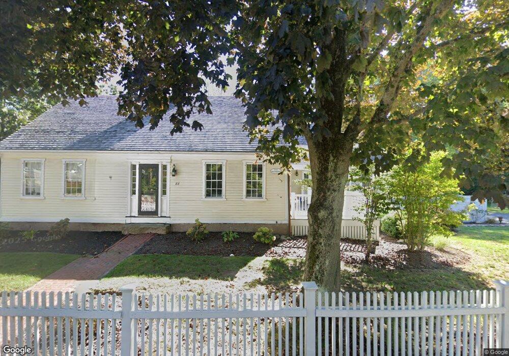
88 Tilden Rd Scituate, MA 02066
Estimated Value: $1,445,270 - $1,820,000
4
Beds
3
Baths
3,550
Sq Ft
$459/Sq Ft
Est. Value
About This Home
This home is located at 88 Tilden Rd, Scituate, MA 02066 and is currently estimated at $1,630,318, approximately $459 per square foot. 88 Tilden Rd is a home located in Plymouth County with nearby schools including Wampatuck Elementary School, Lester J. Gates Middle School, and Scituate High School.
Ownership History
Date
Name
Owned For
Owner Type
Purchase Details
Closed on
Jul 15, 2011
Sold by
Standley Ronald E
Bought by
Donehue Christine E and Cappabianca Marco
Current Estimated Value
Home Financials for this Owner
Home Financials are based on the most recent Mortgage that was taken out on this home.
Original Mortgage
$523,750
Outstanding Balance
$361,513
Interest Rate
4.58%
Mortgage Type
Purchase Money Mortgage
Estimated Equity
$1,268,805
Purchase Details
Closed on
Aug 24, 2007
Sold by
Sullivan Christopher L and Sullivan Maura T
Bought by
Standley Ronald E
Purchase Details
Closed on
Dec 19, 2002
Sold by
Carvelli-Marci Kimberly A
Bought by
Sullivan Christopher L and Sullivan Maura T
Purchase Details
Closed on
Nov 12, 1993
Sold by
Mear Marjorie M
Bought by
Marcia Peter E and Marcia Carvelli-Marcia K
Create a Home Valuation Report for This Property
The Home Valuation Report is an in-depth analysis detailing your home's value as well as a comparison with similar homes in the area
Home Values in the Area
Average Home Value in this Area
Purchase History
| Date | Buyer | Sale Price | Title Company |
|---|---|---|---|
| Donehue Christine E | $660,000 | -- | |
| Standley Ronald E | $705,000 | -- | |
| Sullivan Christopher L | $634,000 | -- | |
| Marcia Peter E | $225,000 | -- |
Source: Public Records
Mortgage History
| Date | Status | Borrower | Loan Amount |
|---|---|---|---|
| Open | Donehue Christine E | $523,750 | |
| Previous Owner | Marcia Peter E | $523,750 | |
| Previous Owner | Marcia Peter E | $10,000 |
Source: Public Records
Tax History
| Year | Tax Paid | Tax Assessment Tax Assessment Total Assessment is a certain percentage of the fair market value that is determined by local assessors to be the total taxable value of land and additions on the property. | Land | Improvement |
|---|---|---|---|---|
| 2025 | $12,098 | $1,211,000 | $446,500 | $764,500 |
| 2024 | $12,568 | $1,213,100 | $405,900 | $807,200 |
| 2023 | $12,221 | $1,098,000 | $369,100 | $728,900 |
| 2022 | $11,821 | $936,700 | $323,800 | $612,900 |
| 2021 | $11,164 | $837,500 | $292,900 | $544,600 |
| 2020 | $10,904 | $807,700 | $281,600 | $526,100 |
| 2019 | $7,374 | $773,800 | $276,100 | $497,700 |
| 2018 | $7,186 | $729,400 | $275,900 | $453,500 |
| 2017 | $10,108 | $717,400 | $263,900 | $453,500 |
| 2016 | $9,974 | $705,400 | $251,900 | $453,500 |
| 2015 | $9,084 | $693,400 | $239,900 | $453,500 |
Source: Public Records
Map
Nearby Homes
- 38 Lauren Ln
- 46 Tilden Rd
- 33 Beaver Dam Rd
- 25 Morton Place
- 1 Washington Ln
- 50 First Parish Rd
- 11 Brookline Rd
- 32 Barker Rd Unit 3
- 49 Jackson Rd
- 91 Front St Unit 106
- 20 Lawson Rd
- 92 Marion Rd
- 20 Meeting House Ln
- 23 Oceanside Dr
- 33 Oceanside Dr
- 111 Elm St
- 115 Elm St
- 20 Grace Way Unit 20
- 6 Grace Way Unit 6
- 27 Grace Way
Your Personal Tour Guide
Ask me questions while you tour the home.