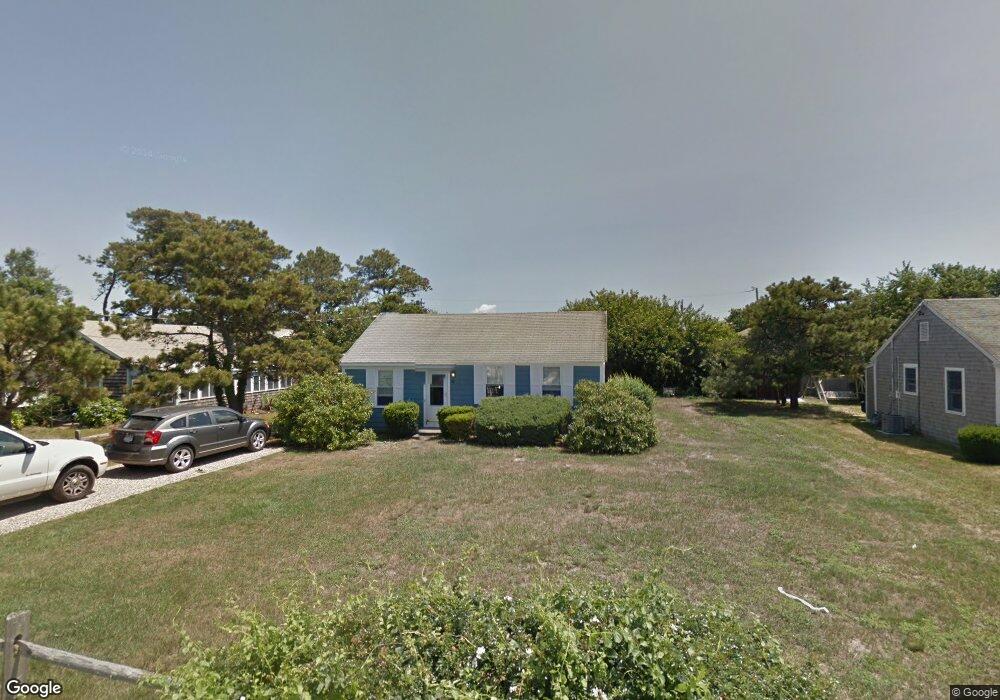
88 Uncle Rolf Rd Dennis Port, MA 02639
Dennis Port NeighborhoodEstimated Value: $458,000 - $566,275
3
Beds
2
Baths
704
Sq Ft
$729/Sq Ft
Est. Value
About This Home
This home is located at 88 Uncle Rolf Rd, Dennis Port, MA 02639 and is currently estimated at $513,319, approximately $729 per square foot. 88 Uncle Rolf Rd is a home located in Barnstable County with nearby schools including Dennis-Yarmouth Regional High School and St. Pius X. School.
Ownership History
Date
Name
Owned For
Owner Type
Purchase Details
Closed on
Sep 16, 2025
Sold by
Sullivan David R and Sullivan Andrea M
Bought by
D & A Cape House Llc
Current Estimated Value
Purchase Details
Closed on
Jun 3, 2014
Sold by
Jean M Sullivin Ret and Sullivan
Bought by
Sullivan David R and Sullivan Andrea M
Create a Home Valuation Report for This Property
The Home Valuation Report is an in-depth analysis detailing your home's value as well as a comparison with similar homes in the area
Home Values in the Area
Average Home Value in this Area
Purchase History
| Date | Buyer | Sale Price | Title Company |
|---|---|---|---|
| D & A Cape House Llc | -- | -- | |
| Sullivan David R | $272,000 | -- | |
| Sullivan David R | $272,000 | -- |
Source: Public Records
Mortgage History
| Date | Status | Borrower | Loan Amount |
|---|---|---|---|
| Closed | Sullivan David R | $0 |
Source: Public Records
Tax History Compared to Growth
Tax History
| Year | Tax Paid | Tax Assessment Tax Assessment Total Assessment is a certain percentage of the fair market value that is determined by local assessors to be the total taxable value of land and additions on the property. | Land | Improvement |
|---|---|---|---|---|
| 2025 | $1,936 | $447,000 | $272,300 | $174,700 |
| 2024 | $1,812 | $412,700 | $261,900 | $150,800 |
| 2023 | $1,752 | $375,100 | $238,000 | $137,100 |
| 2022 | $1,828 | $326,500 | $224,400 | $102,100 |
| 2021 | $4,346 | $305,600 | $220,000 | $85,600 |
| 2020 | $1,964 | $321,900 | $244,400 | $77,500 |
| 2019 | $1,896 | $307,300 | $239,700 | $67,600 |
| 2018 | $3,675 | $252,900 | $191,600 | $61,300 |
| 2017 | $1,544 | $251,000 | $191,700 | $59,300 |
| 2016 | $1,568 | $240,100 | $187,100 | $53,000 |
| 2015 | $1,537 | $240,100 | $187,100 | $53,000 |
| 2014 | $1,495 | $235,500 | $182,500 | $53,000 |
Source: Public Records
Map
Nearby Homes
- 112 Old Wharf Rd Unit E4
- 112 Old Wharf Rd Unit E1
- 64 Beaten Rd
- 120 Old Wharf Rd Unit 11
- 154 Old Wharf Rd Unit 26
- 154 Old Wharf Rd Unit 14
- 37 Ocean Dr Unit 2
- 217 Old Wharf Rd Unit 64
- 241 Old Wharf Rd Unit 82
- 241 Old Wharf Rd Unit 127
- 241 Old Wharf Rd Unit 90
- 262 Old Wharf Rd Unit 67
- 262 Old Wharf Rd Unit 5
- 262 Old Wharf Rd Unit 5
- 262 Old Wharf Rd Unit 20
- 262 Old Wharf Rd Unit 87
- 37 Beach Hills Rd
- 37-A Beach Hills Rd
- 80 Michaels Ave
- 31 Easy St
- 89,89A Uncle Rolf
- 90 Uncle Rolf Rd
- 84 Uncle Rolf Rd
- 203 Captain Chase Rd
- 207 Captain Chase Rd
- 94 Uncle Rolf Rd
- 209 Captain Chase Rd
- 80 Uncle Rolf Rd
- 197 Captain Chase Rd
- 85 Uncle Rolf Rd
- 83 Uncle Rolf Rd
- 87 Uncle Rolf Rd
- 81 Uncle Rolf Rd
- 91 Uncle Rolf Rd
- 96 Uncle Rolf Rd
- 213 Captain Chase Rd
- 78 Uncle Rolf Rd
- 79 Uncle Rolf Rd
- 93 Uncle Rolf Rd
- 200 Captain Chase Rd Unit 15