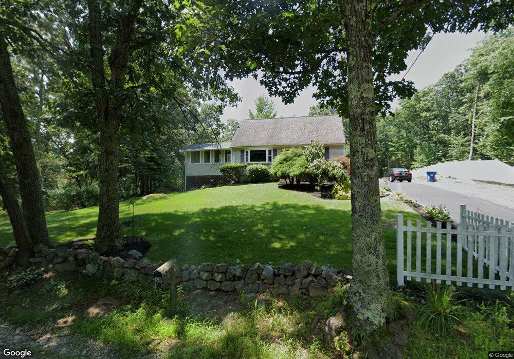
88 Upton Rd Uxbridge, MA 01569
Estimated Value: $479,443 - $539,000
2
Beds
1
Bath
1,697
Sq Ft
$300/Sq Ft
Est. Value
About This Home
This home is located at 88 Upton Rd, Uxbridge, MA 01569 and is currently estimated at $509,361, approximately $300 per square foot. 88 Upton Rd is a home located in Worcester County with nearby schools including Uxbridge High School, Our Lady of the Valley Regional School, and Whitinsville Christian School.
Create a Home Valuation Report for This Property
The Home Valuation Report is an in-depth analysis detailing your home's value as well as a comparison with similar homes in the area
Home Values in the Area
Average Home Value in this Area
Tax History
| Year | Tax Paid | Tax Assessment Tax Assessment Total Assessment is a certain percentage of the fair market value that is determined by local assessors to be the total taxable value of land and additions on the property. | Land | Improvement |
|---|---|---|---|---|
| 2025 | $51 | $388,600 | $147,100 | $241,500 |
| 2024 | $4,770 | $369,200 | $139,600 | $229,600 |
| 2023 | $4,516 | $323,700 | $120,700 | $203,000 |
| 2022 | $4,301 | $283,700 | $105,600 | $178,100 |
| 2021 | $4,373 | $276,400 | $105,600 | $170,800 |
| 2020 | $4,389 | $262,200 | $113,200 | $149,000 |
| 2019 | $4,596 | $264,900 | $124,500 | $140,400 |
| 2018 | $4,220 | $245,800 | $124,500 | $121,300 |
| 2017 | $3,936 | $232,100 | $120,300 | $111,800 |
| 2016 | $3,328 | $189,400 | $87,000 | $102,400 |
| 2015 | $3,263 | $187,500 | $87,000 | $100,500 |
Source: Public Records
Map
Nearby Homes
- 218 E Hartford Ave Unit 218
- 25 Dunny Cove Ln
- 288-290 Providence Rd
- 3 Strathmore Shire Unit A
- 4 Moon Hill Rd
- 597 Mendon Rd
- 3 Moon Hill Rd
- 831 Providence Rd Unit 837
- 125 Heritage Dr
- 164 Heritage Dr Unit 164
- 255 Prairie St
- 24 Olde Canal Way Unit 24
- 35 Pouts Ln
- 44 Pouts Ln
- 185 Prairie St
- 237 Heritage Dr Unit 237
- 240 Heritage Dr
- 12 Hartford Ave E
- 76 Pouts Ln
- 171 Rolling Ridge Dr Unit 98
Your Personal Tour Guide
Ask me questions while you tour the home.