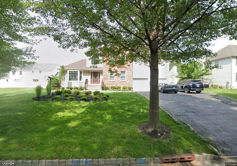
88 William St Morris Plains, NJ 07950
Estimated Value: $885,309 - $995,000
--
Bed
--
Bath
2,595
Sq Ft
$359/Sq Ft
Est. Value
About This Home
This home is located at 88 William St, Morris Plains, NJ 07950 and is currently estimated at $931,827, approximately $359 per square foot. 88 William St is a home located in Morris County with nearby schools including Mount Tabor School, Brooklawn Middle School, and Parsippany Hills High School.
Ownership History
Date
Name
Owned For
Owner Type
Purchase Details
Closed on
Feb 11, 2004
Sold by
Rodriguez Franklin
Bought by
Sokolowski David and Sokolowski Sonal
Current Estimated Value
Home Financials for this Owner
Home Financials are based on the most recent Mortgage that was taken out on this home.
Original Mortgage
$27,500
Outstanding Balance
$12,888
Interest Rate
5.82%
Estimated Equity
$918,939
Purchase Details
Closed on
May 10, 2001
Sold by
Rozanitis Chris
Bought by
Rodriguez Franklin and Rodriguez Maria
Home Financials for this Owner
Home Financials are based on the most recent Mortgage that was taken out on this home.
Original Mortgage
$367,200
Interest Rate
7.09%
Purchase Details
Closed on
Jan 27, 1994
Sold by
The Southpaw Corp
Bought by
Rozanitis Chris and Rozantis Kim
Home Financials for this Owner
Home Financials are based on the most recent Mortgage that was taken out on this home.
Original Mortgage
$251,000
Interest Rate
6.96%
Create a Home Valuation Report for This Property
The Home Valuation Report is an in-depth analysis detailing your home's value as well as a comparison with similar homes in the area
Home Values in the Area
Average Home Value in this Area
Purchase History
| Date | Buyer | Sale Price | Title Company |
|---|---|---|---|
| Sokolowski David | $595,000 | -- | |
| Rodriguez Franklin | $459,000 | -- | |
| Rozanitis Chris | $314,000 | -- |
Source: Public Records
Mortgage History
| Date | Status | Borrower | Loan Amount |
|---|---|---|---|
| Open | Sokolowski David | $27,500 | |
| Previous Owner | Rodriguez Franklin | $367,200 | |
| Previous Owner | Rozanitis Chris | $251,000 |
Source: Public Records
Tax History Compared to Growth
Tax History
| Year | Tax Paid | Tax Assessment Tax Assessment Total Assessment is a certain percentage of the fair market value that is determined by local assessors to be the total taxable value of land and additions on the property. | Land | Improvement |
|---|---|---|---|---|
| 2025 | $16,849 | $485,000 | $188,400 | $296,600 |
| 2024 | $16,529 | $485,000 | $188,400 | $296,600 |
| 2023 | $16,529 | $485,000 | $188,400 | $296,600 |
| 2022 | $15,379 | $485,000 | $188,400 | $296,600 |
| 2021 | $15,379 | $485,000 | $188,400 | $296,600 |
| 2020 | $14,957 | $485,000 | $188,400 | $296,600 |
| 2019 | $14,555 | $485,000 | $188,400 | $296,600 |
| 2018 | $14,143 | $485,000 | $188,400 | $296,600 |
| 2017 | $13,823 | $485,000 | $188,400 | $296,600 |
| 2016 | $13,585 | $485,000 | $188,400 | $296,600 |
| 2015 | $13,241 | $485,000 | $188,400 | $296,600 |
| 2014 | $13,047 | $485,000 | $188,400 | $296,600 |
Source: Public Records
Map
Nearby Homes
- 711 Park Rd
- 20 Whitewood Dr
- 21 Holly Dr
- 1 Ironwood Dr
- 62 Brookstone Cir
- 78 North Place
- 32 Fletcher Place
- 2 Castaby Way
- 29 Whitfield Place
- 26 Wesley Place
- 15 Force Place
- 1466 Tabor Rd
- 34 Moraine Rd
- 2350 State Route 10 Unit D11
- 35 Ferncliff Rd
- 35 Oakdale Rd
- 62 Fernview Rd
- 9 Craydon St
- 42 Flintlock Rd
- 1035 Littleton Rd