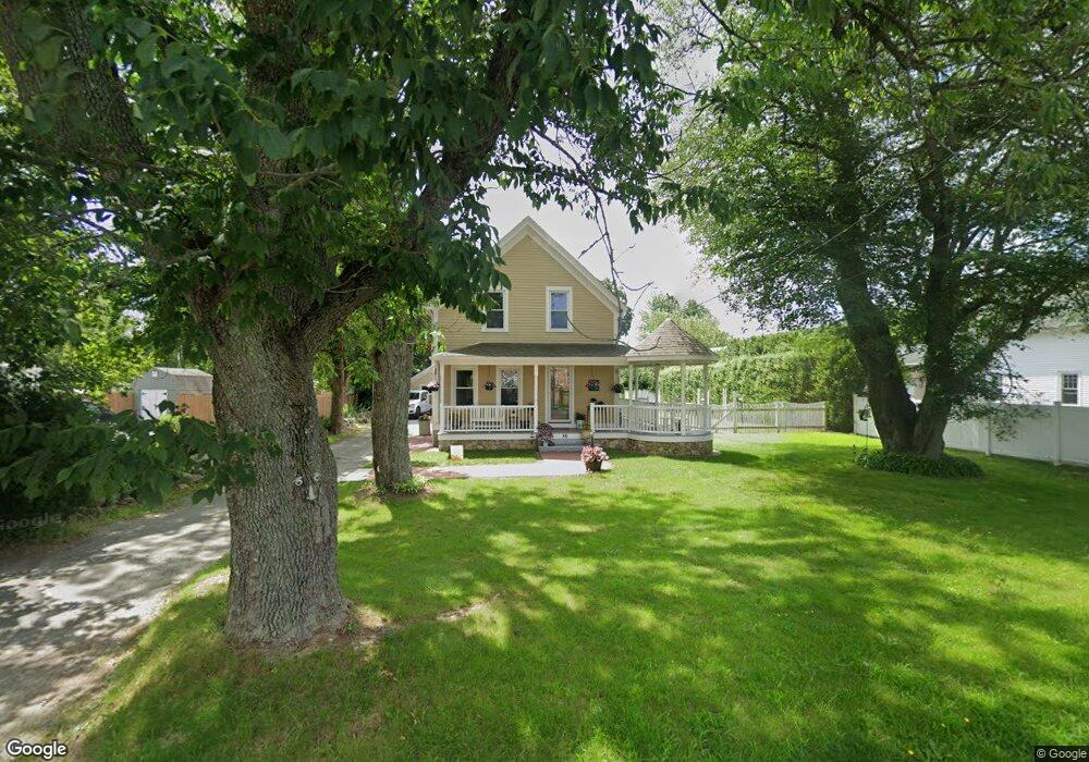
88 Wing Rd Acushnet, MA 02743
Estimated Value: $474,000 - $493,000
--
Bed
2
Baths
1,684
Sq Ft
$286/Sq Ft
Est. Value
About This Home
This home is located at 88 Wing Rd, Acushnet, MA 02743 and is currently estimated at $481,194, approximately $285 per square foot. 88 Wing Rd is a home located in Bristol County with nearby schools including Acushnet Elementary School, Albert F Ford Middle School, and Alma Del Mar Charter School.
Ownership History
Date
Name
Owned For
Owner Type
Purchase Details
Closed on
Jul 19, 2025
Sold by
Gifford Randall J
Bought by
Gifford Randall J and Nobrega Louise
Current Estimated Value
Home Financials for this Owner
Home Financials are based on the most recent Mortgage that was taken out on this home.
Original Mortgage
$180,000
Outstanding Balance
$179,387
Interest Rate
6.85%
Mortgage Type
Credit Line Revolving
Estimated Equity
$301,807
Purchase Details
Closed on
Aug 30, 2004
Sold by
Wood David B and Wood Donna M
Bought by
Gifford Randall J
Home Financials for this Owner
Home Financials are based on the most recent Mortgage that was taken out on this home.
Original Mortgage
$212,000
Interest Rate
6.02%
Mortgage Type
Purchase Money Mortgage
Purchase Details
Closed on
Jul 17, 1998
Sold by
Tardif Ronald and Tardif Theresa L
Bought by
Wood David B and Wood Donna M
Create a Home Valuation Report for This Property
The Home Valuation Report is an in-depth analysis detailing your home's value as well as a comparison with similar homes in the area
Home Values in the Area
Average Home Value in this Area
Purchase History
| Date | Buyer | Sale Price | Title Company |
|---|---|---|---|
| Gifford Randall J | -- | -- | |
| Gifford Randall J | -- | -- | |
| Gifford Randall J | $265,000 | -- | |
| Gifford Randall J | $265,000 | -- | |
| Wood David B | $107,500 | -- | |
| Wood David B | $107,500 | -- |
Source: Public Records
Mortgage History
| Date | Status | Borrower | Loan Amount |
|---|---|---|---|
| Open | Gifford Randall J | $180,000 | |
| Closed | Gifford Randall J | $180,000 | |
| Previous Owner | Wood David B | $193,650 | |
| Previous Owner | Wood David B | $212,000 |
Source: Public Records
Tax History
| Year | Tax Paid | Tax Assessment Tax Assessment Total Assessment is a certain percentage of the fair market value that is determined by local assessors to be the total taxable value of land and additions on the property. | Land | Improvement |
|---|---|---|---|---|
| 2025 | $3,717 | $344,500 | $143,300 | $201,200 |
| 2024 | $3,766 | $330,100 | $137,100 | $193,000 |
| 2023 | $3,557 | $296,400 | $124,600 | $171,800 |
| 2022 | $3,664 | $276,100 | $118,600 | $157,500 |
| 2021 | $3,424 | $247,600 | $118,600 | $129,000 |
| 2020 | $3,452 | $247,600 | $118,600 | $129,000 |
| 2019 | $3,359 | $236,900 | $118,600 | $118,300 |
| 2018 | $0 | $228,600 | $118,600 | $110,000 |
| 2017 | $3,209 | $222,200 | $118,600 | $103,600 |
| 2016 | $3,091 | $212,700 | $118,600 | $94,100 |
| 2015 | $3,037 | $212,700 | $118,600 | $94,100 |
Source: Public Records
Map
Nearby Homes
- 84 Wing Rd
- 92 Wing Rd
- 0 Hathaway Rd Unit 71185029
- 0 Hathaway Rd Unit 71389225
- 0 Hathaway Rd Unit 71670519
- 0 Hathaway Rd Unit 71706922
- 0 Hathaway Rd Unit 71751920
- 0 Hathaway Rd Unit 73298187
- 0 Hathaway Rd Unit 72576242
- 83 Wing Rd
- 5 Hathaway Rd
- 78 Wing Rd
- 3 Noyer St
- 5 Noyer St
- 95 Wing Rd
- 11 Noyer St
- 93 Wing Rd
- 13 Noyer St
- 98 Wing Rd
- 2 Hathaway Rd
Your Personal Tour Guide
Ask me questions while you tour the home.