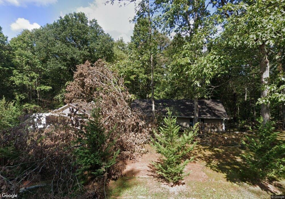
880 Alfred Taylor Dr Demorest, GA 30535
Estimated Value: $197,000 - $236,249
2
Beds
1
Bath
1,120
Sq Ft
$197/Sq Ft
Est. Value
About This Home
This home is located at 880 Alfred Taylor Dr, Demorest, GA 30535 and is currently estimated at $220,562, approximately $196 per square foot. 880 Alfred Taylor Dr is a home located in Habersham County with nearby schools including Fairview Elementary School, North Habersham Middle School, and Habersham Success Academy.
Ownership History
Date
Name
Owned For
Owner Type
Purchase Details
Closed on
May 30, 2025
Sold by
Zavala Paramo Jose Christian
Bought by
Paramo Jose Christian Zaval
Current Estimated Value
Home Financials for this Owner
Home Financials are based on the most recent Mortgage that was taken out on this home.
Original Mortgage
$154,660
Outstanding Balance
$154,259
Interest Rate
6.76%
Mortgage Type
FHA
Estimated Equity
$66,303
Purchase Details
Closed on
Mar 31, 2020
Sold by
West Roy Donald
Bought by
Zavala Jose
Home Financials for this Owner
Home Financials are based on the most recent Mortgage that was taken out on this home.
Original Mortgage
$126,172
Interest Rate
3.5%
Mortgage Type
FHA
Create a Home Valuation Report for This Property
The Home Valuation Report is an in-depth analysis detailing your home's value as well as a comparison with similar homes in the area
Home Values in the Area
Average Home Value in this Area
Purchase History
| Date | Buyer | Sale Price | Title Company |
|---|---|---|---|
| Paramo Jose Christian Zaval | -- | -- | |
| Zavala Jose | $128,500 | -- |
Source: Public Records
Mortgage History
| Date | Status | Borrower | Loan Amount |
|---|---|---|---|
| Open | Paramo Jose Christian Zaval | $154,660 | |
| Previous Owner | Zavala Jose | $126,172 |
Source: Public Records
Tax History Compared to Growth
Tax History
| Year | Tax Paid | Tax Assessment Tax Assessment Total Assessment is a certain percentage of the fair market value that is determined by local assessors to be the total taxable value of land and additions on the property. | Land | Improvement |
|---|---|---|---|---|
| 2025 | $2,229 | $92,257 | $16,000 | $76,257 |
| 2024 | $1,970 | $75,892 | $12,000 | $63,892 |
| 2023 | $1,620 | $64,784 | $12,000 | $52,784 |
| 2022 | $1,389 | $53,256 | $8,000 | $45,256 |
| 2021 | $1,211 | $46,652 | $6,000 | $40,652 |
| 2020 | $842 | $31,292 | $2,000 | $29,292 |
| 2019 | $842 | $31,292 | $2,000 | $29,292 |
| 2018 | $836 | $31,292 | $2,000 | $29,292 |
| 2017 | $775 | $28,844 | $2,000 | $26,844 |
| 2016 | $752 | $72,110 | $2,000 | $26,844 |
| 2015 | $743 | $72,110 | $2,000 | $26,844 |
| 2014 | $745 | $70,290 | $2,000 | $26,116 |
| 2013 | -- | $28,384 | $2,000 | $26,384 |
Source: Public Records
Map
Nearby Homes
- 474 White Pine Cir
- 22 Ridge Haven Dr
- 239 Cool Springs Lot #8 Rd
- 244 Stonehedge Dr
- 239 Cool Springs Rd Unit LOT 8
- 67 Rainbow Cir
- 125 Rainbow Cir
- 125 AND 87 Rainbow Cir
- 303 Chitwood Rd
- 922 Amys Ford Trail
- 2446 Dean Mountain Rd
- 69 Blue Creek Cove
- 2123 Goat Neck Rd
- 0 Waterside Trail Unit 10497096
- 0 Waterside Trail Unit 7556513
- 552 LOT 47 Riverside Dr
- 518 Riverside Dr
- 618 Riverside Dr
- 230 Skyview Dr
- 1045 Fairview School Rd
- 890 Alfred Taylor Dr
- 879 Alfred Taylor Rd
- 773 Alfred Taylor Rd
- 773 Alfred Taylor Dr
- 760 Alfred Taylor Dr
- 760 Alfred Taylor Rd
- 352 Mandy's Cove
- 300 Mandys Cove Dr
- 352 Mandys Cove Dr
- 0 Mandys Cove Dr Unit 7026958
- 404 Mandys Cove Dr
- 370 Mandys Cove Dr
- 1019 Alfred Taylor Rd
- 748 Alfred Taylor Dr
- 895 Alfred Taylor Dr Unit 6,7,8
- 895 Alfred Taylor Dr
- 745 Alfred Taylor Dr
- 668 Alfred Taylor Dr
- 695 Alfred Taylor Dr
- 498 White Pine Cir