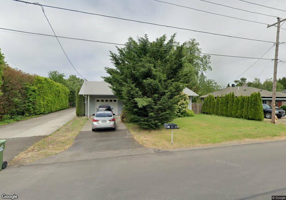
880 Laurelhurst Dr Eugene, OR 97402
Bethel NeighborhoodEstimated Value: $313,000 - $355,000
About This Home
This home is located at 880 Laurelhurst Dr, Eugene, OR 97402 and is currently estimated at $330,812, approximately $347 per square foot. 880 Laurelhurst Dr is a home located in Lane County with nearby schools including Danebo Elementary School, Shasta Middle School, and Willamette High School.
Ownership History
We collect this data history from publicly available records. To have your information removed, we recommend requesting removal directly through your county’s website.
Purchase Details
Home Financials for this Owner
Home Financials are based on the most recent Mortgage that was taken out on this home.Purchase Details
Home Financials for this Owner
Home Financials are based on the most recent Mortgage that was taken out on this home.Purchase Details
Purchase Details
Home Financials for this Owner
Home Financials are based on the most recent Mortgage that was taken out on this home.Purchase Details
Home Financials for this Owner
Home Financials are based on the most recent Mortgage that was taken out on this home.Purchase Details
Home Values in the Area
Average Home Value in this Area
Purchase History
We collect this data history from publicly available records. To have your information removed, we recommend requesting removal directly through your county’s website.
| Date | Buyer | Sale Price | Title Company |
|---|---|---|---|
| -- | Fidelity National Title | ||
| $171,000 | First American Title | ||
| $137,500 | Fidelity National Title Co | ||
| $127,900 | Evergreen Land Title Company | ||
| $250,000 | Fidelity Natl Title Co Of Or | ||
| $115,000 | First American Title |
Mortgage History
We collect this data history from publicly available records. To have your information removed, we recommend requesting removal directly through your county’s website.
| Date | Status | Borrower | Loan Amount |
|---|---|---|---|
| Open | $146,670 | ||
| Previous Owner | $151,098 | ||
| Previous Owner | $121,505 |
Tax History
We collect this data history from publicly available records. To have your information removed, we recommend requesting removal directly through your county’s website.
| Year | Tax Paid | Tax Assessment Tax Assessment Total Assessment is a certain percentage of the fair market value that is determined by local assessors to be the total taxable value of land and additions on the property. | Land | Improvement |
|---|---|---|---|---|
| 2025 | $2,345 | $134,816 | -- | -- |
| 2024 | $2,286 | $130,890 | -- | -- |
| 2023 | $2,286 | $127,078 | $0 | $0 |
| 2022 | $2,128 | $123,377 | $0 | $0 |
| 2021 | $2,083 | $119,784 | $0 | $0 |
| 2020 | $2,022 | $116,296 | $0 | $0 |
| 2019 | $1,923 | $112,909 | $0 | $0 |
| 2018 | $1,869 | $106,428 | $0 | $0 |
| 2017 | $1,786 | $106,428 | $0 | $0 |
| 2016 | $1,741 | $103,328 | $0 | $0 |
| 2015 | $1,706 | $100,318 | $0 | $0 |
| 2014 | $1,680 | $97,396 | $0 | $0 |
Map
- 870 Laurelhurst Dr
- 950 Williams St
- 4749 Royal Ave
- 555 N Danebo Ave Unit 72
- 857 Throne Dr
- 1107 Echo Hollow Rd
- 1145 Ludgate Dr
- 4467 Fergus Ave
- 4462 Fergus Ave
- 4280 Avalon St
- 4285 Fergus Ave
- 1530 Dola St
- 4055 Royal Ave Unit 140
- 4055 Royal Ave Unit 22
- 4055 Royal Ave Unit 13
- 4055 Royal Ave Unit 134
- 795 Red Cedar Ct
- 4900 Royal Ave Unit 105
- 4900 Royal Ave Unit 32
- 4567 Liberty St
- 860 Laurelhurst Dr
- 878 Laurelhurst Dr
- 866 Laurelhurst Dr
- 876 Laurelhurst Dr
- 856 Laurelhurst Dr
- 874 Laurelhurst Dr
- 854 Laurelhurst Dr
- 850 Laurelhurst Dr
- 910 Laurelhurst Dr
- 869 Laurelhurst Dr
- 848 Laurelhurst Dr
- 859 Laurelhurst Dr
- 909 Laurelhurst Dr
- 841 Laurelhurst Dr
- 941 Williams St
- 851 Laurelhurst Dr Unit 1
- 10 Sheffield Ct
- 919 Laurelhurst Dr
- 4645 Royal Ave
- 920 Laurelhurst Dr
Ask me questions while you tour the home.