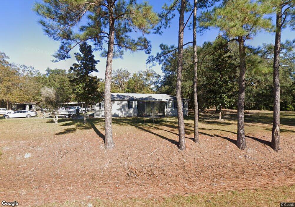
880 Peter King Rd Riceboro, GA 31323
Estimated Value: $178,000 - $340,000
5
Beds
3
Baths
1,614
Sq Ft
$168/Sq Ft
Est. Value
About This Home
This home is located at 880 Peter King Rd, Riceboro, GA 31323 and is currently estimated at $271,595, approximately $168 per square foot. 880 Peter King Rd is a home located in Liberty County with nearby schools including Liberty Elementary School, Midway Middle School, and Liberty County High School.
Ownership History
Date
Name
Owned For
Owner Type
Purchase Details
Closed on
Apr 7, 2016
Sold by
Dashank Llc
Bought by
Stewart Maurice
Current Estimated Value
Home Financials for this Owner
Home Financials are based on the most recent Mortgage that was taken out on this home.
Original Mortgage
$175,506
Outstanding Balance
$139,429
Interest Rate
3.68%
Mortgage Type
VA
Estimated Equity
$132,166
Purchase Details
Closed on
Jan 27, 2015
Sold by
Shanken James R
Bought by
Dashank Llc
Purchase Details
Closed on
Nov 14, 2014
Sold by
Kanada Melvin
Bought by
Shanken James R
Home Financials for this Owner
Home Financials are based on the most recent Mortgage that was taken out on this home.
Original Mortgage
$73,530
Interest Rate
4%
Mortgage Type
New Conventional
Purchase Details
Closed on
Dec 17, 1999
Bought by
Kanada Melvin
Create a Home Valuation Report for This Property
The Home Valuation Report is an in-depth analysis detailing your home's value as well as a comparison with similar homes in the area
Home Values in the Area
Average Home Value in this Area
Purchase History
| Date | Buyer | Sale Price | Title Company |
|---|---|---|---|
| Stewart Maurice | $169,900 | -- | |
| Dashank Llc | -- | -- | |
| Shanken James R | $55,000 | -- | |
| Kanada Melvin | $11,600 | -- |
Source: Public Records
Mortgage History
| Date | Status | Borrower | Loan Amount |
|---|---|---|---|
| Open | Stewart Maurice | $175,506 | |
| Previous Owner | Shanken James R | $73,530 |
Source: Public Records
Tax History Compared to Growth
Tax History
| Year | Tax Paid | Tax Assessment Tax Assessment Total Assessment is a certain percentage of the fair market value that is determined by local assessors to be the total taxable value of land and additions on the property. | Land | Improvement |
|---|---|---|---|---|
| 2024 | $2,590 | $61,601 | $12,979 | $48,622 |
| 2023 | $2,590 | $56,249 | $12,979 | $43,270 |
| 2022 | $1,879 | $47,499 | $12,979 | $34,520 |
| 2021 | $1,722 | $43,587 | $12,979 | $30,608 |
| 2020 | $1,740 | $43,968 | $12,979 | $30,989 |
| 2019 | $1,711 | $44,350 | $12,979 | $31,371 |
| 2018 | $1,705 | $44,731 | $12,979 | $31,752 |
| 2017 | $1,914 | $45,113 | $12,979 | $32,134 |
| 2016 | $1,616 | $45,494 | $12,979 | $32,515 |
| 2015 | $1,213 | $51,199 | $18,684 | $32,515 |
| 2014 | $1,213 | $53,061 | $18,684 | $34,378 |
| 2013 | -- | $37,064 | $6,243 | $30,820 |
Source: Public Records
Map
Nearby Homes
- 6078 S Coastal Hwy
- 5.8 ACRES S Coastal Hwy
- lot 1 Frazier Dr
- lot 2 Frazier Dr
- 1300 Retreat Rd
- 1615 Retreat Rd
- LOT 22 Bermuda Bluff Ln
- 0 Jerico Marsh Rd Unit 10544769
- 0 Jerico Marsh Rd Unit 160926
- LOT 8 Bermuda Bluff Ln
- LOT 6 Bermuda Bluff Ln
- LOT 23 Bermuda Bluff Ln
- LOT 21 Bermuda Bluff Ln
- 0 Sandy Run Rd Unit 10592196
- --- Old Darien Hwy
- 876 Old Darien Hwy
- 72 Big Oak Rd
- 3 and M3 Big Oak Rd
- 3 & M3 Big Oak Rd
- 390 Big Oak Rd
- 921 Peter King Rd
- 820 Peter King Rd
- 803 Peter King Rd
- 210 Peter King Rd Unit C
- 210 Peter King Rd Unit B
- 210 Peter King Rd Unit A
- 210 Peter King Rd
- 1196 Peter King Rd
- 570 Peter King Rd
- 1357 Peter King Rd
- 1352 Peter King Rd
- 1401 Peter King Rd
- 1350 Peter King Rd
- 1497 Peter King Rd
- 1444 Peter King Rd
- 8 Fuller Rd
- 1632 Peter King Rd
- 97 Cottom Dr
- 1601 Peter King Rd
- 129 Cottom Dr