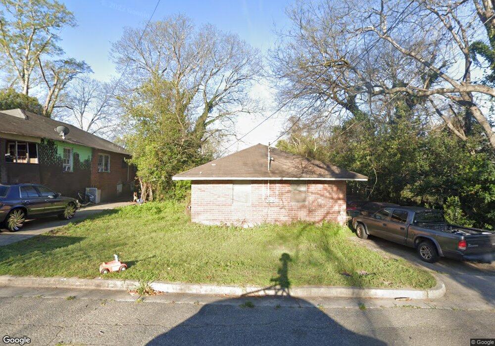
880 Ritchie St Macon, GA 31217
Fort Hill Historic District NeighborhoodEstimated Value: $63,000 - $79,022
2
Beds
2
Baths
1,482
Sq Ft
$49/Sq Ft
Est. Value
About This Home
This home is located at 880 Ritchie St, Macon, GA 31217 and is currently estimated at $72,006, approximately $48 per square foot. 880 Ritchie St is a home located in Bibb County with nearby schools including Burdell Elementary School, Appling Middle School, and Northeast High School.
Ownership History
Date
Name
Owned For
Owner Type
Purchase Details
Closed on
Sep 1, 2023
Sold by
Thomas Derrick
Bought by
Reign Unlimited Inc
Current Estimated Value
Purchase Details
Closed on
May 19, 2022
Sold by
Silver Star Property Management Llc
Bought by
Thomas Derrick
Purchase Details
Closed on
May 14, 2013
Sold by
Curry Willie J
Bought by
Consolidated Investors Of Macon Inc
Purchase Details
Closed on
Apr 17, 2006
Sold by
Consolidated Investors Of Macon Inc
Bought by
Curry Willie J
Create a Home Valuation Report for This Property
The Home Valuation Report is an in-depth analysis detailing your home's value as well as a comparison with similar homes in the area
Home Values in the Area
Average Home Value in this Area
Purchase History
| Date | Buyer | Sale Price | Title Company |
|---|---|---|---|
| Reign Unlimited Inc | $57,500 | -- | |
| Reign Unlimited Inc | $57,500 | -- | |
| Thomas Derrick | -- | -- | |
| Consolidated Investors Of Macon Inc | -- | None Available | |
| Curry Willie J | $35,000 | None Available |
Source: Public Records
Tax History Compared to Growth
Tax History
| Year | Tax Paid | Tax Assessment Tax Assessment Total Assessment is a certain percentage of the fair market value that is determined by local assessors to be the total taxable value of land and additions on the property. | Land | Improvement |
|---|---|---|---|---|
| 2025 | $577 | $23,487 | $2,420 | $21,067 |
| 2024 | $515 | $20,280 | $1,320 | $18,960 |
| 2023 | $509 | $20,060 | $1,100 | $18,960 |
| 2022 | $420 | $12,145 | $1,667 | $10,478 |
| 2021 | $308 | $8,109 | $625 | $7,484 |
| 2020 | $286 | $7,361 | $625 | $6,736 |
| 2019 | $259 | $6,613 | $625 | $5,988 |
| 2018 | $756 | $6,613 | $625 | $5,988 |
| 2017 | $248 | $6,613 | $625 | $5,988 |
| 2016 | $229 | $6,612 | $625 | $5,988 |
| 2015 | $324 | $6,612 | $625 | $5,988 |
| 2014 | $459 | $8,151 | $666 | $7,484 |
Source: Public Records
Map
Nearby Homes
- 970 Center St
- 842 Little Short St
- 990 Center St
- 658 Pringle St
- 390 Cowan St
- 378 Cowan St
- 734 Fort Hill St
- 738 Hall St
- 727 Smith St
- 722 Mitchell St
- 760 Cowan St
- 348 Woolfolk St
- 751 Mitchell St
- 1059 Fort Hill St
- 774 Maynard St
- 363 Woolfolk St Unit 361 Woolfolk Street
- 768 Maynard St
- 363 AND 361 Woolfolk St
- 735 Maynard St
- 857 Mitchell St