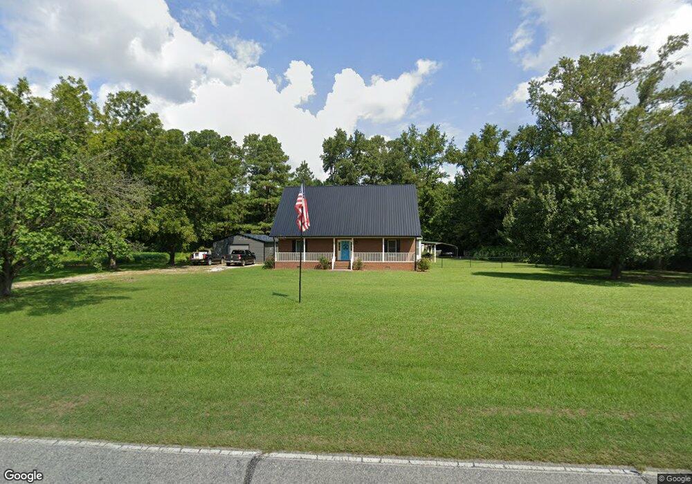
880 Whit Rd Newton Grove, NC 28366
Estimated Value: $265,000 - $303,135
3
Beds
2
Baths
1,613
Sq Ft
$172/Sq Ft
Est. Value
About This Home
This home is located at 880 Whit Rd, Newton Grove, NC 28366 and is currently estimated at $278,034, approximately $172 per square foot. 880 Whit Rd is a home located in Sampson County with nearby schools including Hobbton Elementary School, Hobbton Middle School, and Hobbton High School.
Ownership History
Date
Name
Owned For
Owner Type
Purchase Details
Closed on
Jan 5, 2017
Sold by
Hayes Lynda Sigmon and Williams Lynda Sigmon
Bought by
Hayes Lynda Sigmon and Hayes John Douglas
Current Estimated Value
Purchase Details
Closed on
Mar 24, 2009
Sold by
Williams Larry
Bought by
Williams Lynda Sigmon
Purchase Details
Closed on
Mar 12, 2007
Sold by
Williams Lynda S
Bought by
Williams Larry and Williams Lynda S
Home Financials for this Owner
Home Financials are based on the most recent Mortgage that was taken out on this home.
Original Mortgage
$50,900
Interest Rate
6.11%
Mortgage Type
New Conventional
Create a Home Valuation Report for This Property
The Home Valuation Report is an in-depth analysis detailing your home's value as well as a comparison with similar homes in the area
Home Values in the Area
Average Home Value in this Area
Purchase History
| Date | Buyer | Sale Price | Title Company |
|---|---|---|---|
| Hayes Lynda Sigmon | -- | None Available | |
| Williams Lynda Sigmon | -- | -- | |
| Williams Larry | -- | -- |
Source: Public Records
Mortgage History
| Date | Status | Borrower | Loan Amount |
|---|---|---|---|
| Previous Owner | Williams Larry | $50,900 |
Source: Public Records
Tax History Compared to Growth
Tax History
| Year | Tax Paid | Tax Assessment Tax Assessment Total Assessment is a certain percentage of the fair market value that is determined by local assessors to be the total taxable value of land and additions on the property. | Land | Improvement |
|---|---|---|---|---|
| 2025 | $2,005 | $255,423 | $15,536 | $239,887 |
| 2024 | $1,801 | $255,423 | $15,536 | $239,887 |
| 2023 | $1,568 | $169,492 | $13,509 | $155,983 |
| 2022 | $1,568 | $169,492 | $0 | $0 |
| 2021 | $1,699 | $183,668 | $13,509 | $170,159 |
| 2020 | $1,484 | $160,473 | $13,509 | $146,964 |
| 2019 | $1,484 | $160,473 | $0 | $0 |
| 2018 | $1,409 | $152,377 | $0 | $0 |
| 2017 | $1,409 | $152,377 | $0 | $0 |
| 2016 | $1,417 | $152,377 | $0 | $0 |
| 2015 | $1,417 | $152,377 | $0 | $0 |
| 2014 | $1,417 | $152,377 | $0 | $0 |
Source: Public Records
Map
Nearby Homes
- 13015 Hobbton Hwy
- 762 Share Cake Rd
- 0 Suttontown Rd Unit 100516331
- 0 Suttontown Rd
- 00 Trail End Ln
- 00 Trail End Ln Unit LotWP001
- 0 Hobbton Hwy Unit 100510708
- 520 Fayetteville St
- 770 Simmons Rd
- 1509 Sampson Acres Dr
- 10455 U S 701 Hwy
- 267 Ed Collins Ln
- 0 Main St
- 9501 Harper House Rd
- 9505 Harper House Rd
- 3092 Harnett-Dunn Hwy
- 352 Old Crow Rd
- 410 E Barefoot Rd
- 1676 Smithfield Hwy
- Lot 5 Crumpler Lake Ln