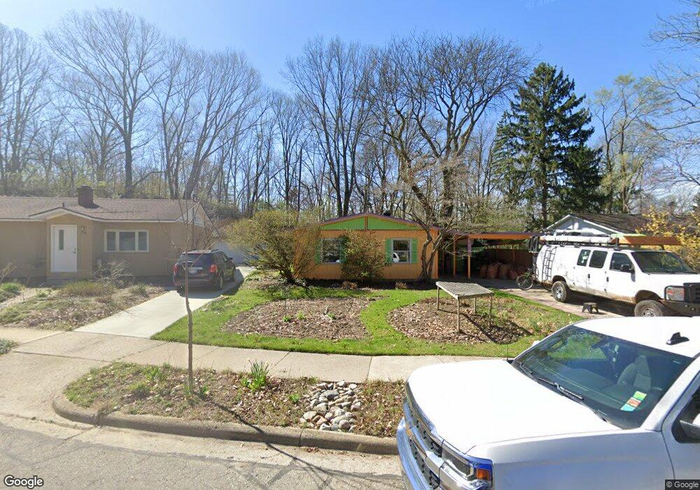
880 Wickfield Ct Ann Arbor, MI 48105
Northern Ann Arbor NeighborhoodEstimated Value: $340,375 - $399,000
3
Beds
1
Bath
984
Sq Ft
$379/Sq Ft
Est. Value
About This Home
This home is located at 880 Wickfield Ct, Ann Arbor, MI 48105 and is currently estimated at $372,844, approximately $378 per square foot. 880 Wickfield Ct is a home located in Washtenaw County with nearby schools including Ann Arbor STEAM at Northside, Clague Middle School, and Skyline High School.
Ownership History
Date
Name
Owned For
Owner Type
Purchase Details
Closed on
Aug 19, 2008
Sold by
Gauger Derek K
Bought by
Williams Linda C
Current Estimated Value
Home Financials for this Owner
Home Financials are based on the most recent Mortgage that was taken out on this home.
Original Mortgage
$136,000
Outstanding Balance
$89,173
Interest Rate
6.31%
Mortgage Type
Unknown
Estimated Equity
$283,671
Purchase Details
Closed on
Sep 29, 1999
Sold by
Cook Margaret E
Bought by
Gauger Derek K
Purchase Details
Closed on
Jun 13, 1995
Sold by
Mehlman Daniel
Bought by
Cook Margaret E
Create a Home Valuation Report for This Property
The Home Valuation Report is an in-depth analysis detailing your home's value as well as a comparison with similar homes in the area
Home Values in the Area
Average Home Value in this Area
Purchase History
| Date | Buyer | Sale Price | Title Company |
|---|---|---|---|
| Williams Linda C | $170,000 | None Available | |
| Gauger Derek K | $127,500 | -- | |
| Cook Margaret E | $89,000 | -- |
Source: Public Records
Mortgage History
| Date | Status | Borrower | Loan Amount |
|---|---|---|---|
| Open | Williams Linda C | $136,000 |
Source: Public Records
Tax History Compared to Growth
Tax History
| Year | Tax Paid | Tax Assessment Tax Assessment Total Assessment is a certain percentage of the fair market value that is determined by local assessors to be the total taxable value of land and additions on the property. | Land | Improvement |
|---|---|---|---|---|
| 2025 | $3,981 | $140,100 | $0 | $0 |
| 2024 | $3,883 | $124,000 | $0 | $0 |
| 2023 | $3,580 | $119,800 | $0 | $0 |
| 2022 | $3,901 | $105,200 | $0 | $0 |
| 2021 | $3,809 | $101,200 | $0 | $0 |
| 2020 | $3,732 | $98,700 | $0 | $0 |
| 2019 | $3,552 | $89,500 | $89,500 | $0 |
| 2018 | $3,502 | $85,300 | $0 | $0 |
| 2017 | $3,407 | $86,300 | $0 | $0 |
| 2016 | $2,902 | $68,124 | $0 | $0 |
| 2015 | $3,130 | $67,921 | $0 | $0 |
| 2014 | $3,130 | $65,800 | $0 | $0 |
| 2013 | -- | $65,800 | $0 | $0 |
Source: Public Records
Map
Nearby Homes
- 822 Starwick Dr
- 1713 Pontiac Trail
- 1540 Jones Dr
- 2757 Polson St
- 2778 Bristol Ridge Dr Unit 38
- 2768 Bristol Ridge Dr Unit 33
- 2776 Bristol Ridge Dr Unit 37
- 2772 Bristol Ridge Dr Unit 35
- 2774 Bristol Ridge Dr Unit 36
- 1261 Island Dr Unit 201
- 2768 S Knightsbridge Cir
- 2759 Bristol Ridge Dr
- 2994 Montana Way
- 1201 Island Dr Unit 104
- 2865 Dillon Dr
- 519 Longshore Dr Unit A
- 2678 S Knightsbridge Cir Unit 24
- 1132 Longshore Dr Unit 2
- 1136 Longshore Dr Unit 1
- 1128 Longshore Dr Unit 1
- 876 Wickfield Ct
- 886 Wickfield Ct
- 870 Wickfield Ct
- 890 Wickfield Ct
- 879 Wickfield Ct
- 866 Wickfield Ct
- 875 Wickfield Ct
- 865 Starwick Dr
- 885 Wickfield Ct
- 869 Wickfield Ct
- 895 Wickfield Ct
- 860 Wickfield Ct
- 889 Wickfield Ct
- 863 Starwick Dr
- 865 Wickfield Ct
- 859 Wickfield Ct
- 1790 David Ct
- 856 Wickfield Ct
- 859 Starwick Dr
- 1795 David Ct