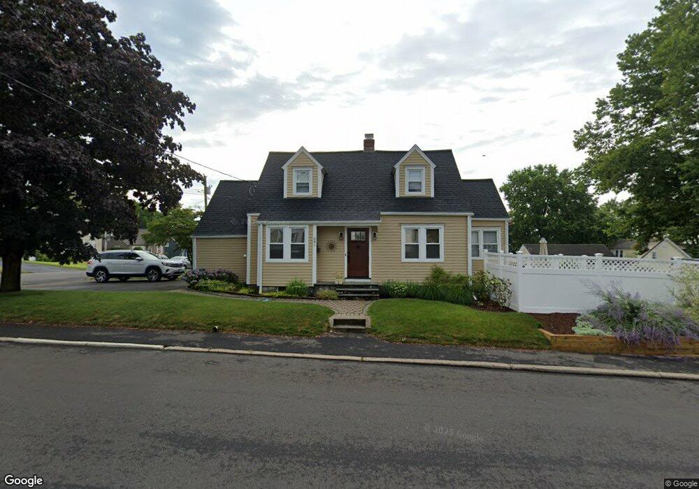
881 Knapps Hwy Fairfield, CT 06825
Tunxis Hill NeighborhoodEstimated Value: $532,384 - $575,000
2
Beds
2
Baths
1,396
Sq Ft
$393/Sq Ft
Est. Value
About This Home
This home is located at 881 Knapps Hwy, Fairfield, CT 06825 and is currently estimated at $548,346, approximately $392 per square foot. 881 Knapps Hwy is a home located in Fairfield County with nearby schools including Mckinley Elementary School, Tomlinson Middle School, and Fairfield Warde High School.
Ownership History
Date
Name
Owned For
Owner Type
Purchase Details
Closed on
Jan 16, 2004
Sold by
Lupien Donald R and Lupien Tercia M
Bought by
Decarlo Deena M
Current Estimated Value
Home Financials for this Owner
Home Financials are based on the most recent Mortgage that was taken out on this home.
Original Mortgage
$248,000
Interest Rate
5.98%
Purchase Details
Closed on
Feb 19, 1999
Sold by
Vesciglio Barry M
Bought by
Lupien Donald R and Lupien Teresa M
Purchase Details
Closed on
Jan 5, 1989
Sold by
Patnani Richard
Bought by
Vesciglio Barry M
Create a Home Valuation Report for This Property
The Home Valuation Report is an in-depth analysis detailing your home's value as well as a comparison with similar homes in the area
Home Values in the Area
Average Home Value in this Area
Purchase History
| Date | Buyer | Sale Price | Title Company |
|---|---|---|---|
| Decarlo Deena M | $310,000 | -- | |
| Decarlo Deena M | $310,000 | -- | |
| Lupien Donald R | $172,800 | -- | |
| Lupien Donald R | $172,800 | -- | |
| Vesciglio Barry M | $173,000 | -- |
Source: Public Records
Mortgage History
| Date | Status | Borrower | Loan Amount |
|---|---|---|---|
| Open | Vesciglio Barry M | $265,500 | |
| Closed | Vesciglio Barry M | $248,000 |
Source: Public Records
Tax History
| Year | Tax Paid | Tax Assessment Tax Assessment Total Assessment is a certain percentage of the fair market value that is determined by local assessors to be the total taxable value of land and additions on the property. | Land | Improvement |
|---|---|---|---|---|
| 2025 | $6,522 | $229,740 | $161,070 | $68,670 |
| 2024 | $6,410 | $229,740 | $161,070 | $68,670 |
| 2023 | $6,320 | $229,740 | $161,070 | $68,670 |
| 2022 | $6,258 | $229,740 | $161,070 | $68,670 |
| 2021 | $6,198 | $229,740 | $161,070 | $68,670 |
| 2020 | $5,660 | $211,260 | $134,190 | $77,070 |
| 2019 | $1,319 | $211,260 | $134,190 | $77,070 |
| 2018 | $1,425 | $211,260 | $134,190 | $77,070 |
| 2017 | $1,425 | $211,260 | $134,190 | $77,070 |
| 2016 | $5,377 | $211,260 | $134,190 | $77,070 |
| 2015 | $5,326 | $214,830 | $149,870 | $64,960 |
| 2014 | $5,242 | $214,830 | $149,870 | $64,960 |
Source: Public Records
Map
Nearby Homes
- 206 Sterling St
- 108 Roseville St
- 1335 Black Rock Turnpike
- 21 Boroskey Rd
- 198 Castle Ave
- 219 Oakwood Dr
- 28 Country Rd
- 376 Knapps Hwy
- 1 Overlook Ave
- 37 Biro St
- 652 Black Rock Turnpike
- 65 Benton St
- 187 Halley Ave
- 12 Reynolds Dr
- 145 Brentwood Ave
- 240 Sunnyridge Ave Unit 63
- 57 Hibiscus St Unit 1
- 156 Halley Ave
- 144 Warsaw St
- 155 Moody Ave
- 247 Sterling St
- 864 Knapps Hwy
- 134 Edison Ave
- 231 Sterling St
- 246 Sterling St
- 236 Sterling St
- 876 Knapps Hwy
- 221 Sterling St
- 888 Knapps Hwy
- 217 Sterling St
- 848 Knapps Hwy
- 845 Knapps Hwy
- 910 Knapps Hwy
- 226 Sterling St
- 860 Knapps Hwy
- 124 Edison Ave
- 834 Knapps Hwy
- 205 Sterling St
- 829 Knapps Hwy
- 216 Sterling St
Your Personal Tour Guide
Ask me questions while you tour the home.