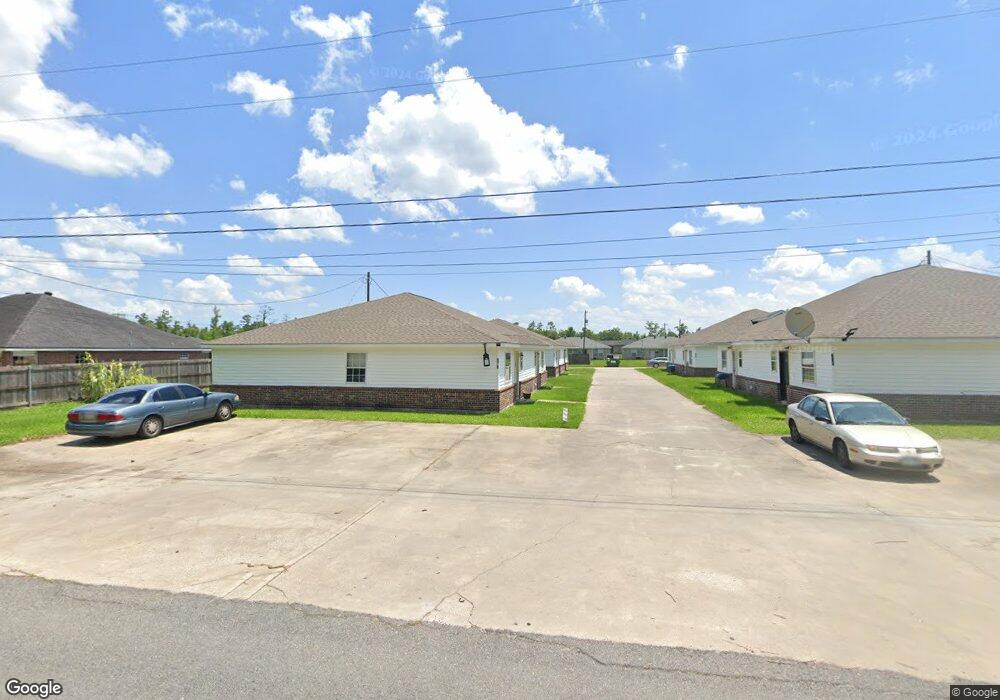
881 Sistrunk Rd Lake Charles, LA 70611
Moss Bluff NeighborhoodEstimated Value: $220,068 - $1,027,000
--
Bed
--
Bath
--
Sq Ft
566
Sq Ft Lot
About This Home
This home is located at 881 Sistrunk Rd, Lake Charles, LA 70611 and is currently estimated at $688,517. 881 Sistrunk Rd is a home located in Calcasieu Parish with nearby schools including Graham & Parks Alternative Public School, Moss Bluff Elementary School, and Putnam Avenue Upper School.
Ownership History
Date
Name
Owned For
Owner Type
Purchase Details
Closed on
Apr 24, 2019
Sold by
Rivet Family Trust
Bought by
Geek Rentals Llc
Current Estimated Value
Home Financials for this Owner
Home Financials are based on the most recent Mortgage that was taken out on this home.
Original Mortgage
$550,000
Outstanding Balance
$486,639
Interest Rate
4%
Mortgage Type
Commercial
Estimated Equity
$201,878
Create a Home Valuation Report for This Property
The Home Valuation Report is an in-depth analysis detailing your home's value as well as a comparison with similar homes in the area
Home Values in the Area
Average Home Value in this Area
Purchase History
| Date | Buyer | Sale Price | Title Company |
|---|---|---|---|
| Geek Rentals Llc | $550,000 | None Available |
Source: Public Records
Mortgage History
| Date | Status | Borrower | Loan Amount |
|---|---|---|---|
| Closed | Home Sweet Investments Llc | $262,500 | |
| Open | Geek Rentals Llc | $550,000 |
Source: Public Records
Tax History Compared to Growth
Tax History
| Year | Tax Paid | Tax Assessment Tax Assessment Total Assessment is a certain percentage of the fair market value that is determined by local assessors to be the total taxable value of land and additions on the property. | Land | Improvement |
|---|---|---|---|---|
| 2024 | $990 | $9,070 | $500 | $8,570 |
| 2023 | $975 | $18,140 | $1,000 | $17,140 |
| 2022 | $1,917 | $18,140 | $1,000 | $17,140 |
| 2021 | $2,011 | $18,140 | $1,000 | $17,140 |
| 2020 | $890 | $8,170 | $460 | $7,710 |
| 2019 | $984 | $9,010 | $440 | $8,570 |
| 2018 | $986 | $9,010 | $440 | $8,570 |
| 2017 | $1,000 | $9,010 | $440 | $8,570 |
| 2016 | $1,006 | $9,010 | $440 | $8,570 |
| 2015 | $1,006 | $9,010 | $440 | $8,570 |
Source: Public Records
Map
Nearby Homes
- 0 Park Rd
- 0 Park Rd Unit SWL25002774
- TBD Tan Tara Cir
- 1032 Tan Tara Cir
- 863 Cooley Rd
- 833 N Huval Dr
- 1492 Becky St
- 1208 Sam Houston Joness Pkwy
- 0 Sam Houston Jones Pkwy Unit 145953
- 959 Southern Meadows Dr
- 647 Morrow Rd
- 1003 New Castle Dr
- 986 Hollyvale Dr
- 125 Thelma Ln
- 290 Morrow Rd
- 1630 Hollow Cove Ln
- 1107 Idlebrook Dr
- 751 N Perkins Ferry Rd
- 1152 Park Rd
- 1647 Hollow Cove
- 885 Sistrunk Rd
- 879 Sistrunk Rd
- 879 Sistrunk Rd Unit 881,883,885
- 879 Sistrunk Rd Unit 879,881,883,885
- 883 Sistrunk Rd
- 1072 Shellie Ln
- 1062 Shellie Ln
- 891 Sistrunk Rd
- 891 Sistrunk Rd
- 891 Sistrunk Rd Unit 891 & 893
- 1092 A & B Shellie Ln
- 1082 Shellie Ln
- 861 Sistrunk Rd
- 0 Shellie Ln
- 1092 Shellie Ln
- 1102 Shellie Ln
- 1102 Shellie Ln Unit B
- 575 Park Rd
- 1112 Shellie Ln
- 1112 Shellie Ln Unit B