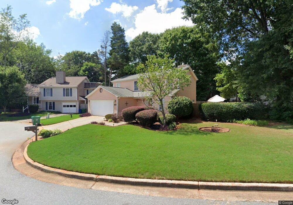
881 Wheatfields Ct Decatur, GA 30030
Estimated Value: $504,176 - $557,000
3
Beds
3
Baths
1,652
Sq Ft
$322/Sq Ft
Est. Value
About This Home
This home is located at 881 Wheatfields Ct, Decatur, GA 30030 and is currently estimated at $531,294, approximately $321 per square foot. 881 Wheatfields Ct is a home located in DeKalb County with nearby schools including Avondale Elementary School, Druid Hills Middle School, and Druid Hills High School.
Ownership History
Date
Name
Owned For
Owner Type
Purchase Details
Closed on
Nov 16, 2007
Sold by
Vinson R Michael
Bought by
Martinez Doris
Current Estimated Value
Home Financials for this Owner
Home Financials are based on the most recent Mortgage that was taken out on this home.
Original Mortgage
$125,001
Outstanding Balance
$78,844
Interest Rate
6.32%
Mortgage Type
New Conventional
Estimated Equity
$452,450
Purchase Details
Closed on
Sep 14, 1998
Sold by
Poholek Christopher and Poholek Catherine
Bought by
Vinson Michael R
Home Financials for this Owner
Home Financials are based on the most recent Mortgage that was taken out on this home.
Original Mortgage
$153,000
Interest Rate
6.95%
Mortgage Type
New Conventional
Create a Home Valuation Report for This Property
The Home Valuation Report is an in-depth analysis detailing your home's value as well as a comparison with similar homes in the area
Home Values in the Area
Average Home Value in this Area
Purchase History
| Date | Buyer | Sale Price | Title Company |
|---|---|---|---|
| Martinez Doris | $240,000 | -- | |
| Vinson Michael R | $170,000 | -- |
Source: Public Records
Mortgage History
| Date | Status | Borrower | Loan Amount |
|---|---|---|---|
| Open | Martinez Doris | $125,001 | |
| Previous Owner | Vinson Michael R | $153,000 |
Source: Public Records
Tax History
| Year | Tax Paid | Tax Assessment Tax Assessment Total Assessment is a certain percentage of the fair market value that is determined by local assessors to be the total taxable value of land and additions on the property. | Land | Improvement |
|---|---|---|---|---|
| 2025 | $4,908 | $178,120 | $52,360 | $125,760 |
| 2024 | $4,535 | $156,080 | $50,040 | $106,040 |
| 2023 | $4,535 | $143,440 | $50,040 | $93,400 |
Source: Public Records
Map
Nearby Homes
- 2630 Talley St Unit 326
- 2630 Talley St Unit 3
- 2630 Talley St Unit 228
- 2630 Talley St Unit 106
- 953 Forrest Blvd
- 1044 N Carter Rd
- 1002 Forrest Blvd
- 1112 Ashbury Dr
- 41 Clarendon Ave
- 101 Dartmouth Ave Unit 1
- 2516 Talley St
- 826 S Columbia Dr
- 64 Clarendon Ave
- 1096 Walker Dr
- 2894 Washington St Unit A
- 1130 N Carter Rd
- 221 Mountain View St
- 85 Devon Ln Unit 85
- 24 Hampshire Ct
- 1 Village Walk Dr
- 869 Wheatfields Ct
- 885 Wheatfields Ct
- 2765 Royal Bluff
- 2759 Royal Bluff
- 2771 Royal Bluff
- 880 Wheatfields Ct
- 864 Ashfield Dr
- 876 Wheatfields Ct
- 887 Wheatfields Ct
- 868 Ashfield Dr
- 872 Wheatfields Ct
- 884 Wheatfields Ct
- 860 Ashfield Dr
- 888 Wheatfields Ct
- 868 Wheatfields Ct
- 864 Wheatfields Ct
- 872 Ashfield Dr
- 2764 Royal Bluff
- 889 Wheatfields Place
- 883 Wheatfields Place
Your Personal Tour Guide
Ask me questions while you tour the home.