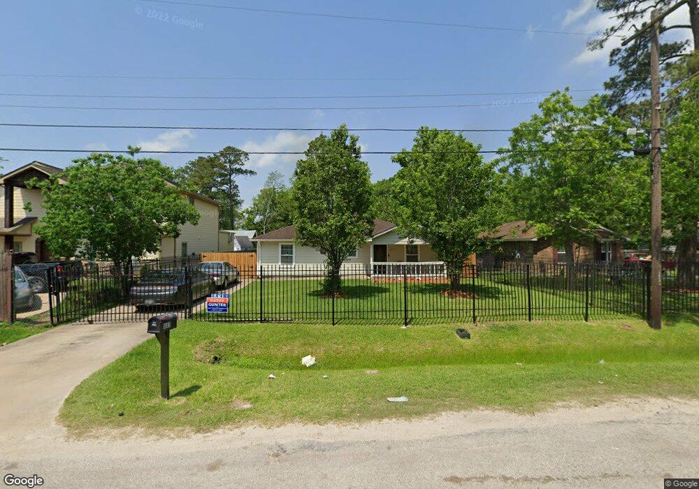
8811 Spaulding St Houston, TX 77016
Trinity-Houston Gardens NeighborhoodEstimated Value: $205,320 - $238,000
3
Beds
2
Baths
1,400
Sq Ft
$157/Sq Ft
Est. Value
About This Home
This home is located at 8811 Spaulding St, Houston, TX 77016 and is currently estimated at $220,080, approximately $157 per square foot. 8811 Spaulding St is a home located in Harris County with nearby schools including Felix Cook Jr. Elementary School, Key Middle, and Kashmere High School.
Ownership History
Date
Name
Owned For
Owner Type
Purchase Details
Closed on
Feb 24, 2014
Sold by
Boudreaux-Mack Cecial S
Bought by
Flores Hilda A
Current Estimated Value
Purchase Details
Closed on
Dec 18, 2007
Sold by
Windham Harvey Baker
Bought by
Boudreaux Mack Cecial S
Purchase Details
Closed on
Jul 21, 2004
Sold by
Estate Of Austin L Richie
Bought by
Windham Harvey Baker
Purchase Details
Closed on
Apr 15, 2004
Sold by
Richie Sarah E
Bought by
Harris County
Create a Home Valuation Report for This Property
The Home Valuation Report is an in-depth analysis detailing your home's value as well as a comparison with similar homes in the area
Home Values in the Area
Average Home Value in this Area
Purchase History
| Date | Buyer | Sale Price | Title Company |
|---|---|---|---|
| Flores Hilda A | -- | -- | |
| Flores Hilda A | -- | -- | |
| Boudreaux Mack Cecial S | -- | None Available | |
| Windham Harvey Baker | $2,700 | -- | |
| Harris County | -- | -- |
Source: Public Records
Tax History Compared to Growth
Tax History
| Year | Tax Paid | Tax Assessment Tax Assessment Total Assessment is a certain percentage of the fair market value that is determined by local assessors to be the total taxable value of land and additions on the property. | Land | Improvement |
|---|---|---|---|---|
| 2025 | $3,821 | $183,753 | $51,795 | $131,958 |
| 2024 | $3,821 | $182,630 | $51,795 | $130,835 |
| 2023 | $5,087 | $252,456 | $38,846 | $213,610 |
| 2022 | $4,098 | $186,094 | $25,898 | $160,196 |
| 2021 | $3,566 | $153,000 | $17,265 | $135,735 |
| 2020 | $3,426 | $141,495 | $17,265 | $124,230 |
| 2019 | $3,231 | $127,691 | $13,812 | $113,879 |
| 2018 | $2,408 | $95,145 | $13,812 | $81,333 |
| 2017 | $2,406 | $95,145 | $13,812 | $81,333 |
| 2016 | $1,937 | $76,595 | $10,791 | $65,804 |
| 2015 | $1,487 | $57,856 | $9,927 | $47,929 |
| 2014 | $1,487 | $57,856 | $9,927 | $47,929 |
Source: Public Records
Map
Nearby Homes
- 8914 Lanewood Dr
- 6513 Laura Koppe Rd
- 6415 Laura Koppe Rd
- 9205 & 9207 Spaulding St
- 8928 Homestead Rd
- 9009 Compton St
- 8700 Lanewood Dr
- 6320 Laura Koppe Rd
- 6213 Laura Koppe Rd
- 7129 Springdale St Unit A/B
- 9227 Homestead Rd
- 9317 Homestead Rd
- 7229 Springdale St
- 8504 Shady Dr
- 7321 Laura Koppe Rd
- 8420 Lanewood Dr
- 7126 Bywood St
- 7126 Bywood A and B St
- 9316 Sundown Dr
- 7229 Touchstone St
- 8809 Spaulding St
- 8815 Spaulding St
- 8825 Spaulding St
- 8814 Lanewood Dr
- 6507 Laura Koppe Rd
- 6509 Laura Koppe Rd
- 8810 Lanewood Dr
- 8810 Lanewood Dr Unit B
- 8829 Spaulding St
- 8822 Lanewood Dr
- 8901 Spaulding St
- 8901 Spaulding St Unit B
- 8901 Spaulding St Unit A
- 8901 Spaulding St Unit 1
- 8901 Spaulding St Unit b
- 8826 Lanewood Dr
- 8822 Spaulding St
- 8902 Lanewood Dr
- 8905 Spaulding St
- 8902 Spaulding St