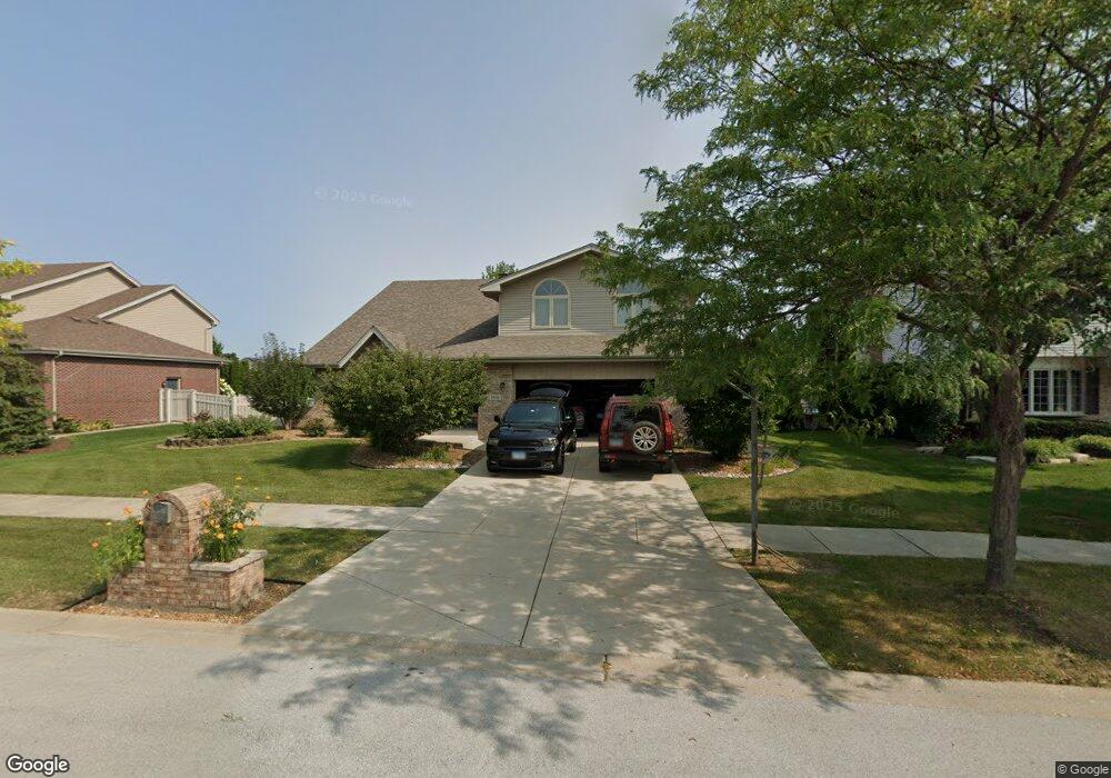
8818 Brown Ln Tinley Park, IL 60487
Central Tinley Park NeighborhoodEstimated Value: $555,097 - $598,000
4
Beds
3
Baths
3,234
Sq Ft
$179/Sq Ft
Est. Value
About This Home
This home is located at 8818 Brown Ln, Tinley Park, IL 60487 and is currently estimated at $578,274, approximately $178 per square foot. 8818 Brown Ln is a home located in Cook County with nearby schools including Millennium Elementary School, Prairie View Middle School, and Victor J Andrew High School.
Ownership History
Date
Name
Owned For
Owner Type
Purchase Details
Closed on
Jul 18, 2000
Sold by
Standard Bank & Trust Company
Bought by
Du Lori S
Current Estimated Value
Home Financials for this Owner
Home Financials are based on the most recent Mortgage that was taken out on this home.
Original Mortgage
$237,547
Outstanding Balance
$84,340
Interest Rate
8.12%
Estimated Equity
$493,934
Create a Home Valuation Report for This Property
The Home Valuation Report is an in-depth analysis detailing your home's value as well as a comparison with similar homes in the area
Home Values in the Area
Average Home Value in this Area
Purchase History
| Date | Buyer | Sale Price | Title Company |
|---|---|---|---|
| Du Lori S | $291,500 | -- |
Source: Public Records
Mortgage History
| Date | Status | Borrower | Loan Amount |
|---|---|---|---|
| Open | Du Lori S | $237,547 |
Source: Public Records
Tax History Compared to Growth
Tax History
| Year | Tax Paid | Tax Assessment Tax Assessment Total Assessment is a certain percentage of the fair market value that is determined by local assessors to be the total taxable value of land and additions on the property. | Land | Improvement |
|---|---|---|---|---|
| 2024 | $11,851 | $46,000 | $6,044 | $39,956 |
| 2023 | $10,757 | $46,000 | $6,044 | $39,956 |
| 2022 | $10,757 | $33,595 | $5,256 | $28,339 |
| 2021 | $10,442 | $33,593 | $5,255 | $28,338 |
| 2020 | $10,247 | $33,593 | $5,255 | $28,338 |
| 2019 | $10,254 | $35,047 | $4,729 | $30,318 |
| 2018 | $10,033 | $35,047 | $4,729 | $30,318 |
| 2017 | $9,784 | $35,047 | $4,729 | $30,318 |
| 2016 | $10,007 | $32,627 | $4,204 | $28,423 |
| 2015 | $9,858 | $32,627 | $4,204 | $28,423 |
| 2014 | $9,792 | $32,627 | $4,204 | $28,423 |
| 2013 | $10,340 | $36,867 | $4,204 | $32,663 |
Source: Public Records
Map
Nearby Homes
- 17631 Dover Ct
- Fremont Plan at Radcliffe Place
- Calysta Plan at Radcliffe Place
- Danbury Plan at Radcliffe Place
- Briarcliffe Plan at Radcliffe Place
- Eden Plan at Radcliffe Place
- Amberwood Plan at Radcliffe Place
- 17533 Pecan Ln
- 17964 Upland Dr
- 9038 Mansfield Dr Unit 8
- 18055 Upland Dr
- 9280 Windsor Pkwy Unit 92
- 9201 175th St
- 9260 Windsor Pkwy Unit 80
- 9051 Mansfield Dr Unit 1
- 8416 Stratford Dr Unit 8416
- 17324 Humber Ln
- 8423 Stratford Dr Unit 8423
- 18261 Kirby Dr Unit 2918261
- 8313 Aster Ln
- 8812 Brown Ln
- 8819 Rayson Ln
- 8813 Rayson Ln
- 8825 Rayson Ln
- 8806 Brown Ln
- 8819 Brown Ln
- 8813 Brown Ln
- 8807 Rayson Ln
- 8825 Brown Ln
- 8807 Brown Ln
- 8800 Brown Ln
- 17830 Woburn Rd
- 8801 Rayson Ln
- 17836 Woburn Rd
- 8831 Brown Ln
- 17818 Woburn Rd
- 8818 Rayson Ln Unit 3
- 8801 Brown Ln
- 8812 Rayson Ln
- 8824 Rayson Ln