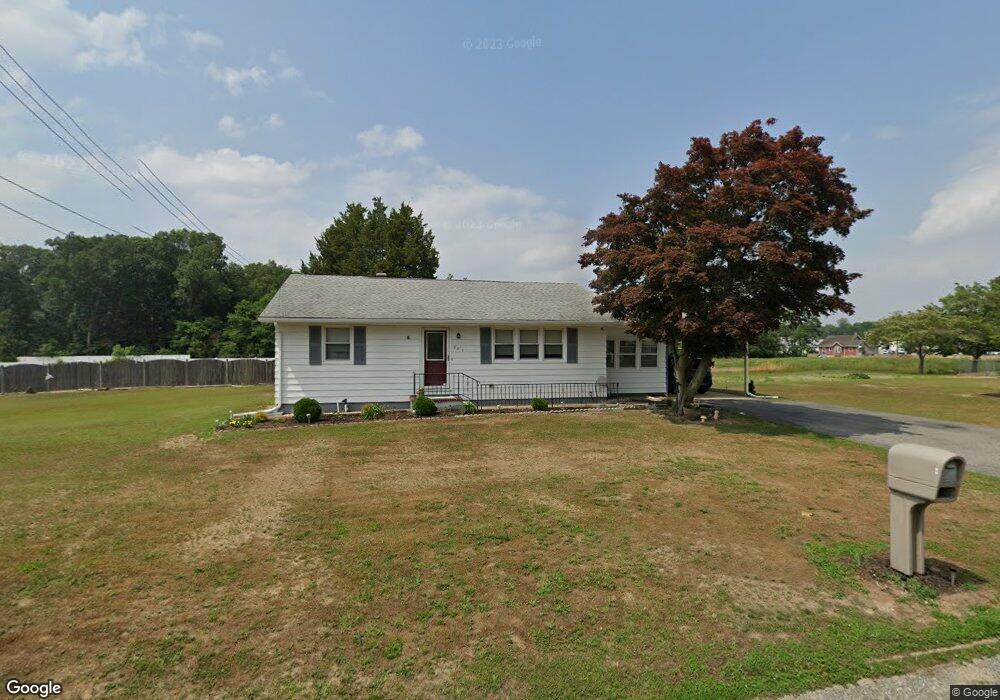
882 Garrison Rd Vineland, NJ 08360
Estimated Value: $213,301 - $319,000
--
Bed
--
Bath
1,160
Sq Ft
$239/Sq Ft
Est. Value
About This Home
This home is located at 882 Garrison Rd, Vineland, NJ 08360 and is currently estimated at $277,325, approximately $239 per square foot. 882 Garrison Rd is a home located in Cumberland County with nearby schools including Dane Barse School, Landis Middle School, and Vineland Senior High School.
Ownership History
Date
Name
Owned For
Owner Type
Purchase Details
Closed on
Oct 2, 2015
Sold by
Buck Michelle A and Falasco Angela M
Bought by
Mortara Angelo
Current Estimated Value
Purchase Details
Closed on
Feb 18, 2013
Sold by
Mortara Angelo
Bought by
Buck Michelle A and Falasco Angela M
Purchase Details
Closed on
Jul 19, 2006
Sold by
Mortara Luigia S
Bought by
Mortara Angelo and Mortara Sarah J
Purchase Details
Closed on
Jun 5, 1996
Sold by
Mortara Luigia
Bought by
Mortara Angelo
Create a Home Valuation Report for This Property
The Home Valuation Report is an in-depth analysis detailing your home's value as well as a comparison with similar homes in the area
Home Values in the Area
Average Home Value in this Area
Purchase History
| Date | Buyer | Sale Price | Title Company |
|---|---|---|---|
| Mortara Angelo | -- | Attorney | |
| Buck Michelle A | -- | -- | |
| Mortara Angelo | -- | -- | |
| Mortara Angelo | -- | -- |
Source: Public Records
Tax History Compared to Growth
Tax History
| Year | Tax Paid | Tax Assessment Tax Assessment Total Assessment is a certain percentage of the fair market value that is determined by local assessors to be the total taxable value of land and additions on the property. | Land | Improvement |
|---|---|---|---|---|
| 2025 | $4,152 | $130,400 | $32,300 | $98,100 |
| 2024 | $4,152 | $130,400 | $32,300 | $98,100 |
| 2023 | $4,125 | $130,400 | $32,300 | $98,100 |
| 2022 | $4,002 | $130,400 | $32,300 | $98,100 |
| 2021 | $3,606 | $130,400 | $32,300 | $98,100 |
| 2020 | $3,817 | $130,400 | $32,300 | $98,100 |
| 2019 | $3,765 | $130,400 | $32,300 | $98,100 |
| 2018 | $3,666 | $130,400 | $32,300 | $98,100 |
| 2017 | $3,482 | $130,400 | $32,300 | $98,100 |
| 2016 | $3,359 | $130,400 | $32,300 | $98,100 |
| 2015 | $3,235 | $130,400 | $32,300 | $98,100 |
| 2014 | $3,059 | $130,400 | $32,300 | $98,100 |
Source: Public Records
Map
Nearby Homes
- 5100 S Delsea Dr
- 2280 Delsea
- 1920 S Delsea Dr Unit 21
- 2365 S Delsea Dr
- 668 W Elmer Rd
- 956 N Korff Dr
- 2640 Brunetta Dr
- 997 W Sherman Ave
- 1011 W Sherman Ave
- 252 W Grant Ave
- 1291 W Sherman Ave Unit UPPER
- 1291 W Sherman Ave Unit LOWER
- 2919 S Delsea Dr
- 0 W Sherman Ave
- 2943 S Delsea Dr
- 375 Foster Ave
- 1146 S Delsea Dr
- 1001 S West Ave
- 1143 S Orchard Rd
- 1064 W Walnut Rd
- 848 Garrison Rd
- 889 Garrison Rd
- 916 Garrison Rd
- 861 Garrison Rd
- 917 Garrison Rd
- 835 Garrison Rd
- 825 Garrison Rd
- 950 Garrison Rd
- 2130 S Delsea Dr
- 941 Garrison Rd
- 2115 W Korff Dr
- 797 Garrison Rd
- 959 Garrison Rd
- 2112 S Delsea Dr
- 2095 W Korff Dr
- 2128 W Korff Dr
- 2152 W Korff Dr
- 2075 W Korff Dr
- 2070 S Delsea Dr
- 2057 W Korff Dr